
Magnitude |
:3 |
| Date & Time (UTC) | 2004-10-14 01:46:03.3 |
| Date & Time (Local) | 1383/7/23 05:16:03.3 |
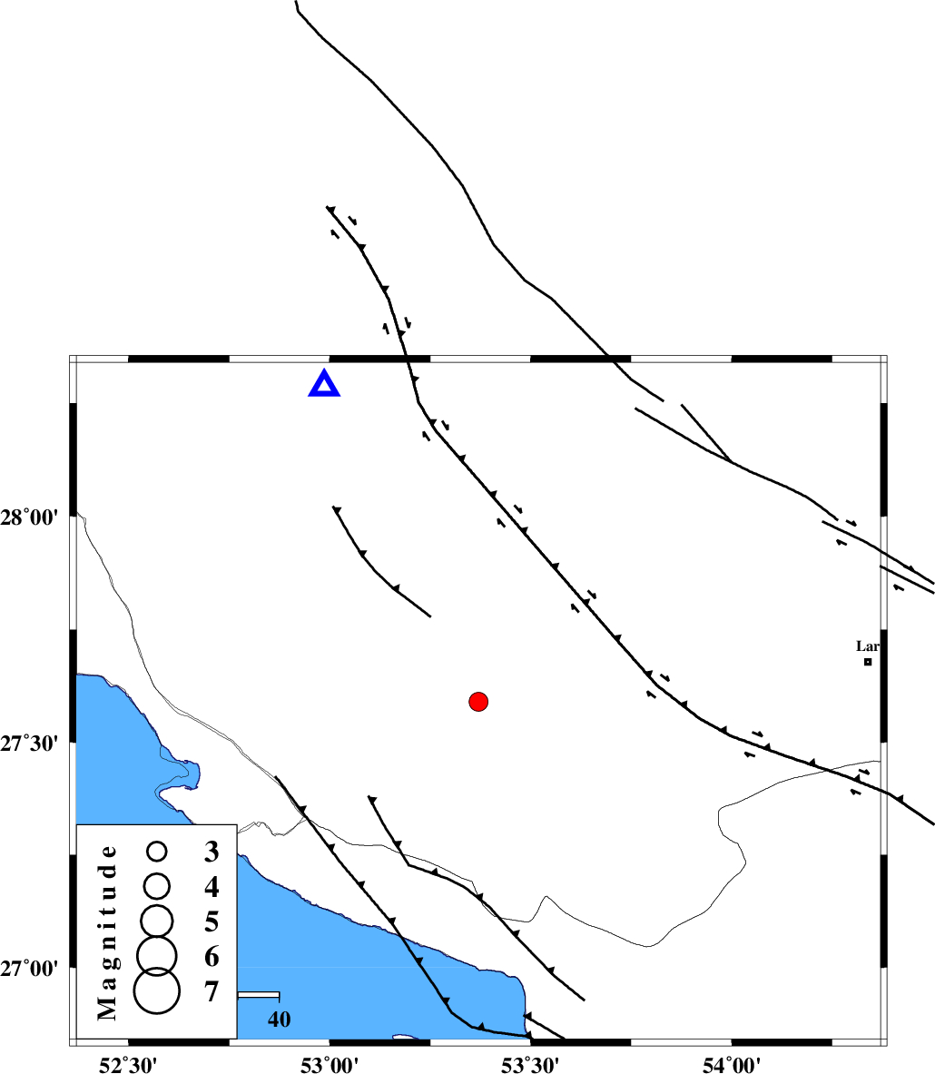
| Location | Lat:27.59 Lon: 53.37 |
| Region | 34 km North-East of Lamerd, Fars Province |
Nearest Cities |
|
| 15 km North West of Fedagh, Fars Province | |
| 23 km North West of Beyram, Fars Province | |
| 30 km South West of Ard, Fars Province | |
| 32 km South of Khonj, Fars Province | |
| 35 km North East of Lamerd, Fars Province | |
| Depth | 34 km |
| Agency | |
Faults within 150 km: |
|
| LAR_F (Length: 99 km) , Distance to epicenter: 51 km | |
| MFF3 (Length: 292 km) , Distance to epicenter: 51 km | |
| BERIZ_F (Length: 49 km) , Distance to epicenter: 68 km | |
| Number of Phases | 5 |
| RMS | 0.1 |
| Number of Stations | 3 |
| Error in Latitude | >8.9 km |
| Error in Longitude | 6 km |
| Error in Depth | 5.3 km |
Download waveform in seisan format
to download seisan software Click here
to access information about IIEES stations Click here
Amplitude | ||||||||
| UID | Agency | Station | Component | Amplitude | Period | Arrival Time | Proccessing Time | Signal Clip |
| 30528 | IIEES | GHIR | E | 226.9 | 0.59 | 2004-10-14 01:46:44 | 2006-03-15 11:56:00 | n |
| 30529 | IIEES | BNDS | N | 69.8 | 0.35 | 2004-10-14 01:47:29 | 2006-03-15 11:56:00 | n |
| 30530 | IIEES | BNDS | E | 58.4 | 0.49 | 2004-10-14 01:47:32 | 2006-03-15 11:56:00 | n |
| 30531 | IIEES | KRBR | E | 30.3 | 0.39 | 2004-10-14 01:47:48 | 2006-03-15 11:56:00 | n |
| 30532 | IIEES | KRBR | N | 31 | 0.39 | 2004-10-14 01:47:49 | 2006-03-15 11:56:00 | n |
Phase | ||||||||||||
| Agency | Station | Component | Phase Type | Phase Quality | First Motion | Observed Arrival Time | Time Residual | Loc. Flag | Input Weight | Distance | Azimuth | |
| IIEES | GHIR | Z | PG | I | 2004-10-14 01:46:18 | -0.2 | y | 85.6 | 334 | |||
| IIEES | GHIR | N | SG | I | 2004-10-14 01:46:29 | 0.1 | y | 85.6 | 334 | |||
| IIEES | BNDS | Z | PN | I | 2004-10-14 01:46:43 | 0.2 | y | 278 | 94 | |||
| IIEES | BNDS | E | SG | E | 2004-10-14 01:47:19 | 0 | y | 278 | 94 | |||
| IIEES | KRBR | Z | PN | I | 2004-10-14 01:47:01 | -0.2 | y | 424 | 51 | |||