
Magnitude |
:3.3 |
| Date & Time (UTC) | 2004-10-14 00:29:09.0 |
| Date & Time (Local) | 1383/7/23 03:59:09.0 |
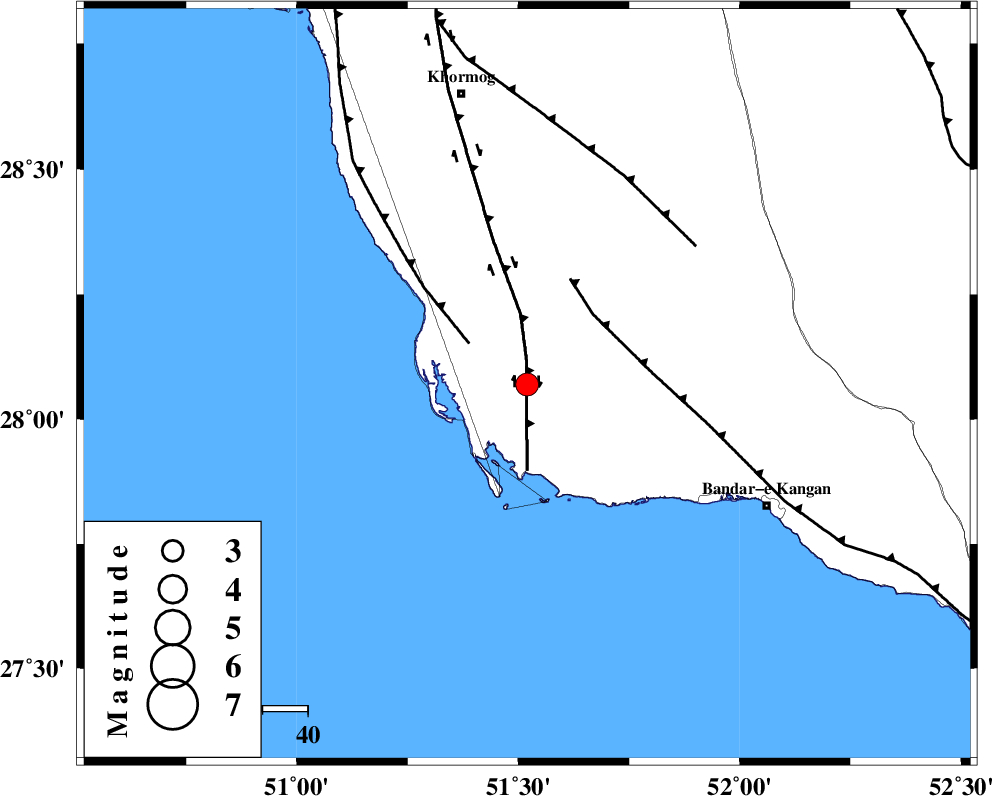
| Location | Lat:28.07 Lon: 51.52 |
| Region | 59 km North-West of Bandar-e kangan, Bushehr Province |
Nearest Cities |
|
| 5 km North of Bardkhun, Bushehr Province | |
| 11 km of Abkesh, Bushehr Province | |
| 19 km South East of Ziyarat, Bushehr Province | |
| 24 km West of Abdan, Bushehr Province | |
| 30 km South of Kaki, Bushehr Province | |
| Depth | 7 km |
| Agency | |
Faults within 150 km: |
|
| BORAZJAN_F (Length: 168 km) , Distance to epicenter: 5 km | |
| ZFF2 (Length: 84 km) , Distance to epicenter: 16 km | |
| MFF3 (Length: 292 km) , Distance to epicenter: 21 km | |
| Number of Phases | 6 |
| RMS | 0.3 |
| Number of Stations | 4 |
| Error in Latitude | >11.1 km |
| Error in Longitude | 6.8 km |
| Error in Depth | 7 km |
Download waveform in seisan format
to download seisan software Click here
to access information about IIEES stations Click here
Amplitude | ||||||||
| UID | Agency | Station | Component | Amplitude | Period | Arrival Time | Proccessing Time | Signal Clip |
| 30515 | IIEES | GHIR | N | 1224.6 | 0.56 | 2004-10-14 00:29:53 | 2006-03-15 11:56:00 | n |
| 30516 | IIEES | GHIR | E | 944.3 | 0.4 | 2004-10-14 00:29:53 | 2006-03-15 11:56:00 | n |
| 30517 | IIEES | BNDS | N | 17.3 | 0.56 | 2004-10-14 00:31:35 | 2006-03-15 11:56:00 | n |
| 30518 | IIEES | BNDS | E | 22.9 | 0.48 | 2004-10-14 00:31:36 | 2006-03-15 11:56:00 | n |
Phase | ||||||||||||
| Agency | Station | Component | Phase Type | Phase Quality | First Motion | Observed Arrival Time | Time Residual | Loc. Flag | Input Weight | Distance | Azimuth | |
| IIEES | GHIR | Z | PG | I | 2004-10-14 00:29:34 | 0.3 | y | 146 | 80 | |||
| IIEES | GHIR | N | SG | I | 2004-10-14 00:29:52 | -0.2 | y | 146 | 80 | |||
| IIEES | BNDS | Z | PN | E | 2004-10-14 00:30:15 | 0.1 | y | 464 | 98 | |||
| IIEES | NASN | Z | PN | I | 2004-10-14 00:30:24 | 0.1 | y | 539 | 13 | |||
| IIEES | KRBR | Z | PN | I | 2004-10-14 00:30:25 | -0.7 | y | 552 | 66 | |||
| IIEES | KRBR | N | SN | 2004-10-14 00:31:23 | 0.3 | y | 552 | 66 | ||||