
Magnitude |
:3.1 |
| Date & Time (UTC) | 2004-10-12 23:00:45.2 |
| Date & Time (Local) | 1383/7/22 02:30:45.2 |
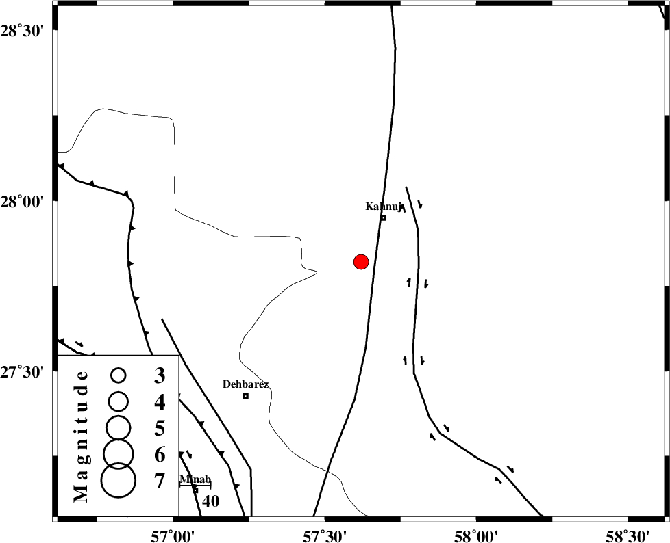
| Location | Lat:27.82 Lon: 57.62 |
| Region | 16 km South of Kahnuj, Kerman Province |
Nearest Cities |
|
| 16 km South of Kahnuj, Kerman Province | |
| 21 km North of Bargah, Kerman Province | |
| 29 km North East of Bejogan, Kerman Province | |
| 34 km North East of Fariab, Hormozgan Province | |
| 35 km North East of Nodezh, Kerman Province | |
| Depth | 14 km |
| Agency | |
Faults within 150 km: |
|
| SABZEVARAN_F (Length: 190 km) , Distance to epicenter: 5 km | |
| JIROFT_F (Length: 144 km) , Distance to epicenter: 19 km | |
| ZENDAN_MINAB_F_Z1 (Length: 183 km) , Distance to epicenter: 66 km | |
| Number of Phases | 5 |
| RMS | 0.2 |
| Number of Stations | 4 |
| Error in Latitude | >12.2 km |
| Error in Longitude | 5.9 km |
| Error in Depth | 17.5 km |
Download waveform in seisan format
to download seisan software Click here
to access information about IIEES stations Click here
Amplitude | ||||||||
| UID | Agency | Station | Component | Amplitude | Period | Arrival Time | Proccessing Time | Signal Clip |
| 30507 | IIEES | BNDS | E | 307.2 | 0.32 | 2004-10-12 23:01:32 | 2006-03-15 11:56:00 | n |
| 30508 | IIEES | BNDS | N | 218.8 | 0.48 | 2004-10-12 23:01:32 | 2006-03-15 11:56:00 | n |
| 30509 | IIEES | KRBR | E | 93 | 0.56 | 2004-10-12 23:02:01 | 2006-03-15 11:56:00 | n |
| 30510 | IIEES | KRBR | N | 160.6 | 0.68 | 2004-10-12 23:02:02 | 2006-03-15 11:56:00 | n |
Phase | ||||||||||||
| Agency | Station | Component | Phase Type | Phase Quality | First Motion | Observed Arrival Time | Time Residual | Loc. Flag | Input Weight | Distance | Azimuth | |
| IIEES | BNDS | Z | PG | E | 2004-10-12 23:01:09 | -0.4 | y | 150 | 252 | |||
| IIEES | BNDS | E | SG | E | 2004-10-12 23:01:28 | 0.3 | y | 150 | 252 | |||
| IIEES | KRBR | Z | PN | E | 2004-10-12 23:01:24 | -0.1 | y | 253 | 341 | |||
| IIEES | ZHSF | Z | PN | E | 2004-10-12 23:01:38 | 0.2 | y | 367 | 57 | |||
| IIEES | GHIR | Z | PN | E | 2004-10-12 23:01:49 | 0.1 | y | 458 | 278 | |||