
Magnitude |
:3.3 |
| Date & Time (UTC) | 2004-10-12 08:41:25.5 |
| Date & Time (Local) | 1383/7/21 12:11:25.5 |
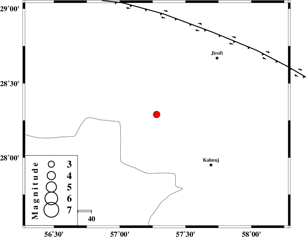
| Location | Lat:28.29 Lon: 57.28 |
| Region | 55 km North-West of Kahnuj, Kerman Province |
Nearest Cities |
|
| 11 km North of Hurpasefid, Kerman Province | |
| 25 km North of Faryab, Kerman Province | |
| 26 km North West of Mehrueye-e paeen, Kerman Province | |
| 28 km North West of Bolock, Kerman Province | |
| 40 km East of Sarkhan, Kerman Province | |
| Depth | 14 km |
| Agency | |
Faults within 150 km: |
|
| SABZEVARAN_F (Length: 190 km) , Distance to epicenter: 44 km | |
| MAIN_ZAGROS_R_F (Length: 1106 km) , Distance to epicenter: 52 km | |
| JIROFT_F (Length: 144 km) , Distance to epicenter: 55 km | |
| Number of Phases | 5 |
| RMS | 0.2 |
| Number of Stations | 4 |
| Error in Latitude | >3.4 km |
| Error in Longitude | 5.1 km |
| Error in Depth | 7.5 km |
Download waveform in seisan format
to download seisan software Click here
to access information about IIEES stations Click here
Amplitude | ||||||||
| UID | Agency | Station | Component | Amplitude | Period | Arrival Time | Proccessing Time | Signal Clip |
| 30487 | IIEES | BNDS | E | 372.3 | 0.23 | 2004-10-12 08:42:08 | 2006-03-15 11:56:00 | n |
| 30488 | IIEES | BNDS | N | 524.6 | 0.48 | 2004-10-12 08:42:09 | 2006-03-15 11:56:00 | n |
| 30489 | IIEES | KRBR | N | 306.2 | 0.36 | 2004-10-12 08:42:30 | 2006-03-15 11:56:00 | n |
| 30490 | IIEES | KRBR | E | 279.3 | 0.31 | 2004-10-12 08:42:30 | 2006-03-15 11:56:00 | n |
Phase | ||||||||||||
| Agency | Station | Component | Phase Type | Phase Quality | First Motion | Observed Arrival Time | Time Residual | Loc. Flag | Input Weight | Distance | Azimuth | |
| IIEES | BNDS | Z | PG | E | 2004-10-12 08:41:49 | -0.2 | y | 147 | 228 | |||
| IIEES | BNDS | E | SG | E | 2004-10-12 08:42:07 | 0 | y | 147 | 228 | |||
| IIEES | KRBR | Z | PG | E | 2004-10-12 08:41:57 | -0.1 | y | 194 | 345 | |||
| IIEES | ZHSF | Z | PN | E | 2004-10-12 08:42:19 | 0.1 | y | 371 | 66 | |||
| IIEES | GHIR | Z | PN | E | 2004-10-12 08:42:25 | 0.3 | y | 421 | 271 | |||