
Magnitude |
:4.1 |
| Date & Time (UTC) | 2004-10-09 06:08:20.8 |
| Date & Time (Local) | 1383/7/18 09:38:20.8 |
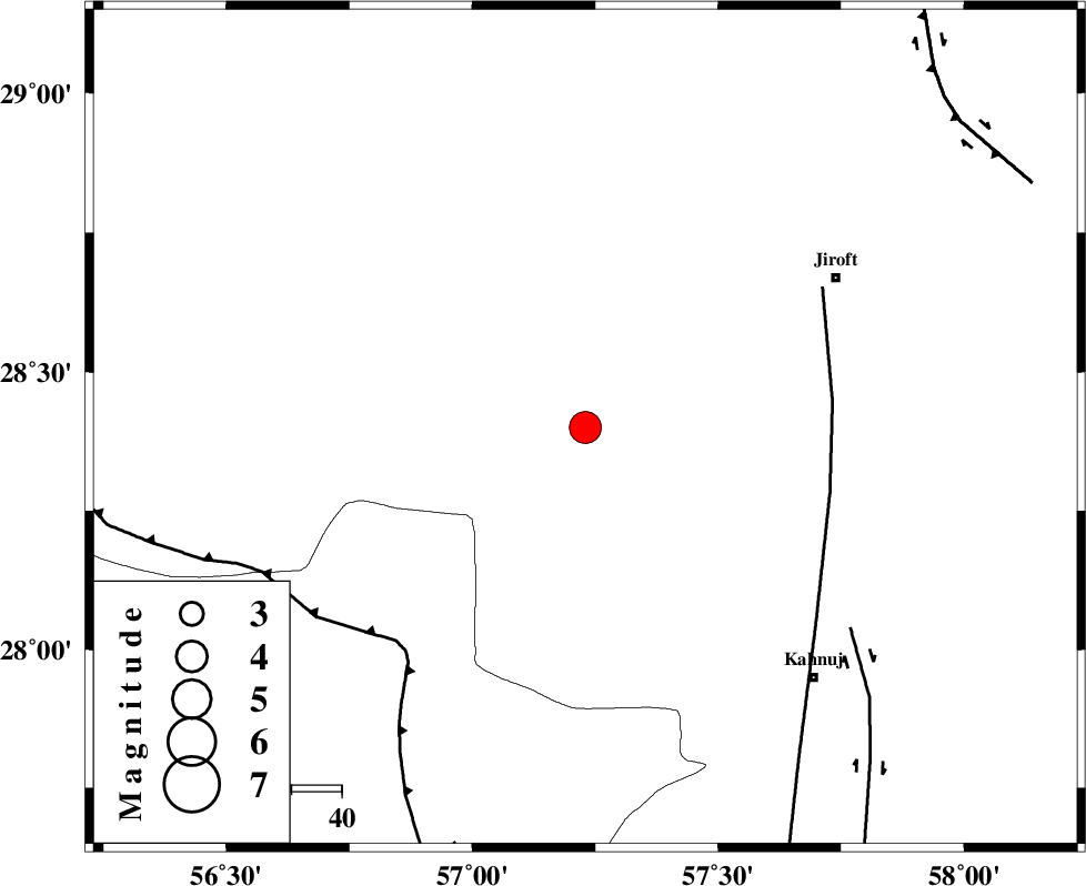
| Location | Lat:28.4 Lon: 57.23 |
| Region | 57 km South-West of Jiroft, Kerman Province |
Nearest Cities |
|
| 24 km North of Hurpasefid, Kerman Province | |
| 35 km North East of Sarkhan, Kerman Province | |
| 37 km North West of Bolock, Kerman Province | |
| 37 km North of Faryab, Kerman Province | |
| 38 km South East of Dolatabad, Kerman Province | |
| Depth | 14 km |
| Agency | |
Faults within 150 km: |
|
| SABZEVARAN_F (Length: 190 km) , Distance to epicenter: 49 km | |
| MAIN_ZAGROS_R_F (Length: 1106 km) , Distance to epicenter: 57 km | |
| JIROFT_F (Length: 144 km) , Distance to epicenter: 66 km | |
| Number of Phases | 5 |
| RMS | 0.1 |
| Number of Stations | 4 |
| Error in Latitude | >2.2 km |
| Error in Longitude | 3.6 km |
| Error in Depth | 5.3 km |
Download waveform in seisan format
to download seisan software Click here
to access information about IIEES stations Click here
Amplitude | ||||||||
| UID | Agency | Station | Component | Amplitude | Period | Arrival Time | Proccessing Time | Signal Clip |
| 30463 | IIEES | BNDS | N | 3276.7 | 0.46 | 2004-10-09 06:09:07 | 2006-03-15 11:56:00 | n |
| 30464 | IIEES | BNDS | E | 3258.9 | 0.31 | 2004-10-09 06:09:08 | 2006-03-15 11:56:00 | n |
| 30465 | IIEES | KRBR | N | 1982.1 | 0.68 | 2004-10-09 06:09:23 | 2006-03-15 11:56:00 | n |
| 30466 | IIEES | KRBR | E | 1839.2 | 0.49 | 2004-10-09 06:09:25 | 2006-03-15 11:56:00 | n |
Phase | ||||||||||||
| Agency | Station | Component | Phase Type | Phase Quality | First Motion | Observed Arrival Time | Time Residual | Loc. Flag | Input Weight | Distance | Azimuth | |
| IIEES | BNDS | Z | PG | E | 2004-10-09 06:08:46 | -0.1 | y | 152 | 224 | |||
| IIEES | BNDS | E | SG | E | 2004-10-09 06:09:04 | 0 | y | 152 | 224 | |||
| IIEES | KRBR | Z | PG | E | 2004-10-09 06:08:50 | -0.1 | y | 182 | 345 | |||
| IIEES | ZHSF | Z | PN | E | 2004-10-09 06:09:14 | 0 | y | 370 | 68 | |||
| IIEES | GHIR | Z | PN | E | 2004-10-09 06:09:20 | 0.2 | y | 417 | 269 | |||