
Magnitude |
:3 |
| Date & Time (UTC) | 2004-08-31 04:54:42.3 |
| Date & Time (Local) | 1383/6/10 09:24:42.3 |
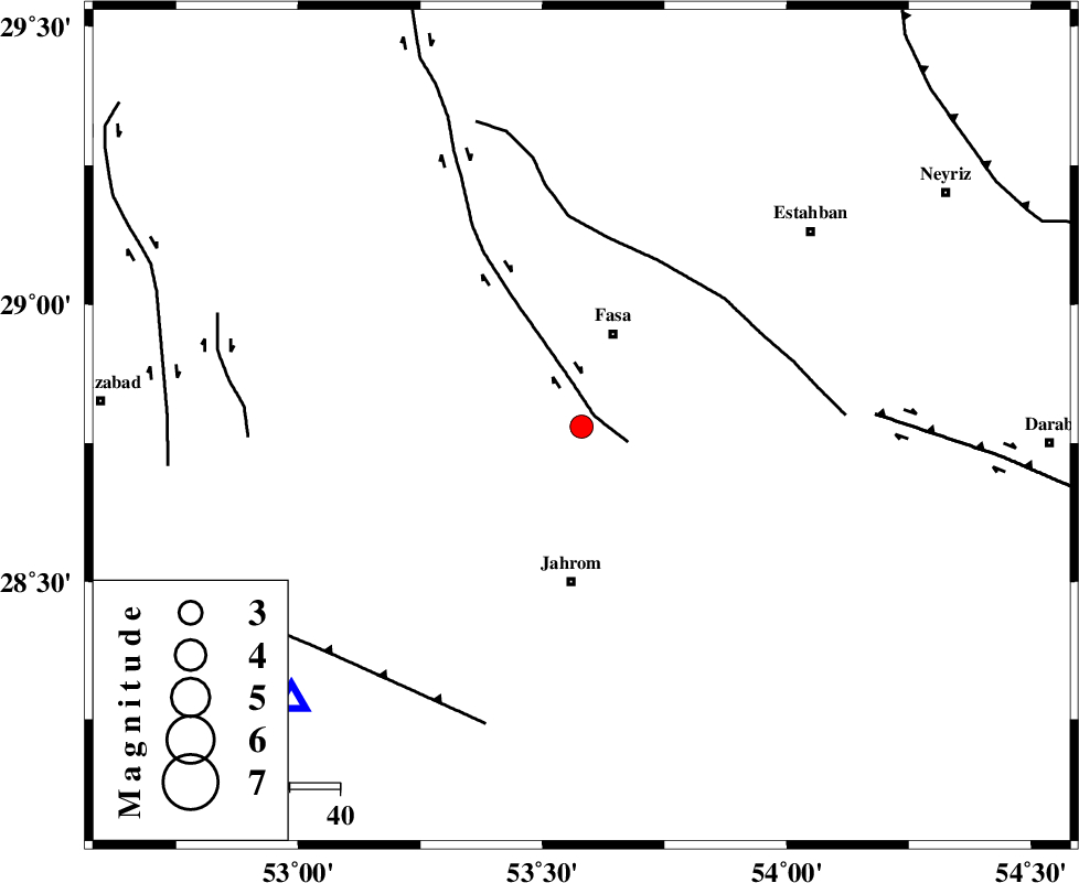
| Location | Lat:28.78 Lon: 53.58 |
| Region | 20 km South of Fasa, Fars Province |
Nearest Cities |
|
| 15 km South of Sahrarud, Fars Province | |
| 15 km West of Fadashkueyeh, Fars Province | |
| 17 km North of Qotbabad, Fars Province | |
| 20 km South of Fasa, Fars Province | |
| 22 km North West of Zahedshahr, Fars Province | |
| Depth | 6 km |
| Agency | |
Faults within 150 km: |
|
| SARVESTAN_F (Length: 94 km) , Distance to epicenter: 3 km | |
| BAKHTEGAN_F (Length: 94 km) , Distance to epicenter: 37 km | |
| HZF1 (Length: 102 km) , Distance to epicenter: 59 km | |
| Number of Phases | 4 |
| RMS | 0.1 |
| Number of Stations | 3 |
| Error in Latitude | >6.7 km |
| Error in Longitude | 5.4 km |
| Error in Depth | 17.4 km |
Download waveform in seisan format
to download seisan software Click here
to access information about IIEES stations Click here
Amplitude | ||||||||
| UID | Agency | Station | Component | Amplitude | Period | Arrival Time | Proccessing Time | Signal Clip |
| 28245 | IIEES | GHIR | N | 534.7 | 0.51 | 2004-08-31 04:55:15 | 2006-03-15 11:56:00 | n |
| 28246 | IIEES | KRBR | N | 58.9 | 0.6 | 2004-08-31 04:56:27 | 2006-03-15 11:56:00 | n |
Phase | ||||||||||||
| Agency | Station | Component | Phase Type | Phase Quality | First Motion | Observed Arrival Time | Time Residual | Loc. Flag | Input Weight | Distance | Azimuth | |
| IIEES | GHIR | Z | PG | E | 2004-08-31 04:54:56 | -0.2 | y | 79.4 | 227 | |||
| IIEES | GHIR | E | SG | E | 2004-08-31 04:55:06 | 0.1 | y | 79.4 | 227 | |||
| IIEES | KRBR | Z | PN | E | 2004-08-31 04:55:33 | 0.1 | y | 337 | 66 | |||
| IIEES | NASN | Z | PN | E | 2004-08-31 04:55:47 | 0 | y | 452 | 351 | |||