
Magnitude |
:2.3 |
| Date & Time (UTC) | 2004-08-29 00:05:37.2 |
| Date & Time (Local) | 1383/6/8 04:35:37.2 |
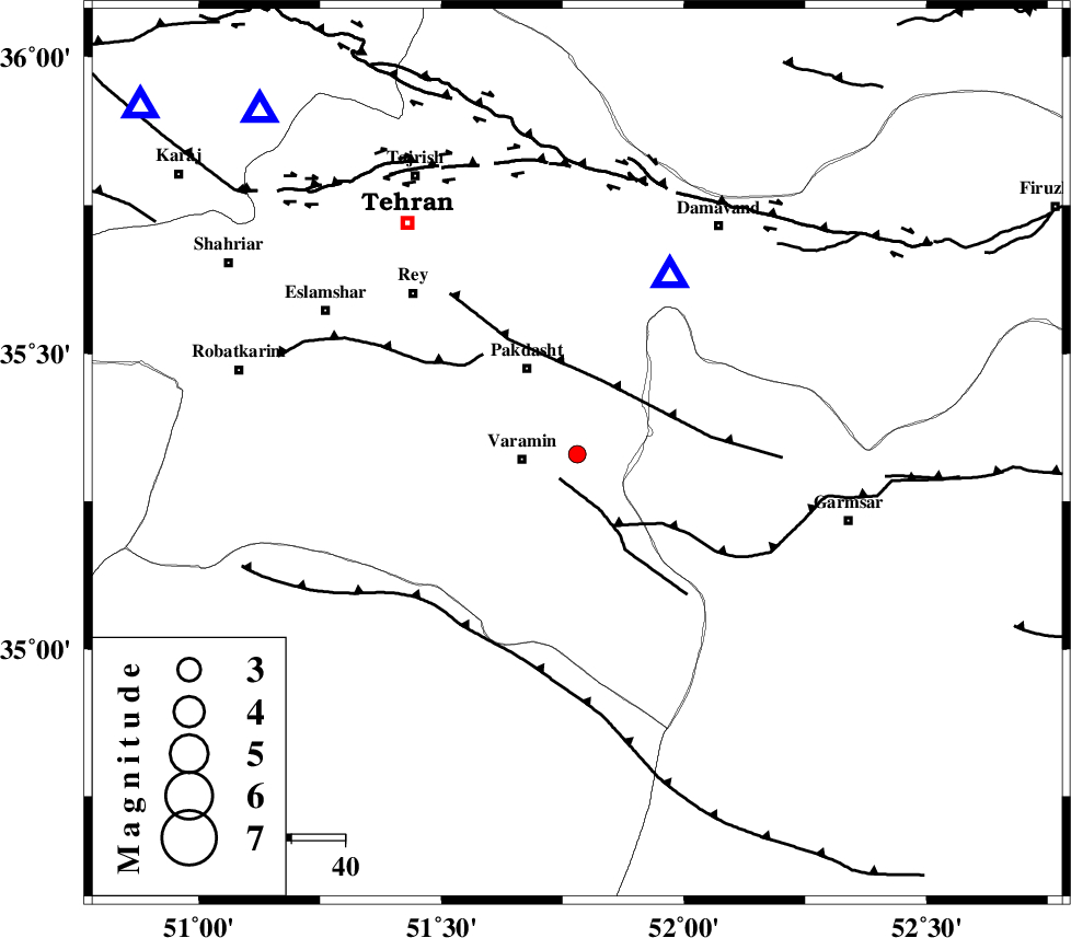
| Location | Lat:35.33 Lon: 51.78 |
| Region | 10 km East of Varamin, Tehran Province |
Nearest Cities |
|
| 3 km of Khalilabad, Tehran Province | |
| 5 km North of Pishva, Tehran Province | |
| 10 km North East of Varamin, Tehran Province | |
| 11 km North West of Shorqazi, Semnan Province | |
| 18 km North East of Ab barik, Tehran Province | |
| Depth | 18 km |
| Agency | |
Faults within 150 km: |
|
| PISHAV_F (Length: 34 km) , Distance to epicenter: 6 km | |
| EYVANEKEY_F (Length: 74 km) , Distance to epicenter: 15 km | |
| GARMSAR_F (Length: 77 km) , Distance to epicenter: 15 km | |
| Number of Phases | 4 |
| RMS | 0 |
| Number of Stations | 3 |
| Error in Latitude | >3.1 km |
| Error in Longitude | 6 km |
| Error in Depth | 29.4 km |
Download waveform in seisan format
to download seisan software Click here
to access information about IIEES stations Click here
Amplitude | ||||||||
| UID | Agency | Station | Component | Amplitude | Period | Arrival Time | Proccessing Time | Signal Clip |
| 28219 | IIEES | DAMV | N | 505.1 | 0.07 | 2004-08-29 00:05:50 | 2006-03-15 11:56:00 | n |
| 28220 | IIEES | THKV | N | 49.2 | 0.06 | 2004-08-29 00:06:09 | 2006-03-15 11:56:00 | n |
Phase | ||||||||||||
| Agency | Station | Component | Phase Type | Phase Quality | First Motion | Observed Arrival Time | Time Residual | Loc. Flag | Input Weight | Distance | Azimuth | |
| IIEES | DAMV | Z | PG | I | 2004-08-29 00:05:44 | 0 | y | 37.1 | 28 | |||
| IIEES | THKV | Z | PG | E | 2004-08-29 00:05:54 | 0 | y | 104 | 309 | |||
| IIEES | THKV | N | SG | E | 2004-08-29 00:06:08 | 0 | y | 104 | 309 | |||
| IIEES | ASAO | Z | PG | E | 2004-08-29 00:06:07 | 0 | y | 183 | 242 | |||