
Magnitude |
:2.9 |
| Date & Time (UTC) | 2004-09-22 18:11:24.3 |
| Date & Time (Local) | 1383/7/1 21:41:24.3 |
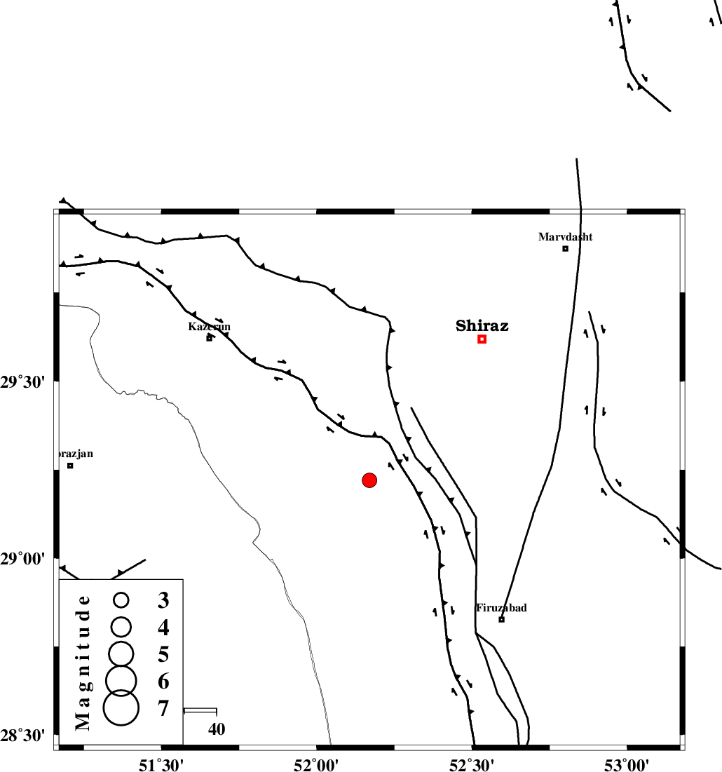
| Location | Lat:29.22 Lon: 52.17 |
| Region | 39 km North of Farashband, Fars Province |
Nearest Cities |
|
| 13 km North of Dadanjan, Fars Province | |
| 18 km East of Jareh, Fars Province | |
| 21 km North East of Nujin, Fars Province | |
| 23 km East of Baladeh, Fars Province | |
| 30 km South of Richi, Fars Province | |
| Depth | 30 km |
| Agency | |
Faults within 150 km: |
|
| KAREBASS_F (Length: 98 km) , Distance to epicenter: 5 km | |
| SABZ_PUSHAN_F_Z3 (Length: 37 km) , Distance to epicenter: 37 km | |
| SABZ_PUSHAN_F_Z1 (Length: 69 km) , Distance to epicenter: 43 km | |
| Number of Phases | 4 |
| RMS | 0.2 |
| Number of Stations | 3 |
| Error in Latitude | >3.7 km |
| Error in Longitude | 7.6 km |
| Error in Depth | 0 km |
Download waveform in seisan format
to download seisan software Click here
to access information about IIEES stations Click here
Amplitude | ||||||||
| UID | Agency | Station | Component | Amplitude | Period | Arrival Time | Proccessing Time | Signal Clip |
| 28175 | IIEES | GHIR | N | 447.1 | 0.32 | 2004-09-22 18:12:07 | 2006-03-15 11:56:00 | n |
| 28176 | IIEES | GHIR | E | 463.7 | 0.48 | 2004-09-22 18:12:08 | 2006-03-15 11:56:00 | n |
| 28177 | IIEES | KRBR | E | 7 | 0.67 | 2004-09-22 18:13:07 | 2006-03-15 11:56:00 | n |
| 28178 | IIEES | KRBR | N | 6 | 0.6 | 2004-09-22 18:13:19 | 2006-03-15 11:56:00 | n |
Phase | ||||||||||||
| Agency | Station | Component | Phase Type | Phase Quality | First Motion | Observed Arrival Time | Time Residual | Loc. Flag | Input Weight | Distance | Azimuth | |
| IIEES | GHIR | Z | PG | E | 2004-09-22 18:11:46 | 0.3 | y | 131 | 142 | |||
| IIEES | GHIR | E | SG | E | 2004-09-22 18:12:01 | -0.2 | y | 131 | 142 | |||
| IIEES | NASN | Z | PN | E | 2004-09-22 18:12:20 | -0.2 | y | 402 | 9 | |||
| IIEES | KRBR | Z | PN | E | 2004-09-22 18:12:27 | 0.2 | y | 453 | 78 | |||