
Magnitude |
:2.8 |
| Date & Time (UTC) | 2004-09-17 23:33:06.2 |
| Date & Time (Local) | 1383/6/28 04:03:06.2 |
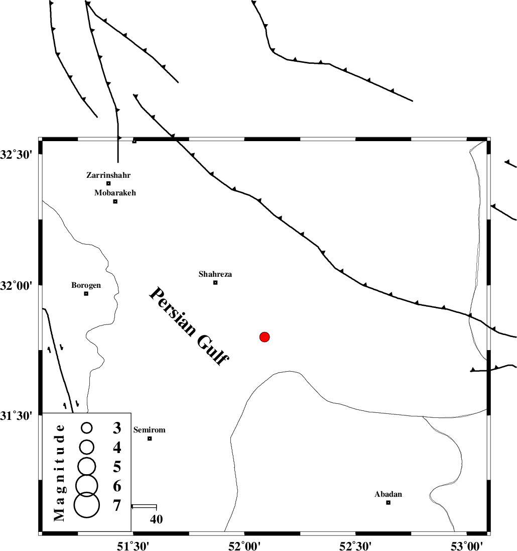
| Location | Lat:31.8 Lon: 52.09 |
| Region | 31 km South-East of Shahreza, Esfahan Province |
Nearest Cities |
|
| 23 km North East of Esfarjan, Esfahan Province | |
| 29 km North East of Kahruyeh, Esfahan Province | |
| 31 km South East of Shahreza, Esfahan Province | |
| 32 km North of Ezad khvast, Fars Province | |
| 33 km North West of Ramsheh, Esfahan Province | |
| Depth | 25 km |
| Agency | |
Faults within 150 km: |
|
| MAIN_ZAGROS_R_F (Length: 1106 km) , Distance to epicenter: 48 km | |
| DENA_F (Length: 137 km) , Distance to epicenter: 87 km | |
| DOPOLAN_F (Length: 107 km) , Distance to epicenter: 88 km | |
| Number of Phases | 5 |
| RMS | 0.1 |
| Number of Stations | 4 |
| Error in Latitude | >11.8 km |
| Error in Longitude | 17.7 km |
| Error in Depth | 15.8 km |
Download waveform in seisan format
to download seisan software Click here
to access information about IIEES stations Click here
Amplitude | ||||||||
| UID | Agency | Station | Component | Amplitude | Period | Arrival Time | Proccessing Time | Signal Clip |
| 28131 | IIEES | ASAO | E | 33.2 | 0.64 | 2004-09-17 23:35:13 | 2006-03-15 11:56:00 | n |
| 28132 | IIEES | ASAO | N | 17.5 | 0.6 | 2004-09-17 23:35:19 | 2006-03-15 11:56:00 | n |
Phase | ||||||||||||
| Agency | Station | Component | Phase Type | Phase Quality | First Motion | Observed Arrival Time | Time Residual | Loc. Flag | Input Weight | Distance | Azimuth | |
| IIEES | NASN | Z | PG | E | 2004-09-17 23:33:27 | 0 | y | 130 | 31 | |||
| IIEES | NASN | N | SG | E | 2004-09-17 23:33:43 | 0 | y | 130 | 31 | |||
| IIEES | ASAO | Z | PN | E | 2004-09-17 23:33:57 | -0.1 | y | 361 | 328 | |||
| IIEES | DAMV | Z | PN | E | 2004-09-17 23:34:05 | -0.1 | y | 426 | 359 | |||
| IIEES | THKV | Z | PN | E | 2004-09-17 23:34:11 | 0.3 | y | 471 | 347 | |||