
Magnitude |
:3.6 |
| Date & Time (UTC) | 2004-07-10 07:57:55.2 |
| Date & Time (Local) | 1383/4/20 12:27:55.2 |
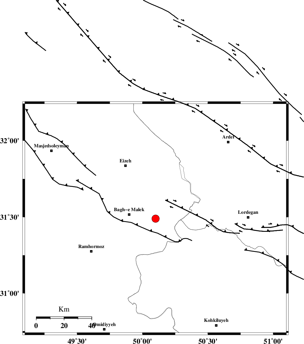
| Location | Lat:31.49 Lon: 50.1 |
| Region | 19 km East of Bagh Malek, Khoozestan Province |
Nearest Cities |
|
| 13 km East of Abolabbas, Khoozestan Province | |
| 15 km North of Seidun, Khoozestan Province | |
| 19 km East of Bagh Malek, Khoozestan Province | |
| 25 km South East of Ghaleh tal, Khoozestan Province | |
| 28 km North East of Dalan, Khoozestan Province | |
| Depth | 14 km |
| Agency | |
Faults within 150 km: |
|
| MFF2 (Length: 205 km) , Distance to epicenter: 6 km | |
| MFF4 (Length: 62 km) , Distance to epicenter: 28 km | |
| DEZFUL_EMBAYMENT (Length: 228 km) , Distance to epicenter: 29 km | |
| Number of Phases | 5 |
| RMS | 0.6 |
| Number of Stations | 4 |
| Error in Latitude | >31.1 km |
| Error in Longitude | 8.2 km |
| Error in Depth | 16.6 km |
Download waveform in seisan format
to download seisan software Click here
to access information about IIEES stations Click here
Amplitude | ||||||||
| UID | Agency | Station | Component | Amplitude | Period | Arrival Time | Proccessing Time | Signal Clip |
| 28087 | IIEES | SHGR | N | 1650.2 | 0.32 | 2004-07-10 07:58:39 | 2006-03-15 11:56:00 | n |
| 28088 | IIEES | SHGR | E | 1983.7 | 0.4 | 2004-07-10 07:58:40 | 2006-03-15 11:56:00 | n |
| 28089 | IIEES | ASAO | N | 67.1 | 0.6 | 2004-07-10 07:59:50 | 2006-03-15 11:56:00 | n |
Phase | ||||||||||||
| Agency | Station | Component | Phase Type | Phase Quality | First Motion | Observed Arrival Time | Time Residual | Loc. Flag | Input Weight | Distance | Azimuth | |
| IIEES | SHGR | Z | PG | E | 2004-07-10 07:58:17 | -0.6 | y | 141 | 300 | |||
| IIEES | NASN | Z | PN | E | 2004-07-10 07:58:40 | 0.3 | y | 294 | 60 | |||
| IIEES | NASN | N | SG | E | 2004-07-10 07:59:17 | -0.6 | y | 294 | 60 | |||
| IIEES | ASAO | Z | PN | E | 2004-07-10 07:58:45 | 0.6 | y | 339 | 359 | |||
| IIEES | DAMV | Z | PN | E | 2004-07-10 07:59:04 | 0.6 | y | 491 | 20 | |||