
Magnitude |
:2.9 |
| Date & Time (UTC) | 2004-09-09 01:36:49.4 |
| Date & Time (Local) | 1383/6/19 06:06:49.4 |
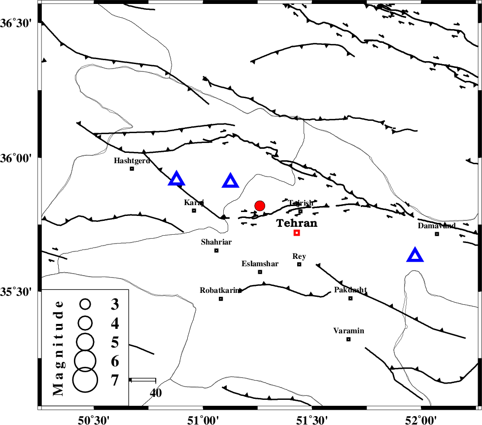
| Location | Lat:35.82 Lon: 51.26 |
| Region | 16 km West of Tajrish, Tehran Province |
Nearest Cities |
|
| 0 km North of Suloqan, Tehran Province | |
| 7 km North of Kan, Tehran Province | |
| 9 km of Emamzadeh davood, Tehran Province | |
| 17 km North West of Tajrish, Tehran Province | |
| 20 km North West of Tehran, Tehran Province | |
| Depth | 6 km |
| Agency | |
Faults within 150 km: |
|
| N_TEHRAN_F4 (Length: 115 km) , Distance to epicenter: 8 km | |
| MOSHA_F (Length: 234 km) , Distance to epicenter: 20 km | |
| TALEGHAN_F (Length: 71 km) , Distance to epicenter: 31 km | |
| Number of Phases | 5 |
| RMS | 0.2 |
| Number of Stations | 5 |
| Error in Latitude | >6.4 km |
| Error in Longitude | 4.1 km |
| Error in Depth | 7.1 km |
Download waveform in seisan format
to download seisan software Click here
to access information about IIEES stations Click here
Amplitude | ||||||||
| UID | Agency | Station | Component | Amplitude | Period | Arrival Time | Proccessing Time | Signal Clip |
| 28079 | IIEES | THKV | N | 1585.5 | 0.32 | 2004-09-09 01:37:06 | 2006-03-15 11:56:00 | n |
| 28080 | IIEES | THKV | E | 1175.1 | 0.33 | 2004-09-09 01:37:07 | 2006-03-15 11:56:00 | n |
| 28081 | IIEES | ASAO | N | 200.9 | 0.76 | 2004-09-09 01:37:53 | 2006-03-15 11:56:00 | n |
| 28082 | IIEES | ASAO | E | 116.5 | 0.44 | 2004-09-09 01:37:53 | 2006-03-15 11:56:00 | n |
Phase | ||||||||||||
| Agency | Station | Component | Phase Type | Phase Quality | First Motion | Observed Arrival Time | Time Residual | Loc. Flag | Input Weight | Distance | Azimuth | |
| IIEES | THKV | Z | PG | E | 2004-09-09 01:36:56 | -0.1 | y | 36.1 | 287 | |||
| IIEES | DAMV | Z | PG | E | 2004-09-09 01:37:01 | -0.2 | y | 67.6 | 108 | |||
| IIEES | ASAO | Z | PG | E | 2004-09-09 01:37:20 | -0.3 | y | 180 | 219 | |||
| IIEES | NASN | Z | PN | E | 2004-09-09 01:37:43 | 0.3 | y | 364 | 157 | |||
| IIEES | SNGE | Z | PN | E | 2004-09-09 01:37:43 | 0.3 | y | 364 | 258 | |||