
Magnitude |
:4 |
| Date & Time (UTC) | 2004-09-03 14:08:52.7 |
| Date & Time (Local) | 1383/6/13 18:38:52.7 |
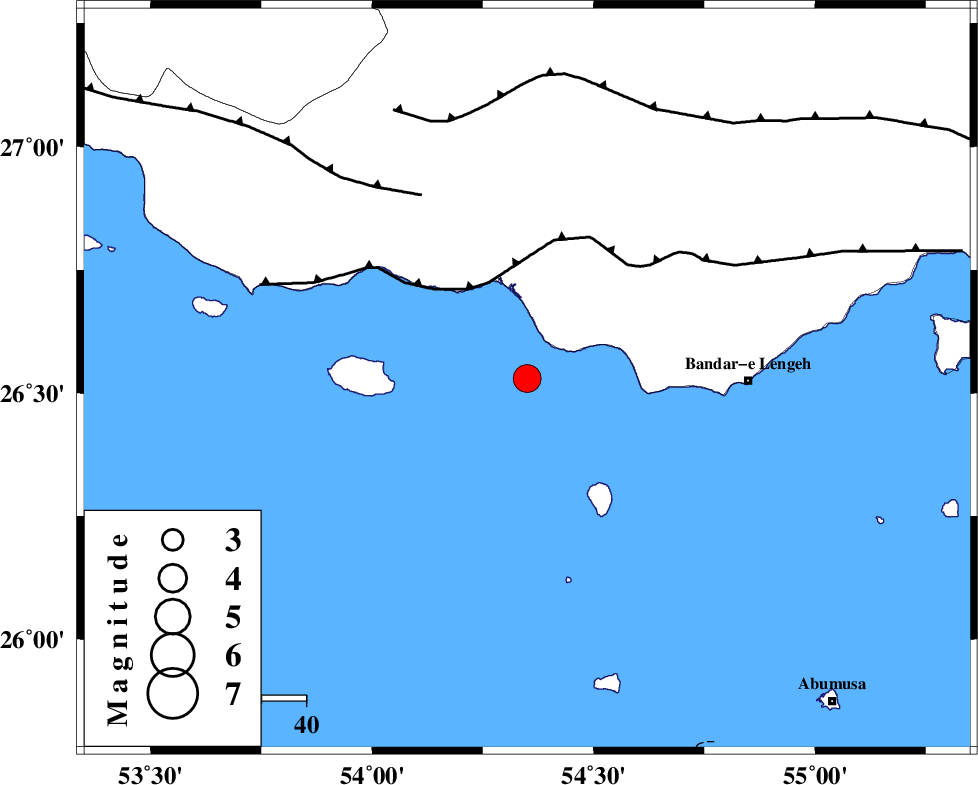
| Location | Lat:26.53 Lon: 54.35 |
| Region | Persian Gulf, 49 km West of Bandar-e lengeh |
Nearest Cities |
|
| 50 km North West of Bandar-e lengeh, Hormozgan Province | |
| 54 km South of Jenah, Hormozgan Province | |
| 74 km South of Bastak, Hormozgan Province | |
| 94 km South East of Ahl, Fars Province | |
| 100 km North West of Abu Musa, Hormozgan Province | |
| Depth | 41 km |
| Agency | |
Faults within 150 km: |
|
| ZFF1 (Length: 165 km) , Distance to epicenter: 23 km | |
| MFF3 (Length: 292 km) , Distance to epicenter: 48 km | |
| MFF1 (Length: 180 km) , Distance to epicenter: 61 km | |
| Number of Phases | 5 |
| RMS | 0.1 |
| Number of Stations | 4 |
| Error in Latitude | >7.8 km |
| Error in Longitude | 8.1 km |
| Error in Depth | 8.5 km |
Download waveform in seisan format
to download seisan software Click here
to access information about IIEES stations Click here
Amplitude | ||||||||
| UID | Agency | Station | Component | Amplitude | Period | Arrival Time | Proccessing Time | Signal Clip |
| 28034 | IIEES | GHIR | E | 1020.1 | 0.52 | 2004-09-03 14:10:09 | 2006-03-15 11:56:00 | n |
| 28035 | IIEES | GHIR | N | 1260.8 | 0.56 | 2004-09-03 14:10:14 | 2006-03-15 11:56:00 | n |
| 28036 | IIEES | KRBR | N | 172.9 | 0.64 | 2004-09-03 14:10:56 | 2006-03-15 11:56:00 | n |
| 28037 | IIEES | KRBR | E | 135.4 | 0.51 | 2004-09-03 14:11:04 | 2006-03-15 11:56:00 | n |
Phase | ||||||||||||
| Agency | Station | Component | Phase Type | Phase Quality | First Motion | Observed Arrival Time | Time Residual | Loc. Flag | Input Weight | Distance | Azimuth | |
| IIEES | GHIR | Z | PG | E | 2004-09-03 14:09:30 | 0 | y | 237 | 326 | |||
| IIEES | GHIR | E | SG | E | 2004-09-03 14:09:58 | 0 | y | 237 | 326 | |||
| IIEES | KRBR | Z | PN | E | 2004-09-03 14:09:53 | -0.1 | y | 450 | 31 | |||
| IIEES | NASN | Z | PN | E | 2004-09-03 14:10:26 | 0 | y | 711 | 348 | |||
| IIEES | ZHSF | Z | PN | E | 2004-09-03 14:10:27 | 0.1 | y | 718 | 60 | |||