
Magnitude |
:3 |
| Date & Time (UTC) | 2004-07-03 06:43:28.1 |
| Date & Time (Local) | 1383/4/13 11:13:28.1 |
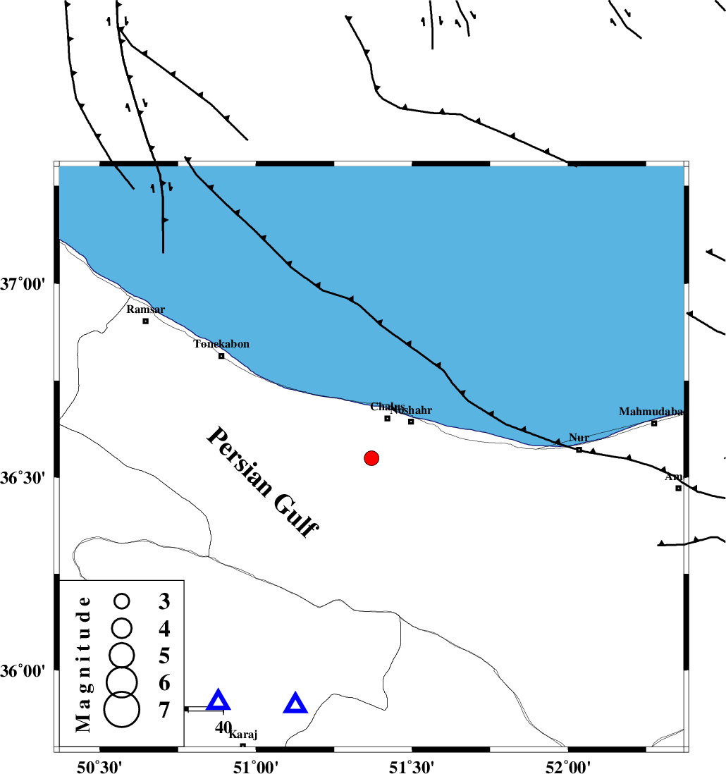
| Location | Lat:36.55 Lon: 51.37 |
| Region | 12 km South of Chalus, Mazandaran Province |
Nearest Cities |
|
| 12 km North East of Goyter, Mazandaran Province | |
| 12 km South of Chalus, Mazandaran Province | |
| 13 km North East of Kardichal, Mazandaran Province | |
| 15 km West of Nowshahr, Mazandaran Province | |
| 15 km North East of Marzanabad, Mazandaran Province | |
| Depth | 22 km |
| Agency | |
Faults within 150 km: |
|
| N_ALBORZ_F (Length: 360 km) , Distance to epicenter: 3 km | |
| KHAZAR_F (Length: 523 km) , Distance to epicenter: 10 km | |
| KOJOOR (Length: 75 km) , Distance to epicenter: 16 km | |
| Number of Phases | 5 |
| RMS | 0.2 |
| Number of Stations | 3 |
| Error in Latitude | >7.6 km |
| Error in Longitude | 5.7 km |
| Error in Depth | 30.3 km |
Download waveform in seisan format
to download seisan software Click here
to access information about IIEES stations Click here
Amplitude | ||||||||
| UID | Agency | Station | Component | Amplitude | Period | Arrival Time | Proccessing Time | Signal Clip |
| 28025 | IIEES | THKV | N | 725.7 | 0.26 | 2004-07-03 06:43:53 | 2006-03-15 11:56:00 | n |
| 28026 | IIEES | ASAO | N | 81.9 | 0.41 | 2004-07-03 06:44:40 | 2006-03-15 11:56:00 | n |
Phase | ||||||||||||
| Agency | Station | Component | Phase Type | Phase Quality | First Motion | Observed Arrival Time | Time Residual | Loc. Flag | Input Weight | Distance | Azimuth | |
| IIEES | THKV | E | PG | E | 2004-07-03 06:43:42 | 0.2 | y | 82.5 | 212 | |||
| IIEES | THKV | N | SG | E | 2004-07-03 06:43:52 | -0.1 | y | 82.5 | 212 | |||
| IIEES | DAMV | Z | PG | E | 2004-07-03 06:43:47 | 0 | y | 115 | 152 | |||
| IIEES | ASAO | Z | PG | E | 2004-07-03 06:44:08 | -0.2 | y | 253 | 209 | |||
| IIEES | ASAO | E | SG | E | 2004-07-03 06:44:38 | 0.1 | y | 253 | 209 | |||