
Magnitude |
:3.6 |
| Date & Time (UTC) | 2004-09-01 16:31:20.1 |
| Date & Time (Local) | 1383/6/11 21:01:20.1 |
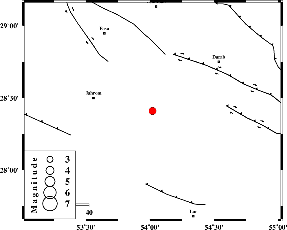
| Location | Lat:28.41 Lon: 54.02 |
| Region | 46 km East of Jahrom, Fars Province |
Nearest Cities |
|
| 18 km North West of Dabiran, Fars Province | |
| 29 km North East of Juyam, Fars Province | |
| 29 km East of Khorramabad, Fars Province | |
| 33 km North West of Shahr-e pir, Fars Province | |
| 35 km South East of Alaviyeh, Fars Province | |
| Depth | 36 km |
| Agency | |
Faults within 150 km: |
|
| BAKHTEGAN_F (Length: 94 km) , Distance to epicenter: 45 km | |
| HZF1 (Length: 102 km) , Distance to epicenter: 46 km | |
| SARVESTAN_F (Length: 94 km) , Distance to epicenter: 51 km | |
| Number of Phases | 6 |
| RMS | 0.1 |
| Number of Stations | 5 |
| Error in Latitude | >4.8 km |
| Error in Longitude | 2.4 km |
| Error in Depth | 3.7 km |
Download waveform in seisan format
to download seisan software Click here
to access information about IIEES stations Click here
Amplitude | ||||||||
| UID | Agency | Station | Component | Amplitude | Period | Arrival Time | Proccessing Time | Signal Clip |
| 28010 | IIEES | GHIR | N | 1419.2 | 0.56 | 2004-09-01 16:32:01 | 2006-03-15 11:56:00 | n |
| 28011 | IIEES | GHIR | E | 2369.1 | 0.68 | 2004-09-01 16:32:02 | 2006-03-15 11:56:00 | n |
| 28012 | IIEES | KRBR | E | 177.6 | 0.56 | 2004-09-01 16:32:55 | 2006-03-15 11:56:00 | n |
| 28013 | IIEES | KRBR | N | 213 | 0.68 | 2004-09-01 16:33:00 | 2006-03-15 11:56:00 | n |
Phase | ||||||||||||
| Agency | Station | Component | Phase Type | Phase Quality | First Motion | Observed Arrival Time | Time Residual | Loc. Flag | Input Weight | Distance | Azimuth | |
| IIEES | GHIR | Z | PG | E | 2004-09-01 16:31:37 | 0 | y | 103 | 263 | |||
| IIEES | KRBR | Z | PN | E | 2004-09-01 16:32:05 | -0.1 | y | 318 | 56 | |||
| IIEES | KRBR | E | SG | E | 2004-09-01 16:32:47 | 0 | y | 318 | 56 | |||
| IIEES | NASN | Z | PN | E | 2004-09-01 16:32:28 | 0.2 | y | 501 | 347 | |||
| IIEES | ZHSF | Z | PN | E | 2004-09-01 16:32:49 | 0.1 | y | 671 | 77 | |||
| IIEES | ASAO | Z | PN | E | 2004-09-01 16:33:02 | -0.3 | y | 780 | 332 | |||