
Magnitude |
:3 |
| Date & Time (UTC) | 2005-01-14 19:51:20.0 |
| Date & Time (Local) | 1383/10/25 23:21:20.0 |
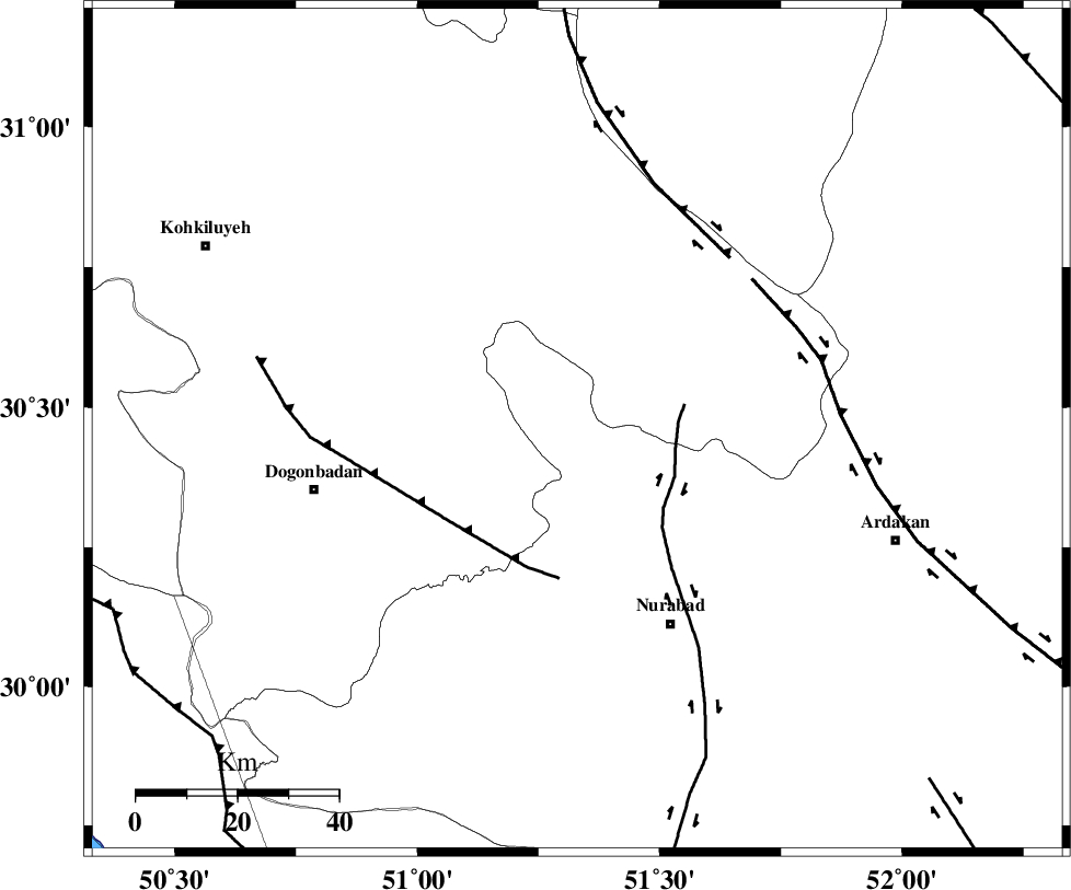
| Location | Lat:30.46 Lon: 51.33 |
| Region | |
Nearest Cities |
|
| 7 km North of Chehar taq, Fars Province | |
| 14 km North of Kopon olia, Fars Province | |
| 16 km South of Sepidar, Kohkiluieh va boyerahmad Province | |
| 18 km North of Dehnumoqimi, Fars Province | |
| 20 km North East of Basht, Kohkiluieh va boyerahmad Province | |
| Depth | 14 km |
| Agency | |
Faults within 150 km: |
|
| KAZERUN_F (Length: 96 km) , Distance to epicenter: 20 km | |
| MISHAN_F (Length: 76 km) , Distance to epicenter: 29 km | |
| DENA_F (Length: 137 km) , Distance to epicenter: 45 km | |
| Number of Phases | 5 |
| RMS | 0.3 |
| Number of Stations | 5 |
| Error in Latitude | >6 km |
| Error in Longitude | 7.2 km |
| Error in Depth | 17.4 km |
Download waveform in seisan format
to download seisan software Click here
to access information about IIEES stations Click here
Amplitude | ||||||||
| UID | Agency | Station | Component | Amplitude | Period | Arrival Time | Proccessing Time | Signal Clip |
| 5925 | IIEES | GHIR | N | 111 | 0.54 | 2005-01-14 19:52:59 | 2005-07-05 05:11:00 | n |
| 5926 | IIEES | SHGO | E | 31.9 | 0.65 | 2005-01-14 19:52:59 | 2005-07-05 05:11:00 | n |
| 5927 | IIEES | SHGR | N | 53.9 | 0.71 | 2005-01-14 19:52:58 | 2005-07-05 05:11:00 | n |
| 5928 | IIEES | SHGR | E | 45.5 | 0.93 | 2005-01-14 19:53:26 | 2005-07-05 05:11:00 | n |
Phase | ||||||||||||
| Agency | Station | Component | Phase Type | Phase Quality | First Motion | Observed Arrival Time | Time Residual | Loc. Flag | Input Weight | Distance | Azimuth | |
| IIEES | GHIR | Z | PN | E | 2005-01-14 19:52:03 | -0.1 | y | 290.2 | 146 | |||
| IIEES | NASN | Z | PN | E | 2005-01-14 19:52:04 | 0 | y | 294.9 | 28 | |||
| IIEES | SHGR | Z | PN | E | 2005-01-14 19:52:05 | 0.4 | y | 301.7 | 308 | |||
| IIEES | SHGR | N | SG | E | 2005-01-14 19:52:44 | -0.3 | y | 301.7 | 308 | |||
| IIEES | KRBR | Z | PN | E | 2005-01-14 19:52:33 | -0.2 | y | 526 | 94 | |||