
Magnitude |
:3 |
| Date & Time (UTC) | 2005-05-27 10:52:53.0 |
| Date & Time (Local) | 1384/3/6 15:22:53.0 |
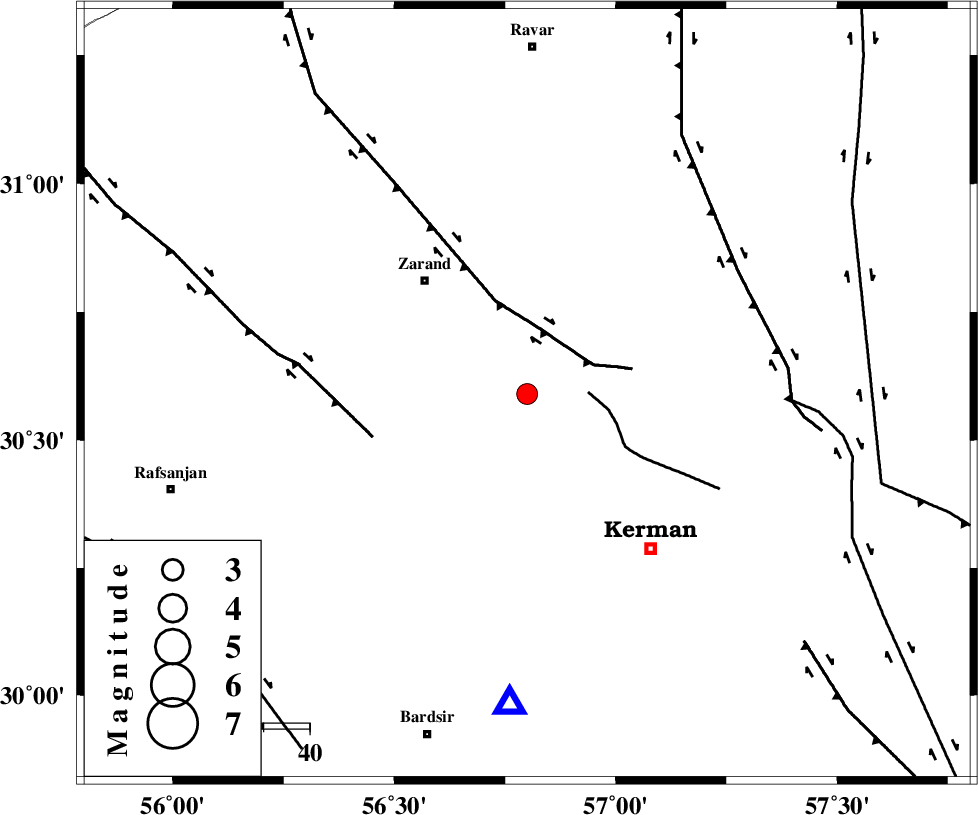
| Location | Lat:30.59 Lon: 56.8 |
| Region | |
Nearest Cities |
|
| 5 km North of Kazemabad, Kerman Province | |
| 10 km West of Chatrud, Kerman Province | |
| 13 km North West of Hutak, Kerman Province | |
| 15 km South of Khankuk, Kerman Province | |
| 22 km South East of Bahaabad, Kerman Province | |
| Depth | 45 km |
| Agency | |
Faults within 150 km: |
|
| CHATRUD_F (Length: 37 km) , Distance to epicenter: 13 km | |
| KUHBANAN_F (Length: 189 km) , Distance to epicenter: 15 km | |
| DARIVAN_F (Length: 131 km) , Distance to epicenter: 35 km | |
| Number of Phases | 6 |
| RMS | 0.1 |
| Number of Stations | 4 |
| Error in Latitude | >2.6 km |
| Error in Longitude | 1.7 km |
| Error in Depth | 2.8 km |
Download waveform in seisan format
to download seisan software Click here
to access information about IIEES stations Click here
Amplitude | ||||||||
| UID | Agency | Station | Component | Amplitude | Period | Arrival Time | Proccessing Time | Signal Clip |
| 5884 | IIEES | KRBR | N | 752.7 | 0.27 | 2005-05-27 10:53:20 | 2005-07-05 05:11:00 | n |
| 5885 | IIEES | GHIR | N | 18.1 | 0.68 | 2005-05-27 10:55:23 | 2005-07-05 05:11:00 | n |
Phase | ||||||||||||
| Agency | Station | Component | Phase Type | Phase Quality | First Motion | Observed Arrival Time | Time Residual | Loc. Flag | Input Weight | Distance | Azimuth | |
| IIEES | KRBR | Z | PG | E | 2005-05-27 10:53:06 | 0.1 | y | 67.95 | 183 | |||
| IIEES | ZHSF | Z | PN | E | 2005-05-27 10:53:47 | 0.2 | y | 398.4 | 105 | |||
| IIEES | ZHSF | N | SG | E | 2005-05-27 10:54:41 | -0.1 | y | 398.4 | 105 | |||
| IIEES | GHIR | Z | PN | E | 2005-05-27 10:53:53 | -0.2 | y | 449.7 | 236 | |||
| IIEES | NASN | Z | PN | E | 2005-05-27 10:53:54 | 0 | y | 450.4 | 304 | |||
| IIEES | NASN | E | SG | E | 2005-05-27 10:54:55 | 0 | y | 450.4 | 304 | |||