
Magnitude |
:3 |
| Date & Time (UTC) | 2005-05-24 20:29:45.2 |
| Date & Time (Local) | 1384/3/4 00:59:45.2 |
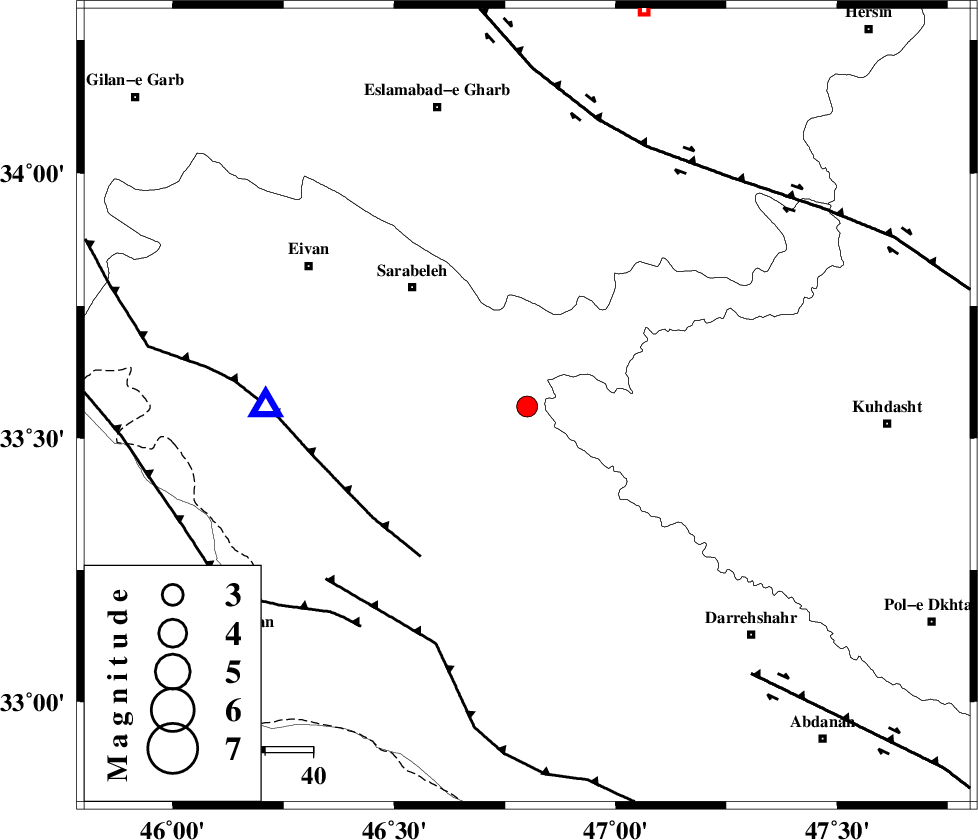
| Location | Lat:33.56 Lon: 46.8 |
| Region | |
Nearest Cities |
|
| 12 km South of Belaveh tare-e sofla, Ilam Province | |
| 13 km East of Sartang-e malehmaran, Ilam Province | |
| 33 km North East of Mehr, Ilam Province | |
| 35 km South East of Sar Ableh, Ilam Province | |
| 35 km South of Qale-ye harsam, Kermanshah Province | |
| Depth | 14 km |
| Agency | |
Faults within 150 km: |
|
| MFF7 (Length: 99 km) , Distance to epicenter: 39 km | |
| MFF6 (Length: 144 km) , Distance to epicenter: 53 km | |
| ZFF4 (Length: 128 km) , Distance to epicenter: 58 km | |
| Number of Phases | 5 |
| RMS | 0.1 |
| Number of Stations | 3 |
| Error in Latitude | >1.7 km |
| Error in Longitude | 3.5 km |
| Error in Depth | 5.3 km |
Download waveform in seisan format
to download seisan software Click here
to access information about IIEES stations Click here
Amplitude | ||||||||
| UID | Agency | Station | Component | Amplitude | Period | Arrival Time | Proccessing Time | Signal Clip |
| 5863 | IIEES | SNGE | N | 178.4 | 0.44 | 2005-05-24 20:30:48 | 2005-07-05 05:11:00 | n |
| 5864 | IIEES | SHGR | E | 90.9 | 0.44 | 2005-05-24 20:31:12 | 2005-07-05 05:11:00 | n |
| 5865 | IIEES | ASAO | N | 41 | 0.44 | 2005-05-24 20:31:17 | 2005-07-05 05:11:00 | n |
Phase | ||||||||||||
| Agency | Station | Component | Phase Type | Phase Quality | First Motion | Observed Arrival Time | Time Residual | Loc. Flag | Input Weight | Distance | Azimuth | |
| IIEES | SNGE | Z | PG | E | 2005-05-24 20:30:14 | -0.1 | y | 177.8 | 16 | |||
| IIEES | SHGR | Z | PG | E | 2005-05-24 20:30:25 | 0.1 | y | 247 | 130 | |||
| IIEES | SHGR | N | SG | E | 2005-05-24 20:30:54 | -0.1 | y | 247 | 130 | |||
| IIEES | ASAO | Z | PN | E | 2005-05-24 20:30:32 | 0.1 | y | 317.8 | 69 | |||
| IIEES | ASAO | N | SG | E | 2005-05-24 20:31:14 | 0 | y | 317.8 | 69 | |||