
Magnitude |
:3.1 |
| Date & Time (UTC) | 2005-05-22 15:55:34.1 |
| Date & Time (Local) | 1384/3/1 20:25:34.1 |
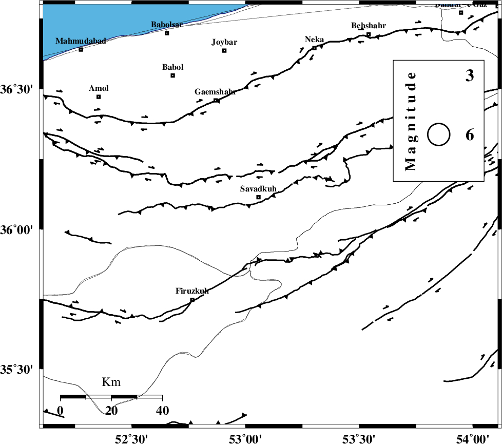
| Location | Lat:36.05 Lon: 53.11 |
| Region | |
Nearest Cities |
|
| 7 km of Shurmast-e peyrudbar, Mazandaran Province | |
| 9 km of Pol-E-Sefid, Mazandaran Province | |
| 11 km West of Sangdeh, Mazandaran Province | |
| 13 km East of Elahband, Mazandaran Province | |
| 18 km South East of Zirab, Mazandaran Province | |
| Depth | 15 km |
| Agency | |
Faults within 150 km: |
|
| N_ALBORZ_F (Length: 360 km) , Distance to epicenter: 17 km | |
| ATARI_F (Length: 185 km) , Distance to epicenter: 39 km | |
| KHAZAR_F (Length: 523 km) , Distance to epicenter: 47 km | |
| Number of Phases | 6 |
| RMS | 0.4 |
| Number of Stations | 4 |
| Error in Latitude | >11.6 km |
| Error in Longitude | 15.5 km |
| Error in Depth | 0 km |
Download waveform in seisan format
to download seisan software Click here
to access information about IIEES stations Click here
Amplitude | ||||||||
| UID | Agency | Station | Component | Amplitude | Period | Arrival Time | Proccessing Time | Signal Clip |
| 5848 | IIEES | DAMV | E | 326.4 | 0.28 | 2005-05-22 15:56:12 | 2005-07-05 05:11:00 | n |
| 5849 | IIEES | ASAO | N | 44.4 | 0.48 | 2005-05-22 15:57:13 | 2005-07-05 05:11:00 | n |
| 5850 | IIEES | GRMI | N | 24.1 | 0.24 | 2005-05-22 15:57:50 | 2005-07-05 05:11:00 | n |
Phase | ||||||||||||
| Agency | Station | Component | Phase Type | Phase Quality | First Motion | Observed Arrival Time | Time Residual | Loc. Flag | Input Weight | Distance | Azimuth | |
| IIEES | DAMV | Z | PG | E | 2005-05-22 15:55:53 | -0.2 | y | 113.2 | 246 | |||
| IIEES | DAMV | E | SG | E | 2005-05-22 15:56:07 | 0.2 | y | 113.2 | 246 | |||
| IIEES | THKV | Z | PG | E | 2005-05-22 15:56:08 | 0.7 | y | 202.1 | 266 | |||
| IIEES | ASAO | Z | PN | E | 2005-05-22 15:56:22 | 0.2 | y | 326.5 | 240 | |||
| IIEES | ASAO | E | SG | E | 2005-05-22 15:57:05 | -0.4 | y | 326.5 | 240 | |||
| IIEES | GRMI | Z | PN | E | 2005-05-22 15:56:49 | -0.7 | y | 554.3 | 305 | |||