
Magnitude |
:3.3 |
| Date & Time (UTC) | 2005-05-13 02:55:10.7 |
| Date & Time (Local) | 1384/2/23 07:25:10.7 |
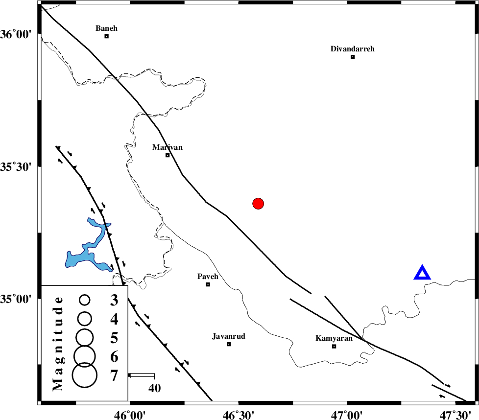
| Location | Lat:35.36 Lon: 46.59 |
| Region | |
Nearest Cities |
|
| 8 km of Shoysheh, Kurdistan Province | |
| 10 km North of Nagol, Kurdistan Province | |
| 13 km North of Avihang, Kurdistan Province | |
| 14 km North of Bisaran, Kurdistan Province | |
| 15 km East of Pir-e khafaran, Kurdistan Province | |
| Depth | 14 km |
| Agency | |
Faults within 150 km: |
|
| PIRANSHAHR_F (Length: 253 km) , Distance to epicenter: 14 km | |
| SARTAKHT_F (Length: 78 km) , Distance to epicenter: 42 km | |
| MORVARID_F (Length: 24 km) , Distance to epicenter: 48 km | |
| Number of Phases | 8 |
| RMS | 0.3 |
| Number of Stations | 7 |
| Error in Latitude | >6.2 km |
| Error in Longitude | 9.7 km |
| Error in Depth | 11.4 km |
Download waveform in seisan format
to download seisan software Click here
to access information about IIEES stations Click here
Amplitude | ||||||||
| UID | Agency | Station | Component | Amplitude | Period | Arrival Time | Proccessing Time | Signal Clip |
| 5735 | IIEES | GRMI | N | 48.4 | 0.6 | 2005-05-13 02:57:16 | 2005-07-05 05:11:00 | n |
| 5736 | IIEES | SHGR | N | 76.6 | 0.76 | 2005-05-13 02:57:36 | 2005-07-05 05:11:00 | n |
| 5737 | IIEES | DAMV | N | 29.9 | 0.64 | 2005-05-13 02:57:52 | 2005-07-05 05:11:00 | n |
| 5738 | IIEES | NASN | N | 13.5 | 0.72 | 2005-05-13 02:58:31 | 2005-07-05 05:11:00 | n |
Phase | ||||||||||||
| Agency | Station | Component | Phase Type | Phase Quality | First Motion | Observed Arrival Time | Time Residual | Loc. Flag | Input Weight | Distance | Azimuth | |
| IIEES | SNGE | Z | PG | E | 2005-05-13 02:55:23 | -0.6 | y | 74.79 | 113 | |||
| IIEES | THKV | Z | PN | E | 2005-05-13 02:56:07 | 0.3 | y | 393.3 | 80 | |||
| IIEES | GRMI | Z | PN | E | 2005-05-13 02:56:08 | 0.1 | y | 400.5 | 16 | |||
| IIEES | SHGR | Z | PN | E | 2005-05-13 02:56:10 | 0.3 | y | 414.3 | 150 | |||
| IIEES | MAKU | Z | PN | E | 2005-05-13 02:56:17 | -0.3 | y | 474.9 | 340 | |||
| IIEES | DAMV | Z | PN | E | 2005-05-13 02:56:19 | 0.2 | y | 489.1 | 85 | |||
| IIEES | NASN | Z | PN | E | 2005-05-13 02:56:38 | 0.1 | y | 639.9 | 115 | |||
| IIEES | NASN | E | SG | E | 2005-05-13 02:58:08 | 0.1 | y | 639.9 | 115 | |||