
Magnitude |
:2.7 |
| Date & Time (UTC) | 2005-05-11 20:20:06.6 |
| Date & Time (Local) | 1384/2/22 00:50:06.6 |
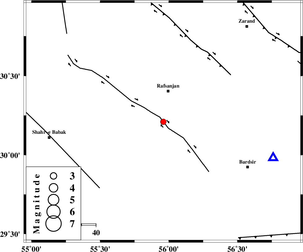
| Location | Lat:30.21 Lon: 55.96 |
| Region | |
Nearest Cities |
|
| 22 km South of Rafsanjan, Kerman Province | |
| 27 km South West of Qasemabad, Kerman Province | |
| 40 km West of Kabutarkhan, Kerman Province | |
| 43 km North East of Pariz, Kerman Province | |
| 47 km South East of Kashkuieyeh, Kerman Province | |
| Depth | 17 km |
| Agency | |
Faults within 150 km: |
|
| RAFSANJAN_F (Length: 129 km) , Distance to epicenter: 4 km | |
| DARIVAN_F (Length: 131 km) , Distance to epicenter: 58 km | |
| SHAHR_E_BABAK_F2 (Length: 272 km) , Distance to epicenter: 65 km | |
| Number of Phases | 5 |
| RMS | 0 |
| Number of Stations | 3 |
| Error in Latitude | >3.5 km |
| Error in Longitude | 3.2 km |
| Error in Depth | 5.3 km |
Download waveform in seisan format
to download seisan software Click here
to access information about IIEES stations Click here
Amplitude | ||||||||
| UID | Agency | Station | Component | Amplitude | Period | Arrival Time | Proccessing Time | Signal Clip |
| 5717 | IIEES | KRBR | N | 451.9 | 0.16 | 2005-05-11 20:20:34 | 2005-07-05 05:11:00 | n |
| 5718 | IIEES | BNDS | N | 15.1 | 0.6 | 2005-05-11 20:21:46 | 2005-07-05 05:11:00 | n |
| 5719 | IIEES | NASN | N | 13.9 | 0.52 | 2005-05-11 20:22:16 | 2005-07-05 05:11:00 | n |
Phase | ||||||||||||
| Agency | Station | Component | Phase Type | Phase Quality | First Motion | Observed Arrival Time | Time Residual | Loc. Flag | Input Weight | Distance | Azimuth | |
| IIEES | KRBR | Z | PG | E | 2005-05-11 20:20:20 | 0.1 | y | 81.47 | 108 | |||
| IIEES | KRBR | N | SG | E | 2005-05-11 20:20:31 | 0 | y | 81.47 | 108 | |||
| IIEES | BNDS | Z | PN | E | 2005-05-11 20:20:52 | 0 | y | 312 | 176 | |||
| IIEES | NASN | Z | PN | E | 2005-05-11 20:21:05 | 0 | y | 414.7 | 315 | |||
| IIEES | NASN | N | SG | E | 2005-05-11 20:22:02 | 0 | y | 414.7 | 315 | |||