
Magnitude |
:2.7 |
| Date & Time (UTC) | 2005-05-10 11:52:48.4 |
| Date & Time (Local) | 1384/2/20 16:22:48.4 |
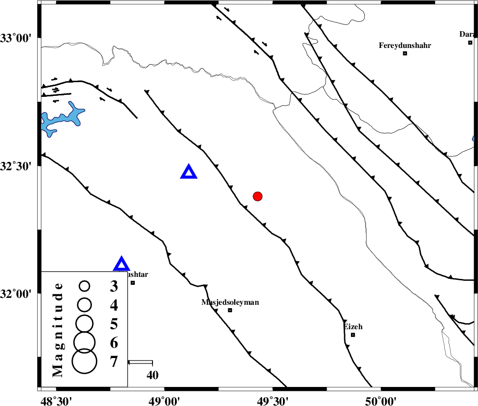
| Location | Lat:32.38 Lon: 49.43 |
| Region | |
Nearest Cities |
|
| 16 km North West of Paabshalal, Khoozestan Province | |
| 19 km North of Qale-yekhvaju, Khoozestan Province | |
| 30 km East of Lali, Khoozestan Province | |
| 31 km North East of Jaefarabad, Khoozestan Province | |
| 44 km North East of Haft shahidan, Khoozestan Province | |
| Depth | 44 km |
| Agency | |
Faults within 150 km: |
|
| MFF2 (Length: 205 km) , Distance to epicenter: 8 km | |
| ZARDKUH_F (Length: 139 km) , Distance to epicenter: 41 km | |
| DEZFUL_EMBAYMENT (Length: 228 km) , Distance to epicenter: 45 km | |
| Number of Phases | 5 |
| RMS | 0 |
| Number of Stations | 5 |
| Error in Latitude | >2 km |
| Error in Longitude | 2.5 km |
| Error in Depth | 2.7 km |
Download waveform in seisan format
to download seisan software Click here
to access information about IIEES stations Click here
Amplitude | ||||||||
| UID | Agency | Station | Component | Amplitude | Period | Arrival Time | Proccessing Time | Signal Clip |
| 5696 | IIEES | SHGR | N | 512.2 | 0.4 | 2005-05-10 11:53:24 | 2005-07-05 05:11:00 | n |
| 5697 | IIEES | ASAO | N | 36.6 | 0.56 | 2005-05-10 11:54:06 | 2005-07-05 05:11:00 | n |
| 5698 | IIEES | SNGE | N | 17.9 | 0.48 | 2005-05-10 11:54:44 | 2005-07-05 05:11:00 | n |
Phase | ||||||||||||
| Agency | Station | Component | Phase Type | Phase Quality | First Motion | Observed Arrival Time | Time Residual | Loc. Flag | Input Weight | Distance | Azimuth | |
| IIEES | SHGO | Z | PG | E | 2005-05-10 11:53:01 | 0 | y | 66.27 | 243 | |||
| IIEES | SHGR | Z | PG | E | 2005-05-10 11:53:01 | 0 | y | 66.27 | 243 | |||
| IIEES | ASAO | Z | PG | E | 2005-05-10 11:53:28 | 0 | y | 246.7 | 13 | |||
| IIEES | NASN | Z | PN | E | 2005-05-10 11:53:33 | 0 | y | 320.8 | 81 | |||
| IIEES | SNGE | Z | PN | E | 2005-05-10 11:53:37 | 0 | y | 357.3 | 328 | |||