
Magnitude |
:2.4 |
| Date & Time (UTC) | 2005-05-10 06:12:21.3 |
| Date & Time (Local) | 1384/2/20 10:42:21.3 |
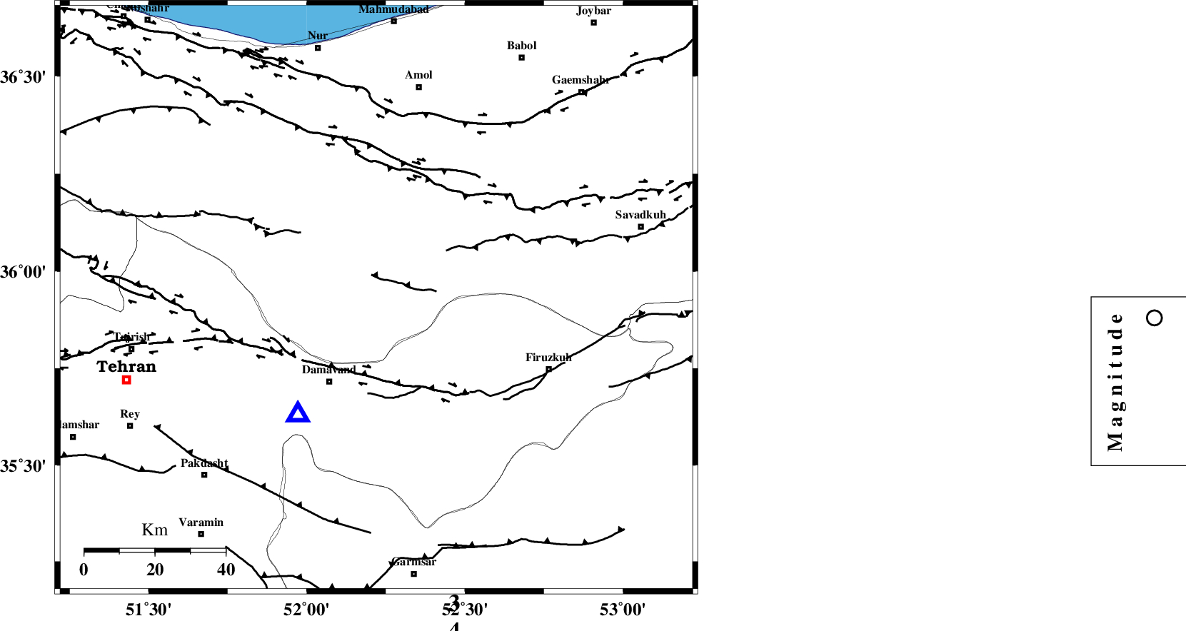
| Location | Lat:35.93 Lon: 52.22 |
| Region | |
Nearest Cities |
|
| 3 km North of Gaznak, Mazandaran Province | |
| 7 km North of Rineh, Mazandaran Province | |
| 9 km of Baijan, Mazandaran Province | |
| 27 km North East of Abali, Tehran Province | |
| 27 km North East of Damavand, Tehran Province | |
| Depth | 15 km |
| Agency | |
Faults within 150 km: |
|
| MOSHA_F (Length: 234 km) , Distance to epicenter: 24 km | |
| N_ALBORZ_F (Length: 360 km) , Distance to epicenter: 40 km | |
| N_TEHRAN_F4 (Length: 115 km) , Distance to epicenter: 41 km | |
| Number of Phases | 5 |
| RMS | 0 |
| Number of Stations | 3 |
| Error in Latitude | >2.1 km |
| Error in Longitude | 4.1 km |
| Error in Depth | 3.7 km |
Download waveform in seisan format
to download seisan software Click here
to access information about IIEES stations Click here
Amplitude | ||||||||
| UID | Agency | Station | Component | Amplitude | Period | Arrival Time | Proccessing Time | Signal Clip |
| 5694 | IIEES | DAMV | N | 504.6 | 0.16 | 2005-05-10 06:12:35 | 2005-07-05 05:11:00 | n |
| 5695 | IIEES | ASAO | N | 19.1 | 0.16 | 2005-05-10 06:13:35 | 2005-07-05 05:11:00 | n |
Phase | ||||||||||||
| Agency | Station | Component | Phase Type | Phase Quality | First Motion | Observed Arrival Time | Time Residual | Loc. Flag | Input Weight | Distance | Azimuth | |
| IIEES | DAMV | Z | PG | E | 2005-05-10 06:12:29 | 0 | y | 40.79 | 214 | |||
| IIEES | DAMV | E | SG | E | 2005-05-10 06:12:34 | 0 | y | 40.79 | 214 | |||
| IIEES | THR | Z | PG | E | 2005-05-10 06:12:38 | 0 | y | 99.14 | 269 | |||
| IIEES | ASAO | Z | PN | E | 2005-05-10 06:13:00 | 0 | y | 252.4 | 233 | |||
| IIEES | ASAO | E | SG | E | 2005-05-10 06:13:32 | 0 | y | 252.4 | 233 | |||