
Magnitude |
:3.2 |
| Date & Time (UTC) | 2005-04-20 01:11:13.6 |
| Date & Time (Local) | 1384/1/31 05:41:13.6 |
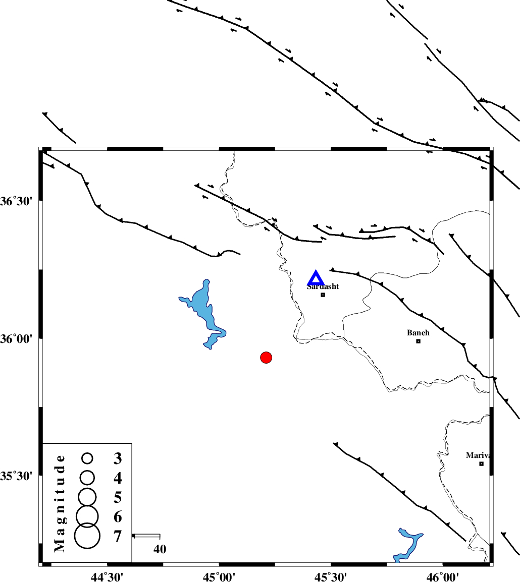
| Location | Lat:35.93 Lon: 45.21 |
| Region | |
Nearest Cities |
|
| 31 km South West of Bivaran-e sofla, Azarbaijan Gharbi Province | |
| 34 km South West of Sardasht, Azarbaijan Gharbi Province | |
| 39 km South West of Bersiv, Azarbaijan Gharbi Province | |
| 43 km South West of Rabat, Azarbaijan Gharbi Province | |
| 44 km West of Bolhasan, Kurdistan Province | |
| Depth | 14 km |
| Agency | |
Faults within 150 km: |
|
| PIRANSHAHR_F (Length: 253 km) , Distance to epicenter: 39 km | |
| HZF4 (Length: 492 km) , Distance to epicenter: 56 km | |
| MFF8 (Length: 48 km) , Distance to epicenter: 142 km | |
| Number of Phases | 4 |
| RMS | 0.1 |
| Number of Stations | 3 |
| Error in Latitude | >7.6 km |
| Error in Longitude | 10.9 km |
| Error in Depth | 9.5 km |
Download waveform in seisan format
to download seisan software Click here
to access information about IIEES stations Click here
Amplitude | ||||||||
| UID | Agency | Station | Component | Amplitude | Period | Arrival Time | Proccessing Time | Signal Clip |
| 5541 | IIEES | SNGE | N | 338.1 | 0.52 | 2005-04-20 01:12:24 | 2005-07-05 05:11:00 | n |
| 5542 | IIEES | ASAO | N | 13.3 | 0.68 | 2005-04-20 01:13:30 | 2005-07-05 05:11:00 | n |
Phase | ||||||||||||
| Agency | Station | Component | Phase Type | Phase Quality | First Motion | Observed Arrival Time | Time Residual | Loc. Flag | Input Weight | Distance | Azimuth | |
| IIEES | SNGE | Z | PG | E | 2005-04-20 01:11:48 | -0.2 | y | 214.7 | 115 | |||
| IIEES | SNGE | N | SG | E | 2005-04-20 01:12:14 | 0 | y | 214.7 | 115 | |||
| IIEES | GRMI | Z | PN | E | 2005-04-20 01:12:10 | 0 | y | 398.6 | 36 | |||
| IIEES | ASAO | Z | PN | E | 2005-04-20 01:12:19 | 0.2 | y | 464 | 108 | |||