
Magnitude |
:2.5 |
| Date & Time (UTC) | 2005-04-10 17:57:58.2 |
| Date & Time (Local) | 1384/1/21 22:27:58.2 |
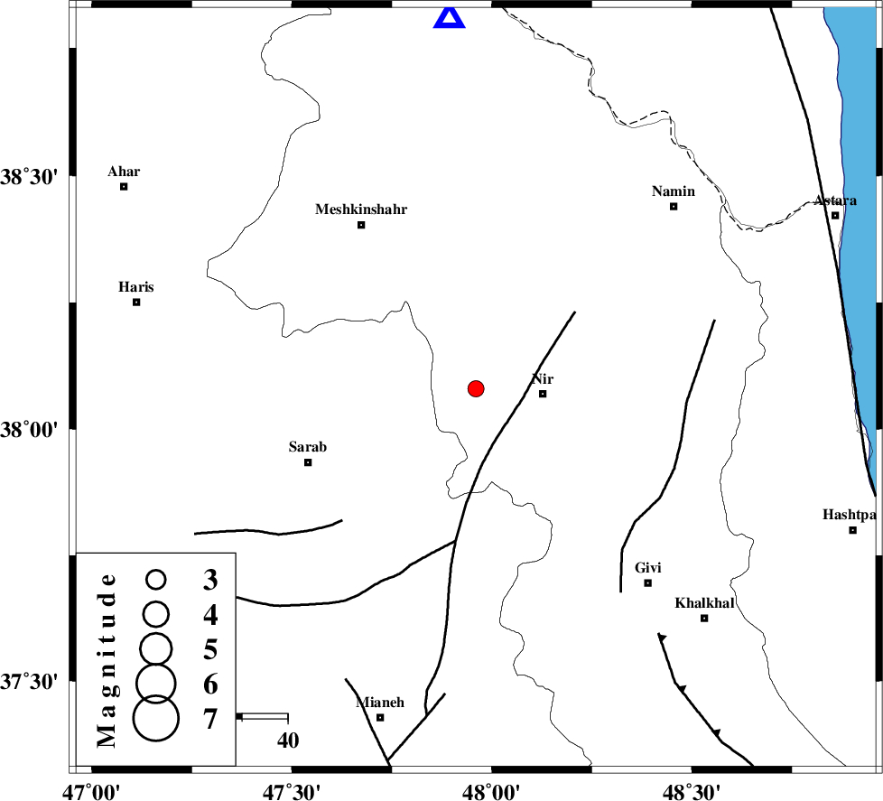
| Location | Lat:38.08 Lon: 47.96 |
| Region | |
Nearest Cities |
|
| 10 km of Eslamabad, Ardebil Province | |
| 14 km North of Qarehshiran, Ardebil Province | |
| 15 km North West of Nir, Ardebil Province | |
| 15 km West of Varniab, Ardebil Province | |
| 15 km North East of Kalian, Azarbaijan Sharghi Province | |
| Depth | 14 km |
| Agency | |
Faults within 150 km: |
|
| BOZQUSH (Length: 70 km) , Distance to epicenter: 12 km | |
| SANGAVAR_F (Length: 61 km) , Distance to epicenter: 46 km | |
| MASULEL_F (Length: 90 km) , Distance to epicenter: 67 km | |
| Number of Phases | 7 |
| RMS | 0.3 |
| Number of Stations | 4 |
| Error in Latitude | >2.5 km |
| Error in Longitude | 6.3 km |
| Error in Depth | 9.4 km |
Download waveform in seisan format
to download seisan software Click here
to access information about IIEES stations Click here
Amplitude | ||||||||
| UID | Agency | Station | Component | Amplitude | Period | Arrival Time | Proccessing Time | Signal Clip |
| 5496 | IIEES | GRMI | E | 349.1 | 0.18 | 2005-04-10 17:58:25 | 2005-07-05 05:11:00 | n |
| 5497 | IIEES | MAKU | N | 15.9 | 0.44 | 2005-04-10 17:59:35 | 2005-07-05 05:11:00 | n |
| 5498 | IIEES | SNGE | N | 9.3 | 0.44 | 2005-04-10 17:59:34 | 2005-07-05 05:11:00 | n |
Phase | ||||||||||||
| Agency | Station | Component | Phase Type | Phase Quality | First Motion | Observed Arrival Time | Time Residual | Loc. Flag | Input Weight | Distance | Azimuth | |
| IIEES | GRMI | Z | PG | E | 2005-04-10 17:58:12 | -0.2 | y | 81.16 | 356 | |||
| IIEES | GRMI | E | SG | E | 2005-04-10 17:58:22 | -0.2 | y | 81.16 | 356 | |||
| IIEES | MAKU | Z | PN | E | 2005-04-10 17:58:46 | 0.7 | y | 318.1 | 297 | |||
| IIEES | MAKU | N | SG | E | 2005-04-10 17:59:27 | -0.2 | y | 318.1 | 297 | |||
| IIEES | SNGE | Z | PN | E | 2005-04-10 17:58:48 | 0.3 | y | 336 | 190 | |||
| IIEES | SNGE | E | SG | E | 2005-04-10 17:59:32 | -0.5 | y | 336 | 190 | |||
| IIEES | ASAO | Z | PN | E | 2005-04-10 17:59:00 | 0.1 | y | 433.6 | 154 | |||