
Magnitude |
:2.9 |
| Date & Time (UTC) | 2005-04-06 04:53:51.5 |
| Date & Time (Local) | 1384/1/17 09:23:51.5 |
| Location | Lat:37.73 Lon: 48.42 |
| Region | |
Nearest Cities |
|
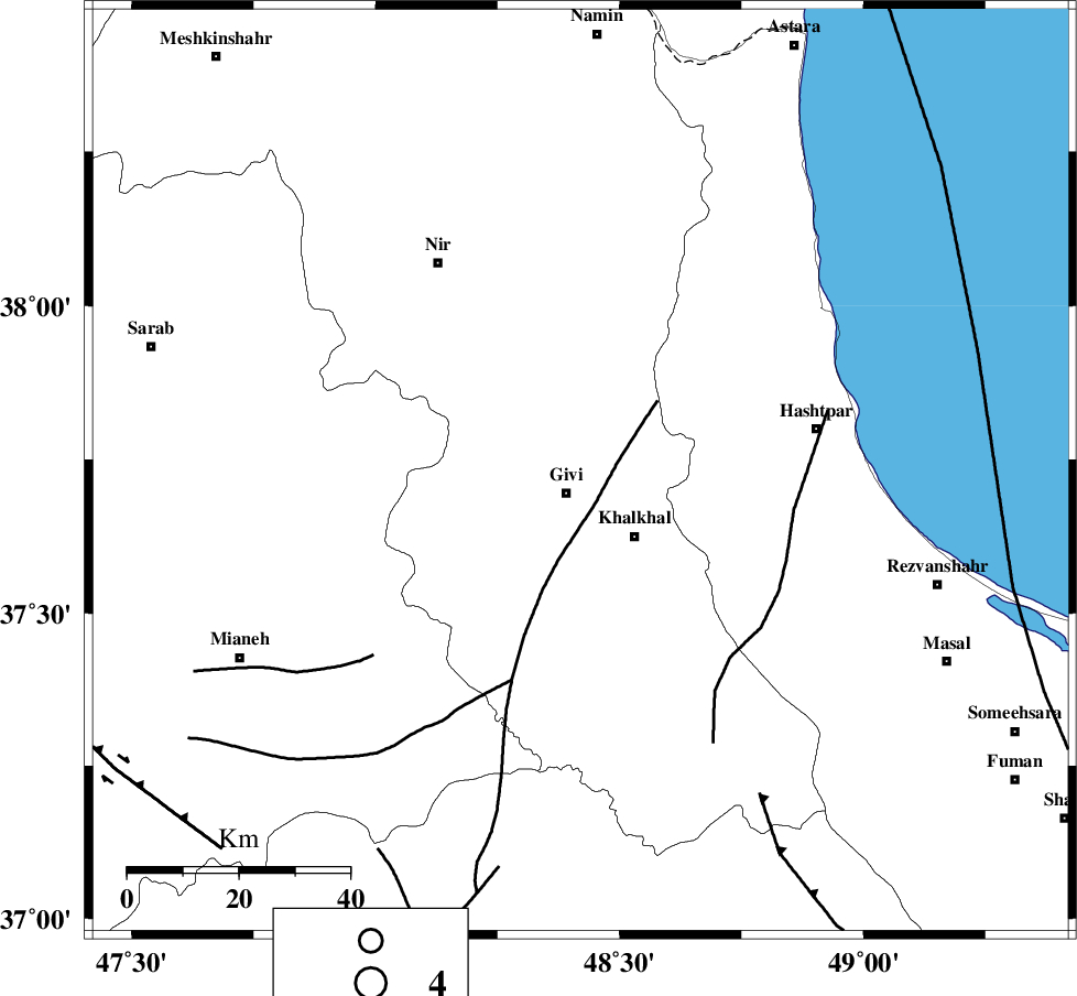
| 5 km North of Givi, Ardebil Province | |
| 14 km North East of Ganjgah, Ardebil Province | |
| 15 km North West of Khalkhal, Ardebil Province | |
| 18 km North of Gazaz, Ardebil Province | |
| 19 km North West of Khojin, Ardebil Province | |
| Depth | 14 km |
| Agency | |
Faults within 150 km: |
|
| SANGAVAR_F (Length: 61 km) , Distance to epicenter: 8 km | |
| MASULEL_F (Length: 90 km) , Distance to epicenter: 15 km | |
| BOZQUSH (Length: 70 km) , Distance to epicenter: 45 km | |
| Number of Phases | 6 |
| RMS | 0.3 |
| Number of Stations | 4 |
| Error in Latitude | >2.7 km |
| Error in Longitude | 13 km |
| Error in Depth | 15.6 km |
Download waveform in seisan format
to download seisan software Click here
to access information about IIEES stations Click here
Amplitude | ||||||||
| UID | Agency | Station | Component | Amplitude | Period | Arrival Time | Proccessing Time | Signal Clip |
| 5455 | IIEES | GRMI | E | 342.4 | 0.13 | 2005-04-06 04:54:32 | 2005-07-05 05:11:00 | n |
| 5456 | IIEES | SNGE | N | 29.5 | 0.52 | 2005-04-06 04:55:21 | 2005-07-05 05:11:00 | n |
| 5457 | IIEES | ASAO | N | 17.2 | 0.6 | 2005-04-06 04:55:38 | 2005-07-05 05:11:00 | n |
| 5458 | IIEES | DAMV | N | 33.4 | 0.26 | 2005-04-06 04:55:35 | 2005-07-05 05:11:00 | n |
Phase | ||||||||||||
| Agency | Station | Component | Phase Type | Phase Quality | First Motion | Observed Arrival Time | Time Residual | Loc. Flag | Input Weight | Distance | Azimuth | |
| IIEES | GRMI | Z | PG | E | 2005-04-06 04:54:12 | -0.5 | y | 128.4 | 339 | |||
| IIEES | GRMI | E | SG | E | 2005-04-06 04:54:29 | 0.4 | y | 128.4 | 339 | |||
| IIEES | SNGE | Z | PN | E | 2005-04-06 04:54:37 | -0.2 | y | 307.7 | 198 | |||
| IIEES | SNGE | N | SG | E | 2005-04-06 04:55:18 | 0.1 | y | 307.7 | 198 | |||
| IIEES | ASAO | Z | PN | E | 2005-04-06 04:54:46 | 0.2 | y | 381.4 | 157 | |||
| IIEES | DAMV | Z | PN | E | 2005-04-06 04:54:48 | 0.1 | y | 393.9 | 125 | |||