
Magnitude |
:3.6 |
| Date & Time (UTC) | 2005-03-21 18:28:17.9 |
| Date & Time (Local) | 1384/1/1 21:58:17.9 |
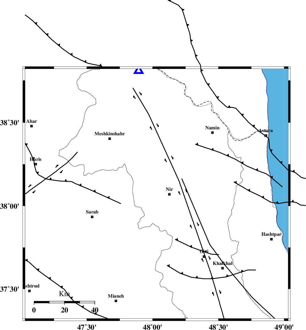
| Location | Lat:38.07 Lon: 48.03 |
| Region | |
Nearest Cities |
|
| 7 km of Eslamabad, Ardebil Province | |
| 9 km North of Nir, Ardebil Province | |
| 10 km North of Qarehshiran, Ardebil Province | |
| 10 km West of Rezaqoli qeshlaq, Ardebil Province | |
| 12 km of Varniab, Ardebil Province | |
| Depth | 18 km |
| Agency | |
Faults within 150 km: |
|
| BOZQUSH (Length: 70 km) , Distance to epicenter: 11 km | |
| SANGAVAR_F (Length: 61 km) , Distance to epicenter: 40 km | |
| MASULEL_F (Length: 90 km) , Distance to epicenter: 63 km | |
| Number of Phases | 6 |
| RMS | 0.2 |
| Number of Stations | 4 |
| Error in Latitude | >3.2 km |
| Error in Longitude | 4.6 km |
| Error in Depth | 5.8 km |
Download waveform in seisan format
to download seisan software Click here
to access information about IIEES stations Click here
Amplitude | ||||||||
| UID | Agency | Station | Component | Amplitude | Period | Arrival Time | Proccessing Time | Signal Clip |
| 5360 | IIEES | GRMI | E | 3167.5 | 0.43 | 2005-03-21 18:28:54 | 2005-07-05 05:11:00 | n |
| 5361 | IIEES | MAKU | N | 172.4 | 0.68 | 2005-03-21 18:30:11 | 2005-07-05 05:11:00 | n |
Phase | ||||||||||||
| Agency | Station | Component | Phase Type | Phase Quality | First Motion | Observed Arrival Time | Time Residual | Loc. Flag | Input Weight | Distance | Azimuth | |
| IIEES | GRMI | Z | PG | E | 2005-03-21 18:28:32 | 0.1 | y | 83.56 | 352 | |||
| IIEES | MAKU | Z | PN | E | 2005-03-21 18:29:05 | -0.2 | y | 324.5 | 297 | |||
| IIEES | MAKU | N | SG | E | 2005-03-21 18:29:49 | 0.1 | y | 324.5 | 297 | |||
| IIEES | ASAO | Z | PN | E | 2005-03-21 18:29:18 | 0 | y | 429.3 | 155 | |||
| IIEES | ASAO | E | SG | E | 2005-03-21 18:30:18 | 0.2 | y | 429.3 | 155 | |||
| IIEES | NASN | Z | PN | E | 2005-03-21 18:29:55 | -0.6 | y | 727.3 | 142 | |||