
Magnitude |
:2.7 |
| Date & Time (UTC) | 2005-03-10 05:41:13.0 |
| Date & Time (Local) | 1383/12/20 09:11:13.0 |
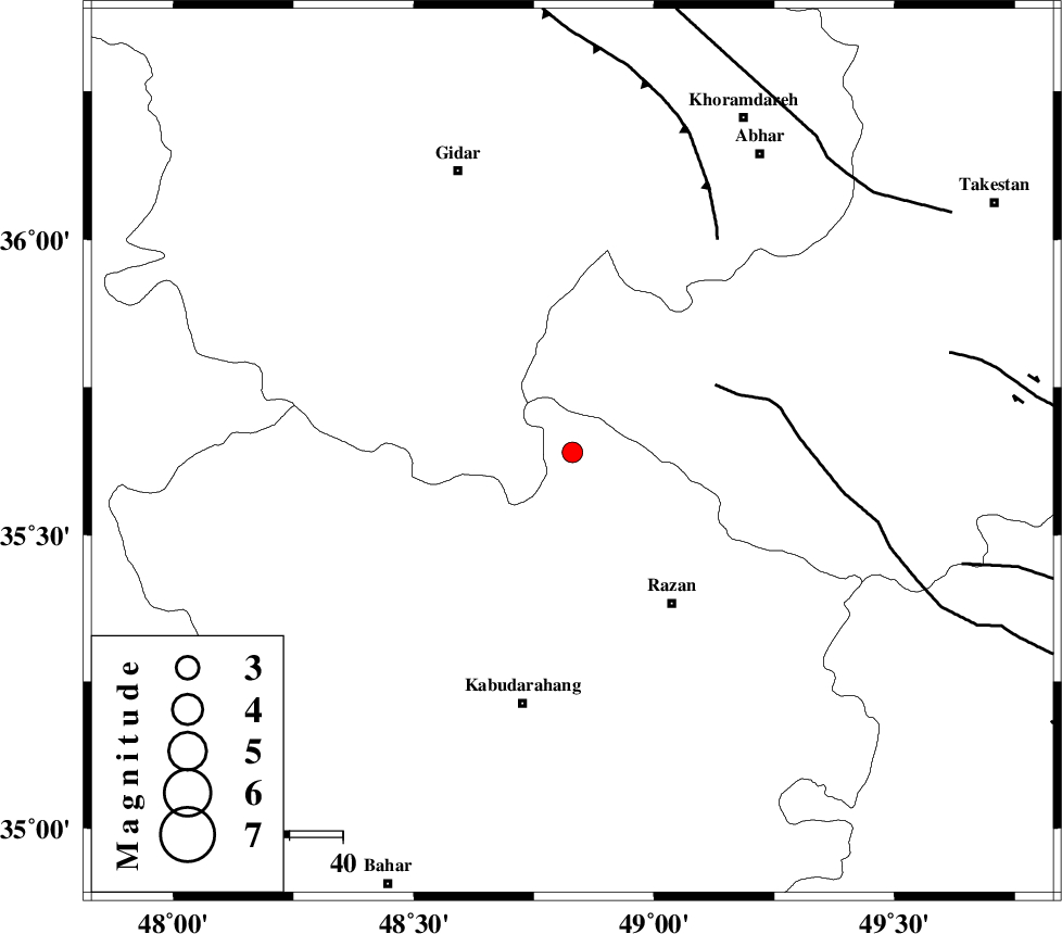
| Location | Lat:35.64 Lon: 48.83 |
| Region | |
Nearest Cities |
|
| 14 km East of Kahla, Zanjan Province | |
| 14 km North of Khorandeh, Hamedan Province | |
| 22 km North of Damag, Hamedan Province | |
| 23 km North East of Babanazar, Hamedan Province | |
| 34 km North West of Razan, Hamedan Province | |
| Depth | 14 km |
| Agency | |
Faults within 150 km: |
|
| KUSHK_E_NOSRAT_F (Length: 230 km) , Distance to epicenter: 30 km | |
| SOLTANIYEH_F (Length: 119 km) , Distance to epicenter: 48 km | |
| IPAK_F (Length: 80 km) , Distance to epicenter: 73 km | |
| Number of Phases | 6 |
| RMS | 0.1 |
| Number of Stations | 4 |
| Error in Latitude | >1.9 km |
| Error in Longitude | 1.4 km |
| Error in Depth | 0 km |
Download waveform in seisan format
to download seisan software Click here
to access information about IIEES stations Click here
Amplitude | ||||||||
| UID | Agency | Station | Component | Amplitude | Period | Arrival Time | Proccessing Time | Signal Clip |
| 5237 | IIEES | SNGE | E | 175.8 | 0.34 | 2005-03-10 05:41:59 | 2005-07-05 05:11:00 | n |
| 5238 | IIEES | ASAO | N | 78.8 | 0.57 | 2005-03-10 05:42:03 | 2005-07-05 05:11:00 | n |
| 5239 | IIEES | DAMV | N | 45.4 | 0.55 | 2005-03-10 05:42:35 | 2005-07-05 05:11:00 | n |
| 5240 | IIEES | GRMI | N | 14.3 | 0.65 | 2005-03-10 05:43:05 | 2005-07-05 05:11:00 | n |
Phase | ||||||||||||
| Agency | Station | Component | Phase Type | Phase Quality | First Motion | Observed Arrival Time | Time Residual | Loc. Flag | Input Weight | Distance | Azimuth | |
| IIEES | SNGE | Z | PG | E | 2005-03-10 05:41:38 | -0.1 | y | 147.8 | 246 | |||
| IIEES | SNGE | E | SG | E | 2005-03-10 05:41:57 | 0.1 | y | 147.8 | 246 | |||
| IIEES | ASAO | Z | PG | E | 2005-03-10 05:41:41 | 0 | y | 162.4 | 138 | |||
| IIEES | ASAO | E | SG | E | 2005-03-10 05:42:01 | -0.1 | y | 162.4 | 138 | |||
| IIEES | DAMV | Z | PN | E | 2005-03-10 05:41:56 | 0.3 | y | 284.3 | 89 | |||
| IIEES | GRMI | Z | PN | E | 2005-03-10 05:42:06 | -0.2 | y | 362.1 | 347 | |||