
Magnitude |
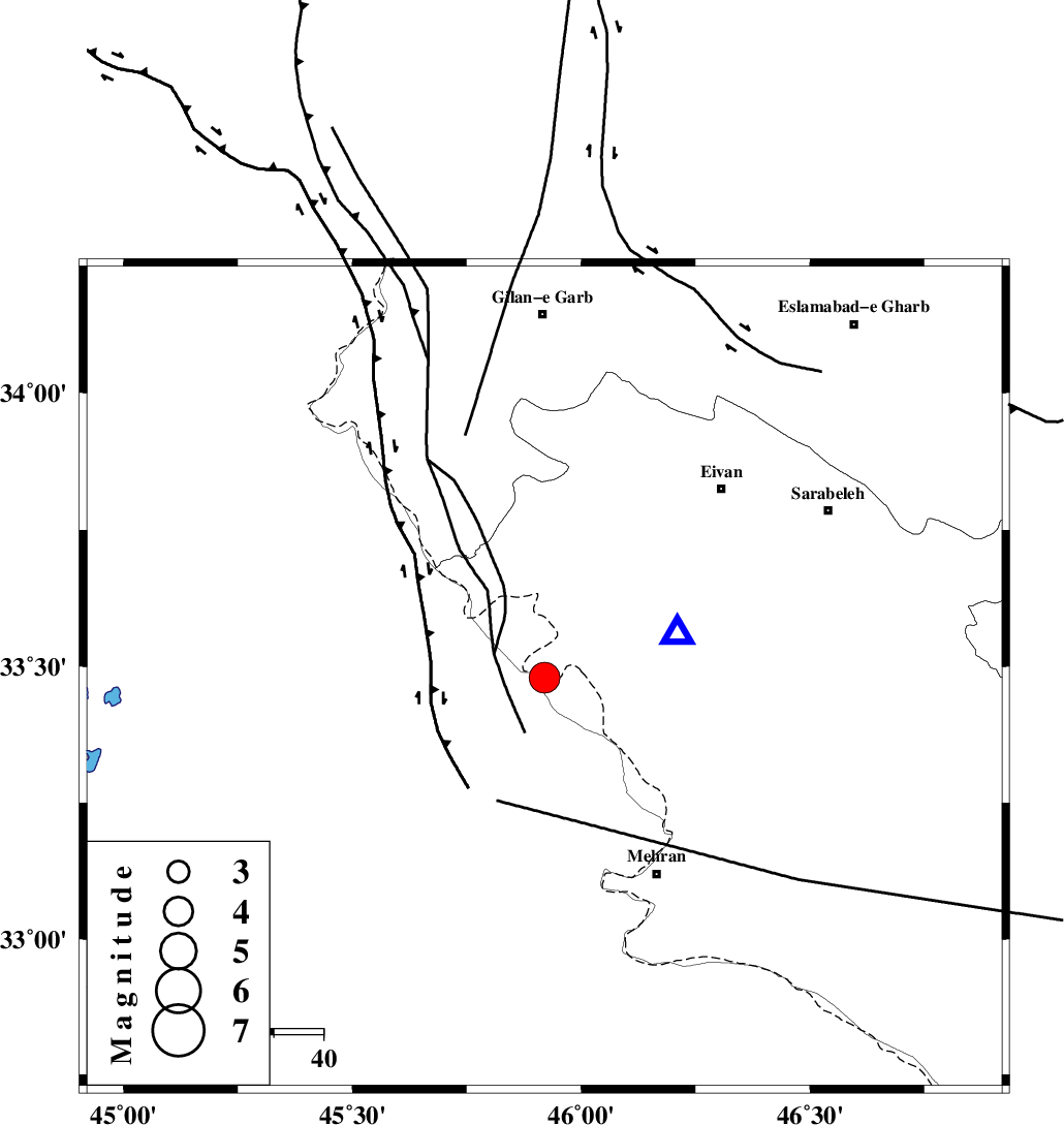
:4.2 |
| Date & Time (UTC) | 2005-01-25 08:21:46.7 |
| Date & Time (Local) | 1383/11/6 11:51:46.7 |
| Location | Lat:33.48 Lon: 45.92 |
| Region | |
Nearest Cities |
|
| 25 km North West of Salehabad, Ilam Province | |
| 40 km South West of Chavar, Ilam Province | |
| 46 km North West of Mehran, Ilam Province | |
| 50 km North West of Galeh-yedarre-hemalakshahi, Ilam Province | |
| 50 km South West of Ilam, Ilam Province | |
| Depth | 14 km |
| Agency | |
Faults within 150 km: |
|
| ZFF4 (Length: 128 km) , Distance to epicenter: 4 km | |
| MFF7 (Length: 99 km) , Distance to epicenter: 21 km | |
| MFF6 (Length: 144 km) , Distance to epicenter: 48 km | |
| Number of Phases | 8 |
| RMS | 0.2 |
| Number of Stations | 6 |
| Error in Latitude | >2.9 km |
| Error in Longitude | 7.6 km |
| Error in Depth | 8.3 km |
Download waveform in seisan format
to download seisan software Click here
to access information about IIEES stations Click here
Amplitude | ||||||||
| UID | Agency | Station | Component | Amplitude | Period | Arrival Time | Proccessing Time | Signal Clip |
| 4581 | IIEES | SNGE | N | 1249.7 | 0.64 | 2005-01-25 08:22:59 | 2005-07-05 05:11:00 | n |
| 4582 | IIEES | SHGR | N | 1149.5 | 0.52 | 2005-01-25 08:23:32 | 2005-07-05 05:11:00 | n |
Phase | ||||||||||||
| Agency | Station | Component | Phase Type | Phase Quality | First Motion | Observed Arrival Time | Time Residual | Loc. Flag | Input Weight | Distance | Azimuth | |
| IIEES | SNGE | Z | PG | E | 2005-01-25 08:22:23 | -0.1 | y | 222.4 | 36 | |||
| IIEES | SNGE | E | SG | E | 2005-01-25 08:22:50 | 0.2 | y | 222.4 | 36 | |||
| IIEES | SHGR | Z | PN | E | 2005-01-25 08:22:33 | 0.2 | y | 309.7 | 119 | |||
| IIEES | SHGR | E | SG | E | 2005-01-25 08:23:13 | -0.1 | y | 309.7 | 119 | |||
| IIEES | SHGO | Z | PN | E | 2005-01-25 08:22:33 | 0.2 | y | 309.7 | 119 | |||
| IIEES | DAMV | Z | PN | E | 2005-01-25 08:23:09 | -0.4 | y | 604.6 | 65 | |||
| IIEES | GRMI | Z | PN | E | 2005-01-25 08:23:11 | -0.1 | y | 618 | 16 | |||
| IIEES | MAKU | Z | PN | E | 2005-01-25 08:23:16 | 0 | y | 661.7 | 351 | |||