
Magnitude |
:2.7 |
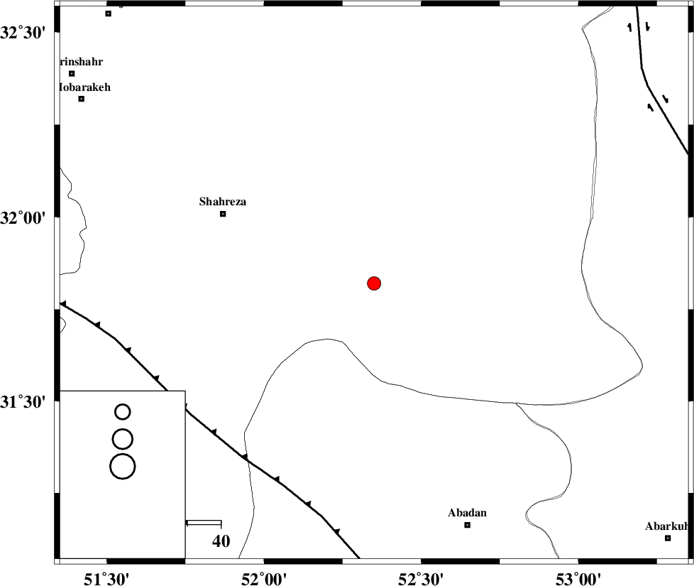
| Date & Time (UTC) | 2005-01-21 09:47:08.5 |
| Date & Time (Local) | 1383/11/2 13:17:08.5 |
| Location | Lat:31.82 Lon: 52.35 |
| Region | |
Nearest Cities |
|
| 10 km North of Ramsheh, Esfahan Province | |
| 41 km North East of Ezad khvast, Fars Province | |
| 44 km South West of Hasanabad, Esfahan Province | |
| 45 km North East of Esfarjan, Esfahan Province | |
| 50 km South East of Shahreza, Esfahan Province | |
| Depth | 14 km |
| Agency | |
Faults within 150 km: |
|
| MAIN_ZAGROS_R_F (Length: 1106 km) , Distance to epicenter: 66 km | |
| SHAHR_E_BABAK_F1 (Length: 392 km) , Distance to epicenter: 101 km | |
| DENA_F (Length: 137 km) , Distance to epicenter: 111 km | |
| Number of Phases | 4 |
| RMS | 0.1 |
| Number of Stations | 3 |
| Error in Latitude | >9.3 km |
| Error in Longitude | 17.5 km |
| Error in Depth | 14.1 km |
Download waveform in seisan format
to download seisan software Click here
to access information about IIEES stations Click here
Amplitude | ||||||||
| UID | Agency | Station | Component | Amplitude | Period | Arrival Time | Proccessing Time | Signal Clip |
| 4562 | IIEES | ASAO | N | 13.5 | 0.47 | 2005-01-21 09:48:49 | 2005-07-05 05:11:00 | n |
| 4563 | IIEES | DAMV | N | 16.4 | 0.51 | 2005-01-21 09:49:04 | 2005-07-05 05:11:00 | n |
Phase | ||||||||||||
| Agency | Station | Component | Phase Type | Phase Quality | First Motion | Observed Arrival Time | Time Residual | Loc. Flag | Input Weight | Distance | Azimuth | |
| IIEES | NASN | Z | PG | E | 2005-01-21 09:47:28 | -0.1 | y | 117.2 | 21 | |||
| IIEES | NASN | E | SG | E | 2005-01-21 09:47:42 | 0 | y | 117.2 | 21 | |||
| IIEES | ASAO | Z | PN | E | 2005-01-21 09:48:02 | -0.1 | y | 372.8 | 325 | |||
| IIEES | DAMV | Z | PN | E | 2005-01-21 09:48:09 | 0.2 | y | 424.6 | 355 | |||