
Magnitude |
:3.7 |
| Date & Time (UTC) | 2005-01-18 17:41:21.0 |
| Date & Time (Local) | 1383/10/29 21:11:21.0 |
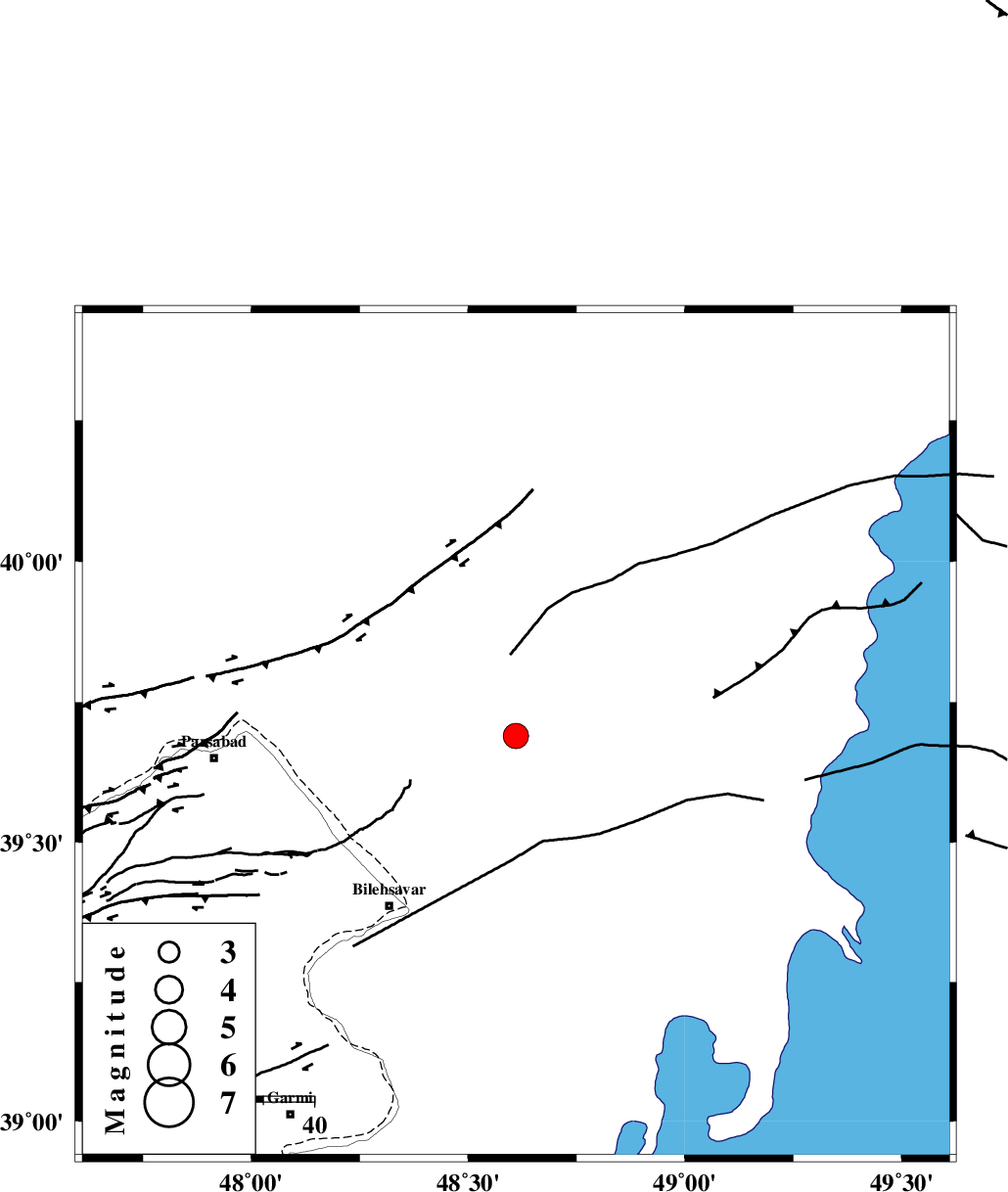
| Location | Lat:39.69 Lon: 48.61 |
| Region | |
Nearest Cities |
|
| 42 km North East of Bileh Savar, Ardebil Province | |
| 51 km North East of Kushlu, Ardebil Province | |
| 52 km North East of Tazeh kand-e gadim, Ardebil Province | |
| 55 km North East of Gorg tappeh, Ardebil Province | |
| 56 km North East of Jaefarabad, Ardebil Province | |
| Depth | 24 km |
| Agency | |
Faults within 150 km: |
|
| TALESH_F (Length: 258 km) , Distance to epicenter: 52 km | |
| DASHT_E_MOGHAN__ (Length: 104 km) , Distance to epicenter: 67 km | |
| Number of Phases | 7 |
| RMS | 0.3 |
| Number of Stations | 5 |
| Error in Latitude | >7.5 km |
| Error in Longitude | 4.7 km |
| Error in Depth | 8.3 km |
Download waveform in seisan format
to download seisan software Click here
to access information about IIEES stations Click here
Amplitude | ||||||||
| UID | Agency | Station | Component | Amplitude | Period | Arrival Time | Proccessing Time | Signal Clip |
| 4547 | IIEES | GRMI | N | 2147.8 | 0.22 | 2005-01-18 17:41:55 | 2005-07-05 05:11:00 | n |
| 4548 | IIEES | GRMI | E | 1752.6 | 0.4 | 2005-01-18 17:41:55 | 2005-07-05 05:11:00 | n |
Phase | ||||||||||||
| Agency | Station | Component | Phase Type | Phase Quality | First Motion | Observed Arrival Time | Time Residual | Loc. Flag | Input Weight | Distance | Azimuth | |
| IIEES | GRMI | Z | PG | E | 2005-01-18 17:41:40 | 0.2 | y | 115.4 | 213 | |||
| IIEES | GRMI | E | SG | E | 2005-01-18 17:41:54 | -0.1 | y | 115.4 | 213 | |||
| IIEES | MAKU | Z | PN | E | 2005-01-18 17:42:09 | -0.2 | y | 339.7 | 265 | |||
| IIEES | MAKU | N | SN | 2005-01-18 17:42:46 | 0.1 | y | 339.7 | 265 | ||||
| IIEES | SNGE | Z | PN | E | 2005-01-18 17:42:32 | -0.2 | y | 522 | 193 | |||
| IIEES | DAMV | Z | PN | E | 2005-01-18 17:42:34 | -0.3 | y | 539 | 146 | |||
| IIEES | ASAO | Z | PN | E | 2005-01-18 17:42:41 | 0.6 | y | 583.9 | 167 | |||