
Magnitude |
:2.7 |
| Date & Time (UTC) | 2005-01-13 09:10:43.1 |
| Date & Time (Local) | 1383/10/24 12:40:43.1 |
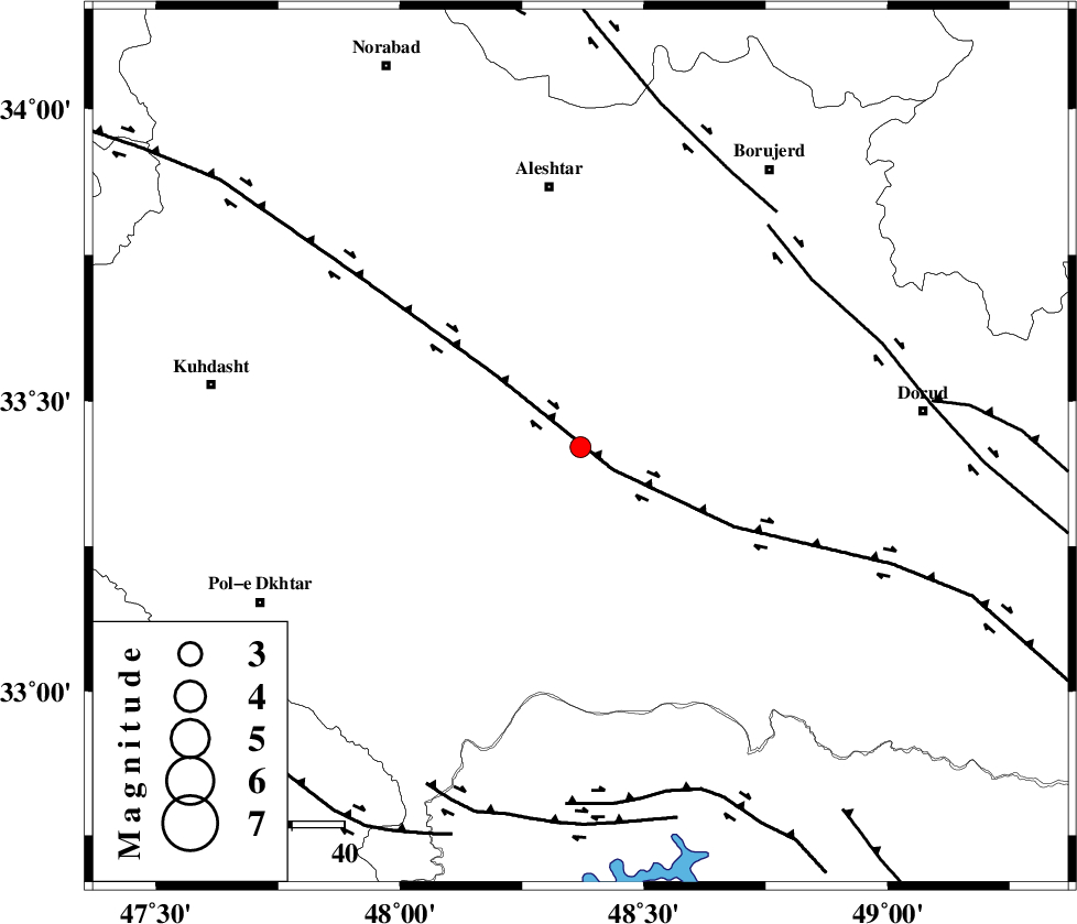
| Location | Lat:33.42 Lon: 48.37 |
| Region | |
Nearest Cities |
|
| 4 km of Badrabad-e sofla, Lorestan Province | |
| 4 km North of Daraei, Lorestan Province | |
| 7 km of Khorramabad, Lorestan Province | |
| 8 km of Kamalvand-e gholamali, Lorestan Province | |
| 16 km North East of Shoorab-e sofla, Lorestan Province | |
| Depth | 14 km |
| Agency | |
Faults within 150 km: |
|
| HZF4 (Length: 492 km) , Distance to epicenter: 8 km | |
| DORUD (Length: 100 km) , Distance to epicenter: 54 km | |
| NAHAVAND_F (Length: 102 km) , Distance to epicenter: 58 km | |
| Number of Phases | 5 |
| RMS | 0.2 |
| Number of Stations | 4 |
| Error in Latitude | >2.7 km |
| Error in Longitude | 7.6 km |
| Error in Depth | 12 km |
Download waveform in seisan format
to download seisan software Click here
to access information about IIEES stations Click here
Amplitude | ||||||||
| UID | Agency | Station | Component | Amplitude | Period | Arrival Time | Proccessing Time | Signal Clip |
| 4474 | IIEES | SHGR | N | 139.8 | 0.52 | 2005-01-13 09:11:29 | 2005-07-05 05:11:00 | n |
| 4475 | IIEES | SHGR | E | 124.1 | 0.36 | 2005-01-13 09:11:31 | 2005-07-05 05:11:00 | n |
| 4476 | IIEES | ASAO | N | 58.5 | 0.52 | 2005-01-13 09:11:47 | 2005-07-05 05:11:00 | n |
| 4477 | IIEES | SNGE | N | 59.7 | 0.6 | 2005-01-13 09:11:48 | 2005-07-05 05:11:00 | n |
Phase | ||||||||||||
| Agency | Station | Component | Phase Type | Phase Quality | First Motion | Observed Arrival Time | Time Residual | Loc. Flag | Input Weight | Distance | Azimuth | |
| IIEES | SHGR | Z | PG | E | 2005-01-13 09:11:07 | -0.4 | y | 150.3 | 164 | |||
| IIEES | SHGR | E | SG | E | 2005-01-13 09:11:26 | 0.2 | y | 150.3 | 164 | |||
| IIEES | ASAO | Z | PG | E | 2005-01-13 09:11:15 | -0.2 | y | 197.8 | 50 | |||
| IIEES | SNGE | Z | PG | E | 2005-01-13 09:11:17 | 0.1 | y | 208.7 | 333 | |||
| IIEES | NASN | Z | PN | E | 2005-01-13 09:11:43 | 0.3 | y | 419.6 | 98 | |||