
Magnitude |
:2.6 |
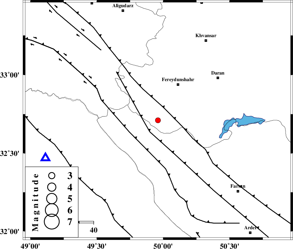
| Date & Time (UTC) | 2005-01-06 22:32:06.8 |
| Date & Time (Local) | 1383/10/18 02:02:06.8 |
| Location | Lat:32.71 Lon: 49.96 |
| Region | |
Nearest Cities |
|
| 9 km North of Durak, Chaharmahal Bakhtiari Province | |
| 18 km South East of Masir, Esfahan Province | |
| 22 km South West of Sibak, Esfahan Province | |
| 25 km West of Ghale? sorkh, Esfahan Province | |
| 29 km South West of Fereydunshahr, Esfahan Province | |
| Depth | 27 km |
| Agency | |
Faults within 150 km: |
|
| ARDAL_F (Length: 170 km) , Distance to epicenter: 10 km | |
| MAIN_ZAGROS_R_F (Length: 1106 km) , Distance to epicenter: 10 km | |
| ZARDKUH_F (Length: 139 km) , Distance to epicenter: 22 km | |
| Number of Phases | 5 |
| RMS | 0.1 |
| Number of Stations | 4 |
| Error in Latitude | >2.4 km |
| Error in Longitude | 1.6 km |
| Error in Depth | 4 km |
Download waveform in seisan format
to download seisan software Click here
to access information about IIEES stations Click here
Amplitude | ||||||||
| UID | Agency | Station | Component | Amplitude | Period | Arrival Time | Proccessing Time | Signal Clip |
| 4428 | IIEES | SHGR | E | 142.7 | 0.28 | 2005-01-06 22:32:47 | 2005-07-05 05:11:00 | n |
| 4429 | IIEES | SHGR | N | 127.2 | 0.73 | 2005-01-06 22:32:48 | 2005-07-05 05:11:00 | n |
| 4430 | IIEES | ASAO | E | 56 | 0.48 | 2005-01-06 22:33:12 | 2005-07-05 05:11:00 | n |
| 4431 | IIEES | ASAO | N | 34.9 | 0.6 | 2005-01-06 22:33:15 | 2005-07-05 05:11:00 | n |
Phase | ||||||||||||
| Agency | Station | Component | Phase Type | Phase Quality | First Motion | Observed Arrival Time | Time Residual | Loc. Flag | Input Weight | Distance | Azimuth | |
| IIEES | SHGR | Z | PG | E | 2005-01-06 22:32:27 | 0 | y | 127.7 | 239 | |||
| IIEES | ASAO | Z | PG | E | 2005-01-06 22:32:39 | 0.1 | y | 203.5 | 2 | |||
| IIEES | NASN | Z | PN | E | 2005-01-06 22:32:46 | 0.1 | y | 267.5 | 87 | |||
| IIEES | NASN | N | SG | E | 2005-01-06 22:33:20 | -0.1 | y | 267.5 | 87 | |||
| IIEES | SNGE | Z | PN | E | 2005-01-06 22:32:57 | -0.1 | y | 357.5 | 318 | |||