
Magnitude |
:3.6 |
| Date & Time (UTC) | 2005-01-01 10:15:00.4 |
| Date & Time (Local) | 1383/10/12 13:45:00.4 |
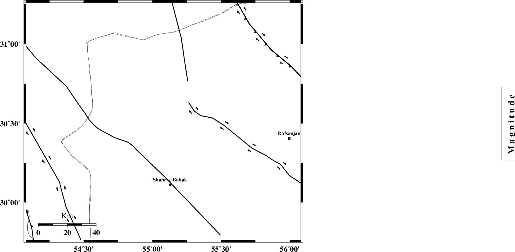
| Location | Lat:30.51 Lon: 55.08 |
| Region | |
Nearest Cities |
|
| 5 km of Jozam, Kerman Province | |
| 27 km South East of Dehaj, Kerman Province | |
| 35 km East of Khabar, Kerman Province | |
| 41 km North of Khorsand, Kerman Province | |
| 43 km North West of Meimand, Kerman Province | |
| Depth | 17 km |
| Agency | |
Faults within 150 km: |
|
| RAFSANJAN_F (Length: 129 km) , Distance to epicenter: 22 km | |
| SHAHR_E_BABAK_F2 (Length: 272 km) , Distance to epicenter: 27 km | |
| ANAR_F (Length: 127 km) , Distance to epicenter: 33 km | |
| Number of Phases | 5 |
| RMS | 0.3 |
| Number of Stations | 4 |
| Error in Latitude | >12 km |
| Error in Longitude | 7.8 km |
| Error in Depth | 16.5 km |
Download waveform in seisan format
to download seisan software Click here
to access information about IIEES stations Click here
Amplitude | ||||||||
| UID | Agency | Station | Component | Amplitude | Period | Arrival Time | Proccessing Time | Signal Clip |
| 4380 | IIEES | SHGO | E | 27.5 | 0.5 | 2005-01-01 10:18:10 | 2005-07-05 05:11:00 | n |
| 4381 | IIEES | SHGO | N | 26.9 | 0.7 | 2005-01-01 10:18:26 | 2005-07-05 05:11:00 | n |
Phase | ||||||||||||
| Agency | Station | Component | Phase Type | Phase Quality | First Motion | Observed Arrival Time | Time Residual | Loc. Flag | Input Weight | Distance | Azimuth | |
| IIEES | NASN | Z | PN | E | 2005-01-01 10:15:49 | -0.3 | y | 332.4 | 320 | |||
| IIEES | ZHSF | Z | PN | E | 2005-01-01 10:16:17 | 0 | y | 558.6 | 99 | |||
| IIEES | SHGO | Z | PN | E | 2005-01-01 10:16:25 | 0.2 | y | 622.8 | 288 | |||
| IIEES | SHGO | N | SG | E | 2005-01-01 10:17:53 | 0 | y | 622.8 | 288 | |||
| IIEES | DAMV | Z | PN | E | 2005-01-01 10:16:27 | 0.4 | y | 637.2 | 334 | |||