
Magnitude |
:2.7 |
| Date & Time (UTC) | 2005-06-05 06:21:22.2 |
| Date & Time (Local) | 1384/3/15 10:51:22.2 |
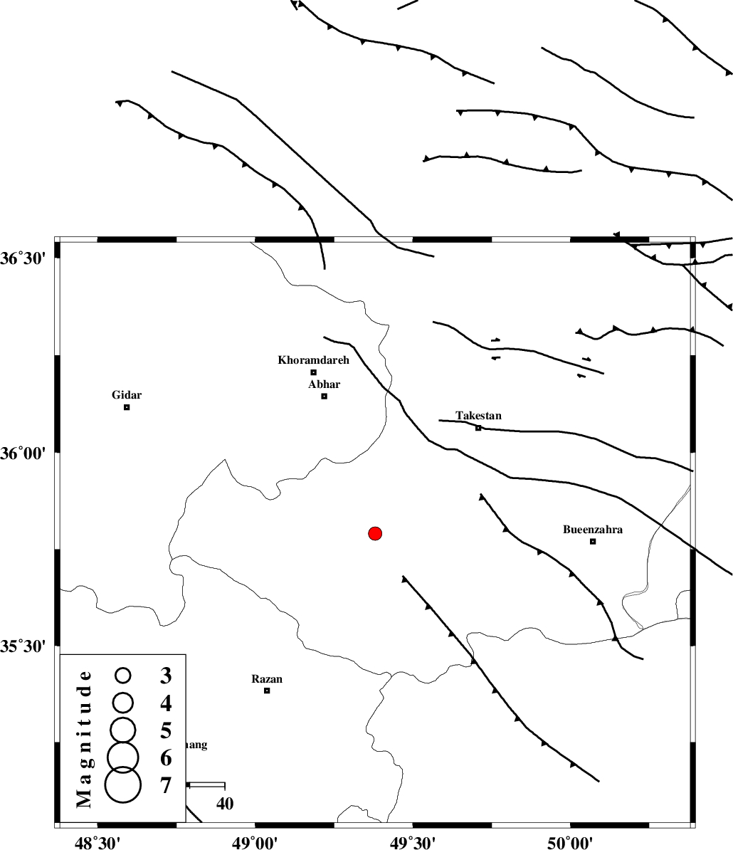
| Location | Lat:35.79 Lon: 49.38 |
| Region | |
Nearest Cities |
|
| 6 km of Hoseynabad, Ghazvin Province | |
| 9 km North of Ab-e garm, Ghazvin Province | |
| 20 km South West of Nahavand, Ghazvin Province | |
| 21 km North of Kolanjin, Ghazvin Province | |
| 23 km South of Ziaabad, Ghazvin Province | |
| Depth | 14 km |
| Agency | |
Faults within 150 km: |
|
| KUSHK_E_NOSRAT_F (Length: 230 km) , Distance to epicenter: 13 km | |
| IPAK_F (Length: 80 km) , Distance to epicenter: 21 km | |
| SOLTANIYEH_F (Length: 119 km) , Distance to epicenter: 32 km | |
| Number of Phases | 4 |
| RMS | 0.2 |
| Number of Stations | 3 |
| Error in Latitude | >9.6 km |
| Error in Longitude | 2.7 km |
| Error in Depth | 0 km |
Download waveform in seisan format
to download seisan software Click here
to access information about IIEES stations Click here
Amplitude | ||||||||
| UID | Agency | Station | Component | Amplitude | Period | Arrival Time | Proccessing Time | Signal Clip |
| 4206 | IIEES | ASAO | N | 99.5 | 0.13 | 2005-06-05 06:22:05 | 2005-07-05 05:11:00 | n |
| 4207 | IIEES | SNGE | N | 93.7 | 0.4 | 2005-06-05 06:22:26 | 2005-07-05 05:11:00 | n |
Phase | ||||||||||||
| Agency | Station | Component | Phase Type | Phase Quality | First Motion | Observed Arrival Time | Time Residual | Loc. Flag | Input Weight | Distance | Azimuth | |
| IIEES | ASAO | Z | PG | E | 2005-06-05 06:21:48 | -0.2 | y | 149.7 | 157 | |||
| IIEES | SNGE | Z | PG | E | 2005-06-05 06:21:56 | -0.3 | y | 200.3 | 248 | |||
| IIEES | SNGE | E | SG | E | 2005-06-05 06:22:22 | 0.2 | y | 200.3 | 248 | |||
| IIEES | NASN | Z | PN | E | 2005-06-05 06:22:27 | 0.3 | y | 457.6 | 135 | |||