
Magnitude |
:3.1 |
| Date & Time (UTC) | 2005-06-01 09:09:34.3 |
| Date & Time (Local) | 1384/3/11 13:39:34.3 |
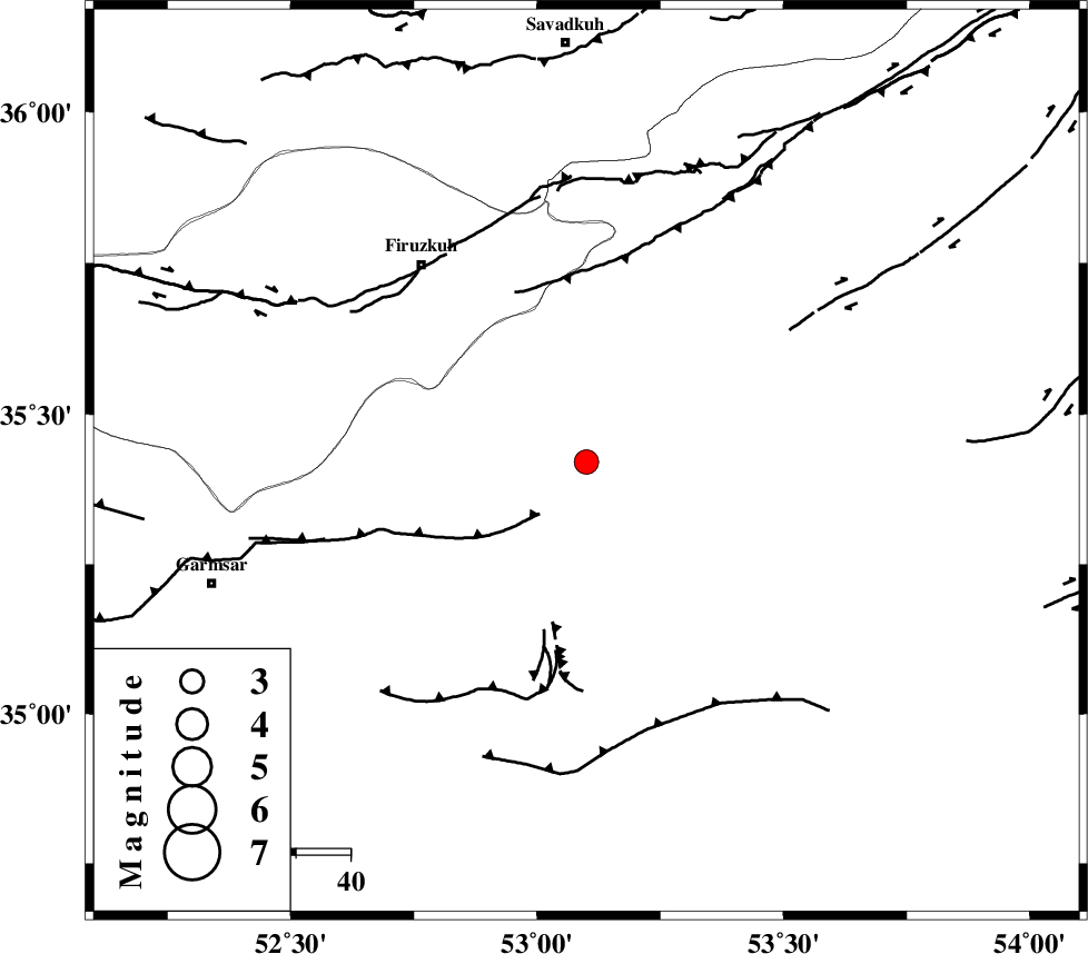
| Location | Lat:35.42 Lon: 53.1 |
| Region | |
Nearest Cities |
|
| 2 km North of Lasjerd, Semnan Province | |
| 11 km West of Sorkheh, Semnan Province | |
| 20 km South of Aftar, Semnan Province | |
| 32 km South West of Semnan, Semnan Province | |
| 38 km South West of Alae, Semnan Province | |
| Depth | 15 km |
| Agency | |
Faults within 150 km: |
|
| KUH_E_GACHAB_F2 (Length: 31 km) , Distance to epicenter: 19 km | |
| ATARI_F (Length: 185 km) , Distance to epicenter: 27 km | |
| KUH_E_GACHAB_F1 (Length: 53 km) , Distance to epicenter: 28 km | |
| Number of Phases | 6 |
| RMS | 0.1 |
| Number of Stations | 5 |
| Error in Latitude | >6.9 km |
| Error in Longitude | 5.5 km |
| Error in Depth | 5.5 km |
Download waveform in seisan format
to download seisan software Click here
to access information about IIEES stations Click here
Amplitude | ||||||||
| UID | Agency | Station | Component | Amplitude | Period | Arrival Time | Proccessing Time | Signal Clip |
| 4165 | IIEES | DAMV | N | 542.5 | 0.43 | 2005-06-01 09:10:11 | 2005-07-05 05:11:00 | n |
| 4166 | IIEES | NASN | N | 68.1 | 0.3 | 2005-06-01 09:11:13 | 2005-07-05 05:11:00 | n |
| 4167 | IIEES | ASAO | N | 119 | 0.52 | 2005-06-01 09:11:00 | 2005-07-05 05:11:00 | n |
Phase | ||||||||||||
| Agency | Station | Component | Phase Type | Phase Quality | First Motion | Observed Arrival Time | Time Residual | Loc. Flag | Input Weight | Distance | Azimuth | |
| IIEES | DAMV | Z | PG | E | 2005-06-01 09:09:52 | 0.1 | y | 105.4 | 283 | |||
| IIEES | DAMV | E | SG | E | 2005-06-01 09:10:05 | 0 | y | 105.4 | 283 | |||
| IIEES | THKV | Z | PG | E | 2005-06-01 09:10:08 | -0.1 | y | 208.8 | 286 | |||
| IIEES | NASN | Z | PN | E | 2005-06-01 09:10:18 | 0 | y | 292.1 | 185 | |||
| IIEES | ASAO | Z | PN | E | 2005-06-01 09:10:19 | 0.1 | y | 297.3 | 252 | |||
| IIEES | SNGE | Z | PN | E | 2005-06-01 09:10:47 | -0.1 | y | 525.1 | 268 | |||