
Magnitude |
:3.1 |
| Date & Time (UTC) | 2006-02-05 18:35:20.8 |
| Date & Time (Local) | 1384/11/16 22:05:20.8 |
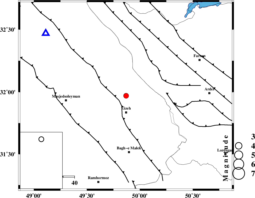
| Location | Lat:31.97 Lon: 49.87 |
| Region | |
Nearest Cities |
|
| 5 km of Torshak, Khoozestan Province | |
| 13 km North of Rasvand, Khoozestan Province | |
| 15 km North of Izeh, Khoozestan Province | |
| 22 km North of Chenarestan, Khoozestan Province | |
| 38 km North of Ghaleh tal, Khoozestan Province | |
| Depth | 18 km |
| Agency | |
Faults within 150 km: |
|
| MFF2 (Length: 205 km) , Distance to epicenter: 7 km | |
| ZARDKUH_F (Length: 139 km) , Distance to epicenter: 35 km | |
| DOPOLAN_F (Length: 107 km) , Distance to epicenter: 36 km | |
| Number of Phases | 8 |
| RMS | 0.1 |
| Number of Stations | 5 |
| Error in Latitude | >2.2 km |
| Error in Longitude | 1.3 km |
| Error in Depth | 3.2 km |
Download waveform in seisan format
to download seisan software Click here
to access information about IIEES stations Click here
Amplitude | ||||||||
| UID | Agency | Station | Component | Amplitude | Period | Arrival Time | Proccessing Time | Signal Clip |
| 15097 | IIEES | SHGR | E | 594.8 | 0.6 | 2006-02-05 18:36:05 | 2006-06-10 03:46:00 | n |
| 15098 | IIEES | SHGR | N | 746.3 | 0.56 | 2006-02-05 18:36:09 | 2006-06-10 03:46:00 | n |
| 15099 | IIEES | ASAO | E | 88.8 | 0.64 | 2006-02-05 18:36:49 | 2006-06-10 03:46:00 | n |
| 15100 | IIEES | ASAO | N | 59.3 | 0.56 | 2006-02-05 18:36:51 | 2006-06-10 03:46:00 | n |
| 15101 | IIEES | SNGE | N | 28.5 | 0.56 | 2006-02-05 18:37:34 | 2006-06-10 03:46:00 | n |
| 15102 | IIEES | SNGE | E | 17.5 | 0.6 | 2006-02-05 18:37:36 | 2006-06-10 03:46:00 | n |
Phase | ||||||||||||
| Agency | Station | Component | Phase Type | Phase Quality | First Motion | Observed Arrival Time | Time Residual | Loc. Flag | Input Weight | Distance | Azimuth | |
| IIEES | SHGR | Z | PG | E | 2006-02-05 18:35:38 | 0 | y | 102 | 279 | |||
| IIEES | SHGR | N | SG | E | 2006-02-05 18:35:50 | 0.1 | y | 102 | 279 | |||
| IIEES | ASAO | Z | PN | E | 2006-02-05 18:36:03 | -0.2 | y | 286 | 3 | |||
| IIEES | ASAO | N | SG | E | 2006-02-05 18:36:41 | 0.1 | y | 286 | 3 | |||
| IIEES | NASN | Z | PN | E | 2006-02-05 18:36:04 | 0.1 | y | 291 | 71 | |||
| IIEES | NASN | N | SG | E | 2006-02-05 18:36:43 | 0 | y | 291 | 71 | |||
| IIEES | SNGE | Z | PN | E | 2006-02-05 18:36:19 | -0.2 | y | 418 | 327 | |||
| IIEES | DAMV | Z | PN | E | 2006-02-05 18:36:24 | 0 | y | 450 | 25 | |||