
Magnitude |
:3.3 |
| Date & Time (UTC) | 2006-01-01 03:08:08.3 |
| Date & Time (Local) | 1384/10/11 06:38:08.3 |
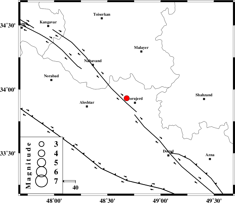
| Location | Lat:33.93 Lon: 48.68 |
| Region | |
Nearest Cities |
|
| 4 km of Bon dizeh, Lorestan Province | |
| 8 km North of Borujerd, Lorestan Province | |
| 10 km of Ashtarinan, Lorestan Province | |
| 14 km South of Darre-ye gorg, Lorestan Province | |
| 15 km North West of Hemmatabad, Lorestan Province | |
| Depth | 14 km |
| Agency | |
Faults within 150 km: |
|
| NAHAVAND_F (Length: 102 km) , Distance to epicenter: 4 km | |
| DORUD (Length: 100 km) , Distance to epicenter: 16 km | |
| SAHANEH_F (Length: 77 km) , Distance to epicenter: 47 km | |
| Number of Phases | 9 |
| RMS | 0.1 |
| Number of Stations | 6 |
| Error in Latitude | >1 km |
| Error in Longitude | 1.5 km |
| Error in Depth | 3.5 km |
Download waveform in seisan format
to download seisan software Click here
to access information about IIEES stations Click here
Amplitude | ||||||||
| UID | Agency | Station | Component | Amplitude | Period | Arrival Time | Proccessing Time | Signal Clip |
| 14355 | IIEES | ASAO | E | 718.5 | 0.56 | 2006-01-01 03:08:50 | 2006-06-10 03:46:00 | n |
| 14356 | IIEES | ASAO | N | 611.3 | 0.28 | 2006-01-01 03:08:51 | 2006-06-10 03:46:00 | n |
| 14357 | IIEES | SNGE | N | 187.4 | 0.48 | 2006-01-01 03:09:09 | 2006-06-10 03:46:00 | n |
| 14358 | IIEES | SHGR | E | 303.1 | 0.36 | 2006-01-01 03:09:09 | 2006-06-10 03:46:00 | n |
| 14359 | IIEES | SHGR | N | 316 | 0.68 | 2006-01-01 03:09:11 | 2006-06-10 03:46:00 | n |
| 14360 | IIEES | THKV | E | 86.2 | 0.48 | 2006-01-01 03:09:34 | 2006-06-10 03:46:00 | n |
Phase | ||||||||||||
| Agency | Station | Component | Phase Type | Phase Quality | First Motion | Observed Arrival Time | Time Residual | Loc. Flag | Input Weight | Distance | Azimuth | |
| IIEES | ASAO | Z | PG | E | 2006-01-01 03:08:31 | -0.2 | y | 142 | 61 | |||
| IIEES | ASAO | N | SG | E | 2006-01-01 03:08:49 | 0 | y | 142 | 61 | |||
| IIEES | SNGE | Z | PG | E | 2006-01-01 03:08:37 | -0.1 | y | 178 | 317 | |||
| IIEES | SNGE | E | SG | E | 2006-01-01 03:08:59 | 0.1 | y | 178 | 317 | |||
| IIEES | SHGR | Z | PG | E | 2006-01-01 03:08:41 | 0.1 | y | 202 | 177 | |||
| IIEES | SHGR | E | SG | E | 2006-01-01 03:09:05 | -0.1 | y | 202 | 177 | |||
| IIEES | THKV | Z | PN | E | 2006-01-01 03:08:53 | 0 | y | 298 | 42 | |||
| IIEES | DAMV | Z | PN | E | 2006-01-01 03:09:00 | 0 | y | 355 | 57 | |||
| IIEES | NASN | Z | PN | E | 2006-01-01 03:09:06 | 0.1 | y | 404 | 107 | |||