
Magnitude |
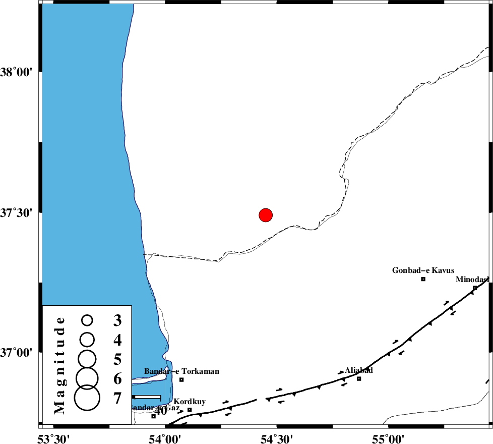
:3.8 |
| Date & Time (UTC) | 2005-12-15 08:41:12.8 |
| Date & Time (Local) | 1384/9/24 12:11:12.8 |
| Location | Lat:37.49 Lon: 54.45 |
| Region | |
Nearest Cities |
|
| 25 km North West of Enchehborun, Golestan Province | |
| 37 km South West of Dashliborun, Golestan Province | |
| 52 km North West of Gariduji, Golestan Province | |
| 53 km North of Aq Qaleh, Golestan Province | |
| 53 km North of Qanqarmeh, Golestan Province | |
| Depth | 43 km |
| Agency | |
Faults within 150 km: |
|
| KHAZAR_F (Length: 523 km) , Distance to epicenter: 70 km | |
| N_ALBORZ_F (Length: 360 km) , Distance to epicenter: 98 km | |
| SHAVAR_F (Length: 87 km) , Distance to epicenter: 103 km | |
| Number of Phases | 6 |
| RMS | 0.5 |
| Number of Stations | 3 |
| Error in Latitude | >8.1 km |
| Error in Longitude | 14.1 km |
| Error in Depth | 10.1 km |
Download waveform in seisan format
to download seisan software Click here
to access information about IIEES stations Click here
Amplitude | ||||||||
| UID | Agency | Station | Component | Amplitude | Period | Arrival Time | Proccessing Time | Signal Clip |
| 10467 | IIEES | DAMV | N | 282.8 | 0.39 | 2005-12-15 08:42:45 | 2006-01-09 11:55:00 | n |
| 10468 | IIEES | THKV | E | 281.3 | 0.48 | 2005-12-15 08:43:04 | 2006-01-09 11:55:00 | n |
Phase | ||||||||||||
| Agency | Station | Component | Phase Type | Phase Quality | First Motion | Observed Arrival Time | Time Residual | Loc. Flag | Input Weight | Distance | Azimuth | |
| IIEES | DAMV | Z | Pn | E | 2005-12-15 08:41:55 | -0.4 | y | 303 | 228 | |||
| IIEES | DAMV | N | Sn | 2005-12-15 08:42:26 | -0.1 | y | 303 | 228 | ||||
| IIEES | THKV | Z | Pn | E | 2005-12-15 08:42:04 | 0.9 | y | 364 | 242 | |||
| IIEES | THKV | N | Sg | E | 2005-12-15 08:42:52 | 0 | y | 364 | 242 | |||
| IIEES | GRMI | Z | Pn | E | 2005-12-15 08:42:31 | -0.6 | y | 593 | 286 | |||
| IIEES | GRMI | N | Sn | 2005-12-15 08:43:29 | 0.1 | y | 593 | 286 | ||||