
Magnitude |
:2.5 |
| Date & Time (UTC) | 2005-11-12 12:11:36.5 |
| Date & Time (Local) | 1384/8/21 15:41:36.5 |
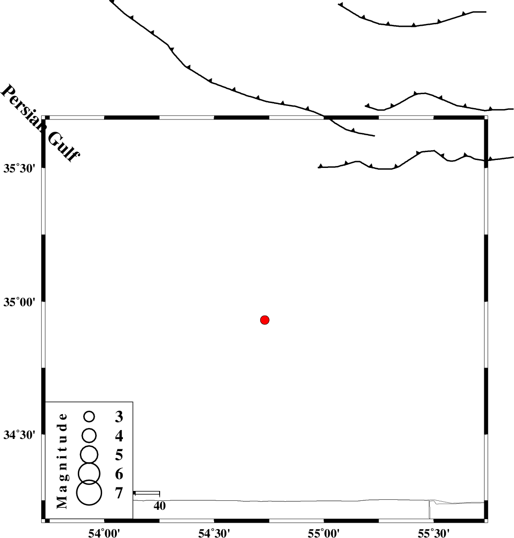
| Location | Lat:34.93 Lon: 54.73 |
| Region | |
Nearest Cities |
|
| 103 km North East of Jondaq, Esfahan Province | |
| 122 km North West of Farrokhi, Esfahan Province | |
| 132 km South East of Alae, Semnan Province | |
| 132 km North West of Khur, Esfahan Province | |
| 133 km South East of Amirabad, Semnan Province | |
| Depth | 14 km |
| Agency | |
Faults within 150 km: |
|
| TORUD_F (Length: 136 km) , Distance to epicenter: 45 km | |
| DORUNEH_F (Length: 713 km) , Distance to epicenter: 69 km | |
| KUH_E_GUGERD_F (Length: 73 km) , Distance to epicenter: 104 km | |
| Number of Phases | 6 |
| RMS | 0.1 |
| Number of Stations | 4 |
| Error in Latitude | >3.6 km |
| Error in Longitude | 5.5 km |
| Error in Depth | 7.3 km |
Download waveform in seisan format
to download seisan software Click here
to access information about IIEES stations Click here
Amplitude | ||||||||
| UID | Agency | Station | Component | Amplitude | Period | Arrival Time | Proccessing Time | Signal Clip |
| 10172 | IIEES | NASN | N | 19.7 | 0.2 | 2005-11-12 12:13:02 | 2006-01-09 11:55:00 | n |
| 10173 | IIEES | ASAO | N | 7.7 | 0.42 | 2005-11-12 12:13:51 | 2006-01-09 11:55:00 | n |
Phase | ||||||||||||
| Agency | Station | Component | Phase Type | Phase Quality | First Motion | Observed Arrival Time | Time Residual | Loc. Flag | Input Weight | Distance | Azimuth | |
| IIEES | NASN | Z | PN | E | 2005-11-12 12:12:21 | 0.1 | y | 296 | 218 | |||
| IIEES | NASN | E | SG | E | 2005-11-12 12:12:59 | -0.1 | y | 296 | 218 | |||
| IIEES | CHTH | Z | PN | E | 2005-11-12 12:12:27 | -0.2 | y | 345 | 289 | |||
| IIEES | THKV | Z | PN | E | 2005-11-12 12:12:29 | 0 | y | 367 | 288 | |||
| IIEES | THKV | N | Sn | 2005-11-12 12:13:09 | 0.1 | y | 367 | 288 | ||||
| IIEES | ASAO | Z | PN | E | 2005-11-12 12:12:38 | -0.1 | y | 433 | 266 | |||