
Magnitude |
:3.2 |
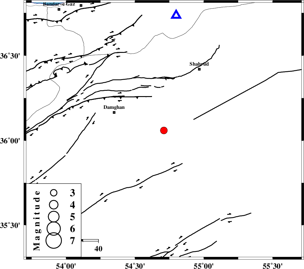
| Date & Time (UTC) | 2005-10-23 06:09:18.1 |
| Date & Time (Local) | 1384/8/1 09:39:18.1 |
| Location | Lat:36.06 Lon: 54.71 |
| Region | |
Nearest Cities |
|
| 22 km South East of Mehmandust, Semnan Province | |
| 35 km South East of Damghan, Semnan Province | |
| 42 km South West of Ruyan, Semnan Province | |
| 46 km South West of Shahrud, Semnan Province | |
| 47 km South of Majen, Semnan Province | |
| Depth | 17 km |
| Agency | |
Faults within 150 km: |
|
| MEYAMEY_F (Length: 141 km) , Distance to epicenter: 21 km | |
| ATARI_F (Length: 185 km) , Distance to epicenter: 23 km | |
| DAMGHAN_F (Length: 95 km) , Distance to epicenter: 26 km | |
| Number of Phases | 8 |
| RMS | 0.4 |
| Number of Stations | 6 |
| Error in Latitude | >10.4 km |
| Error in Longitude | 5.6 km |
| Error in Depth | 0 km |
Download waveform in seisan format
to download seisan software Click here
to access information about IIEES stations Click here
Amplitude | ||||||||
| UID | Agency | Station | Component | Amplitude | Period | Arrival Time | Proccessing Time | Signal Clip |
| 10098 | IIEES | DAMV | N | 102.5 | 0.45 | 2005-10-23 06:10:37 | 2006-01-09 11:55:00 | n |
| 10099 | IIEES | KRBR | E | 8 | 0.55 | 2005-10-23 06:13:21 | 2006-01-09 11:55:00 | n |
Phase | ||||||||||||
| Agency | Station | Component | Phase Type | Phase Quality | First Motion | Observed Arrival Time | Time Residual | Loc. Flag | Input Weight | Distance | Azimuth | |
| IIEES | DAMV | Z | PN | E | 2005-10-23 06:09:57 | 0.1 | y | 252 | 260 | |||
| IIEES | DAMV | N | SG | E | 2005-10-23 06:10:29 | -0.4 | y | 252 | 260 | |||
| IIEES | CHTH | Z | PN | E | 2005-10-23 06:10:05 | -0.3 | y | 324 | 268 | |||
| IIEES | CHTH | N | SG | E | 2005-10-23 06:10:49 | 0.5 | y | 324 | 268 | |||
| IIEES | THKV | Z | PN | E | 2005-10-23 06:10:08 | -0.4 | y | 346 | 268 | |||
| IIEES | NASN | Z | PN | E | 2005-10-23 06:10:15 | -0.1 | y | 402 | 206 | |||
| IIEES | ASAO | Z | PN | E | 2005-10-23 06:10:23 | 0.7 | y | 458 | 250 | |||
| IIEES | KRBR | Z | Pn | E | 2005-10-23 06:10:52 | 0 | y | 701 | 164 | |||