
Magnitude |
:3.1 |
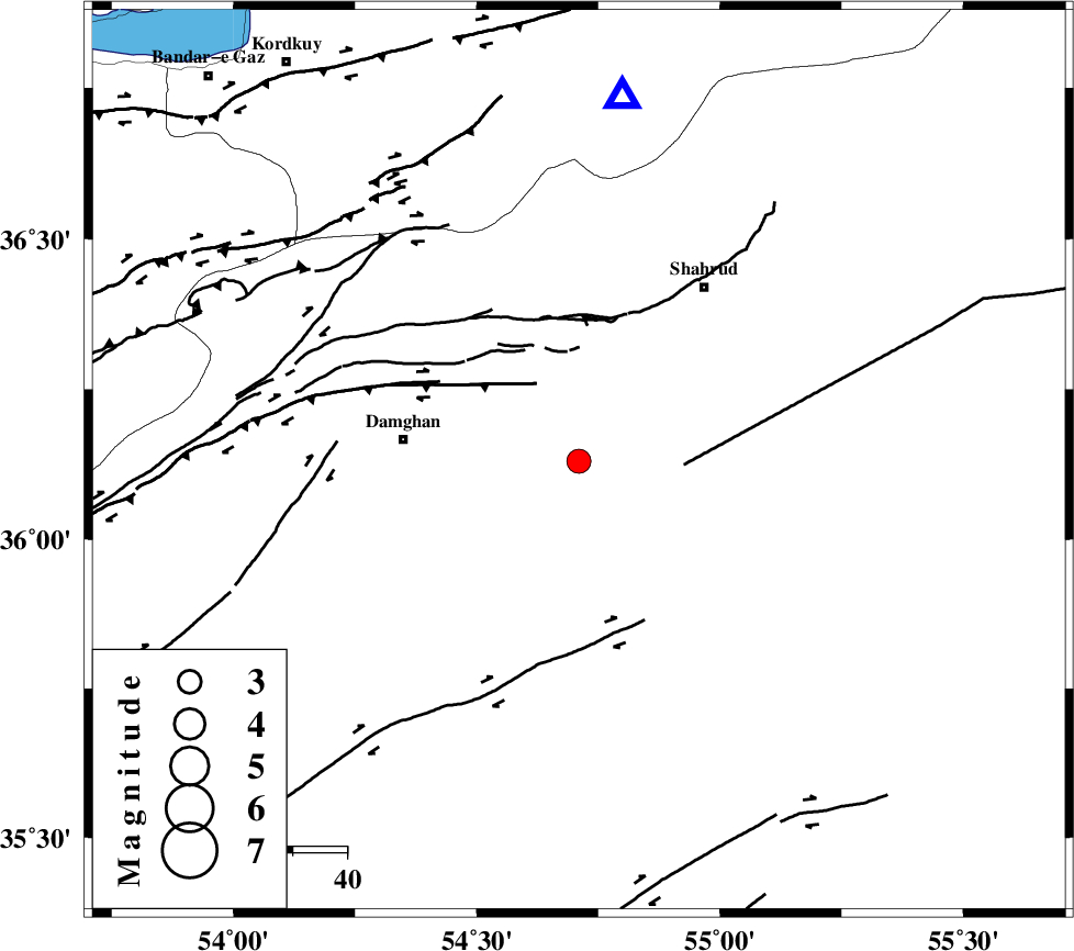
| Date & Time (UTC) | 2005-10-23 05:54:30.0 |
| Date & Time (Local) | 1384/8/1 09:24:30.0 |
| Location | Lat:36.13 Lon: 54.71 |
| Region | |
Nearest Cities |
|
| 17 km East of Mehmandust, Semnan Province | |
| 33 km East of Damghan, Semnan Province | |
| 36 km South West of Ruyan, Semnan Province | |
| 39 km South of Majen, Semnan Province | |
| 40 km South West of Shahrud, Semnan Province | |
| Depth | 35 km |
| Agency | |
Faults within 150 km: |
|
| ATARI_F (Length: 185 km) , Distance to epicenter: 15 km | |
| DAMGHAN_F (Length: 95 km) , Distance to epicenter: 18 km | |
| MEYAMEY_F (Length: 141 km) , Distance to epicenter: 19 km | |
| Number of Phases | 7 |
| RMS | 0.2 |
| Number of Stations | 5 |
| Error in Latitude | >4 km |
| Error in Longitude | 9.3 km |
| Error in Depth | 9.5 km |
Download waveform in seisan format
to download seisan software Click here
to access information about IIEES stations Click here
Amplitude | ||||||||
| UID | Agency | Station | Component | Amplitude | Period | Arrival Time | Proccessing Time | Signal Clip |
| 10096 | IIEES | DAMV | N | 147.1 | 0.46 | 2005-10-23 05:55:48 | 2006-01-09 11:55:00 | n |
| 10097 | IIEES | ASAO | N | 19.6 | 0.52 | 2005-10-23 05:57:02 | 2006-01-09 11:55:00 | n |
Phase | ||||||||||||
| Agency | Station | Component | Phase Type | Phase Quality | First Motion | Observed Arrival Time | Time Residual | Loc. Flag | Input Weight | Distance | Azimuth | |
| IIEES | DAMV | Z | PN | E | 2005-10-23 05:55:07 | 0.1 | y | 254 | 258 | |||
| IIEES | DAMV | N | SG | E | 2005-10-23 05:55:40 | 0 | y | 254 | 258 | |||
| IIEES | CHTH | Z | Pn | E | 2005-10-23 05:55:15 | -0.3 | y | 324 | 267 | |||
| IIEES | THKV | Z | PN | E | 2005-10-23 05:55:19 | 0.3 | y | 346 | 267 | |||
| IIEES | NASN | Z | Pn | E | 2005-10-23 05:55:26 | 0 | y | 409 | 206 | |||
| IIEES | NASN | E | Sn | 2005-10-23 05:56:08 | 0 | y | 409 | 206 | ||||
| IIEES | ASAO | Z | Pn | E | 2005-10-23 05:55:33 | -0.1 | y | 461 | 249 | |||