
Magnitude |
:2.8 |
| Date & Time (UTC) | 2005-09-30 23:33:41.5 |
| Date & Time (Local) | 1384/7/9 03:03:41.5 |
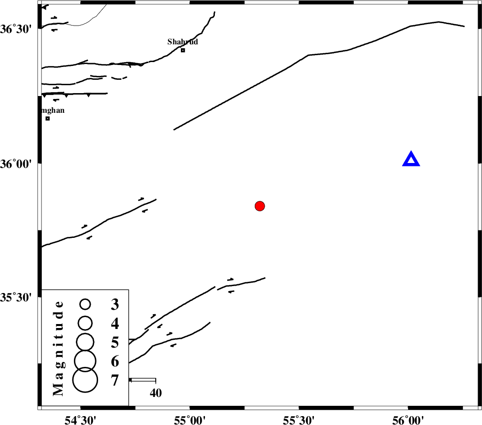
| Location | Lat:35.84 Lon: 55.32 |
| Region | |
Nearest Cities |
|
| 52 km South West of Biarjomand, Semnan Province | |
| 63 km South West of Khankhodi, Semnan Province | |
| 63 km South East of Ruyan, Semnan Province | |
| 70 km South West of Miamay, Semnan Province | |
| 72 km South East of Shahrud, Semnan Province | |
| Depth | 15 km |
| Agency | |
Faults within 150 km: |
|
| TORUD_F (Length: 136 km) , Distance to epicenter: 29 km | |
| MEYAMEY_F (Length: 141 km) , Distance to epicenter: 47 km | |
| DAMGHAN_F (Length: 95 km) , Distance to epicenter: 70 km | |
| Number of Phases | 6 |
| RMS | 0.1 |
| Number of Stations | 4 |
| Error in Latitude | >4.3 km |
| Error in Longitude | 2.5 km |
| Error in Depth | 0 km |
Download waveform in seisan format
to download seisan software Click here
to access information about IIEES stations Click here
Amplitude | ||||||||
| UID | Agency | Station | Component | Amplitude | Period | Arrival Time | Proccessing Time | Signal Clip |
| 10015 | IIEES | DAMV | N | 50.1 | 0.66 | 2005-09-30 23:35:14 | 2006-01-09 11:55:00 | n |
| 10016 | IIEES | ASAO | N | 7.8 | 0.56 | 2005-09-30 23:36:27 | 2006-01-09 11:55:00 | n |
Phase | ||||||||||||
| Agency | Station | Component | Phase Type | Phase Quality | First Motion | Observed Arrival Time | Time Residual | Loc. Flag | Input Weight | Distance | Azimuth | |
| IIEES | DAMV | Z | PN | E | 2005-09-30 23:34:27 | 0 | y | 303 | 267 | |||
| IIEES | DAMV | N | SG | E | 2005-09-30 23:35:06 | -0.1 | y | 303 | 267 | |||
| IIEES | THKV | Z | PN | E | 2005-09-30 23:34:39 | 0 | y | 401 | 273 | |||
| IIEES | NASN | Z | Pn | E | 2005-09-30 23:34:40 | -0.1 | y | 408 | 215 | |||
| IIEES | ASAO | Z | PN | E | 2005-09-30 23:34:51 | 0.2 | y | 502 | 255 | |||
| IIEES | ASAO | N | SG | E | 2005-09-30 23:36:01 | 0.1 | y | 502 | 255 | |||