
Magnitude |
:3 |
| Date & Time (UTC) | 2005-09-26 00:55:11.5 |
| Date & Time (Local) | 1384/7/4 04:25:11.5 |
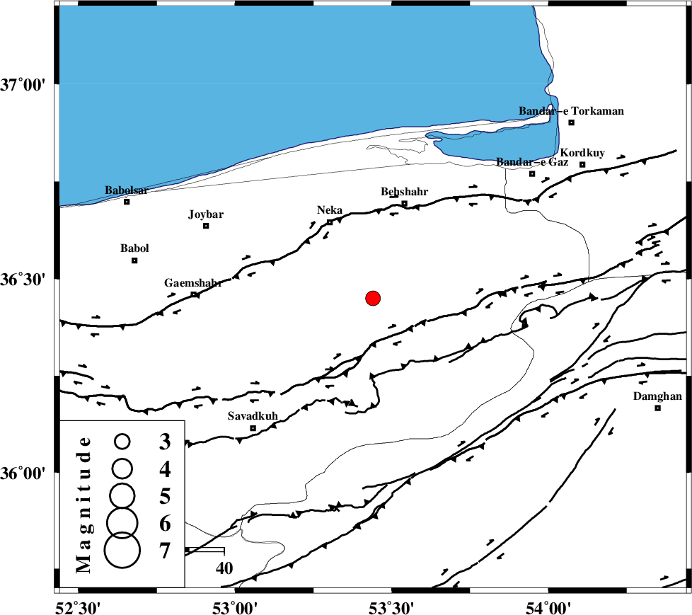
| Location | Lat:36.45 Lon: 53.44 |
| Region | |
Nearest Cities |
|
| 14 km South of Chelmardi, Mazandaran Province | |
| 17 km North of Khalkhil, Mazandaran Province | |
| 21 km South East of Razandin sofla, Mazandaran Province | |
| 25 km South of Rostamkola, Mazandaran Province | |
| 25 km South East of Neka, Mazandaran Province | |
| Depth | 15 km |
| Agency | |
Faults within 150 km: |
|
| N_ALBORZ_F (Length: 360 km) , Distance to epicenter: 11 km | |
| KHAZAR_F (Length: 523 km) , Distance to epicenter: 24 km | |
| DAMGHAN_F (Length: 95 km) , Distance to epicenter: 49 km | |
| Number of Phases | 6 |
| RMS | 0.4 |
| Number of Stations | 5 |
| Error in Latitude | >5.6 km |
| Error in Longitude | 13.3 km |
| Error in Depth | 0 km |
Download waveform in seisan format
to download seisan software Click here
to access information about IIEES stations Click here
Amplitude | ||||||||
| UID | Agency | Station | Component | Amplitude | Period | Arrival Time | Proccessing Time | Signal Clip |
| 9985 | IIEES | DAMV | N | 267.2 | 0.55 | 2005-09-26 00:56:03 | 2006-01-09 11:55:00 | n |
| 9986 | IIEES | ASAO | N | 32.2 | 0.5 | 2005-09-26 00:56:57 | 2006-01-09 11:55:00 | n |
Phase | ||||||||||||
| Agency | Station | Component | Phase Type | Phase Quality | First Motion | Observed Arrival Time | Time Residual | Loc. Flag | Input Weight | Distance | Azimuth | |
| IIEES | DAMV | Z | PG | E | 2005-09-26 00:55:37 | -0.7 | y | 161 | 236 | |||
| IIEES | THKV | Z | PG | E | 2005-09-26 00:55:51 | 0.5 | y | 238 | 256 | |||
| IIEES | ASAO | Z | PN | E | 2005-09-26 00:56:06 | 0.2 | y | 375 | 237 | |||
| IIEES | NASN | Z | PN | E | 2005-09-26 00:56:10 | 0 | y | 409 | 188 | |||
| IIEES | NASN | E | SG | E | 2005-09-26 00:57:06 | 0.2 | y | 409 | 188 | |||
| IIEES | GRMI | Z | PN | E | 2005-09-26 00:56:28 | -0.1 | y | 555 | 300 | |||