
Magnitude |
:3.1 |
| Date & Time (UTC) | 2005-09-16 16:37:51.9 |
| Date & Time (Local) | 1384/6/25 21:07:51.9 |
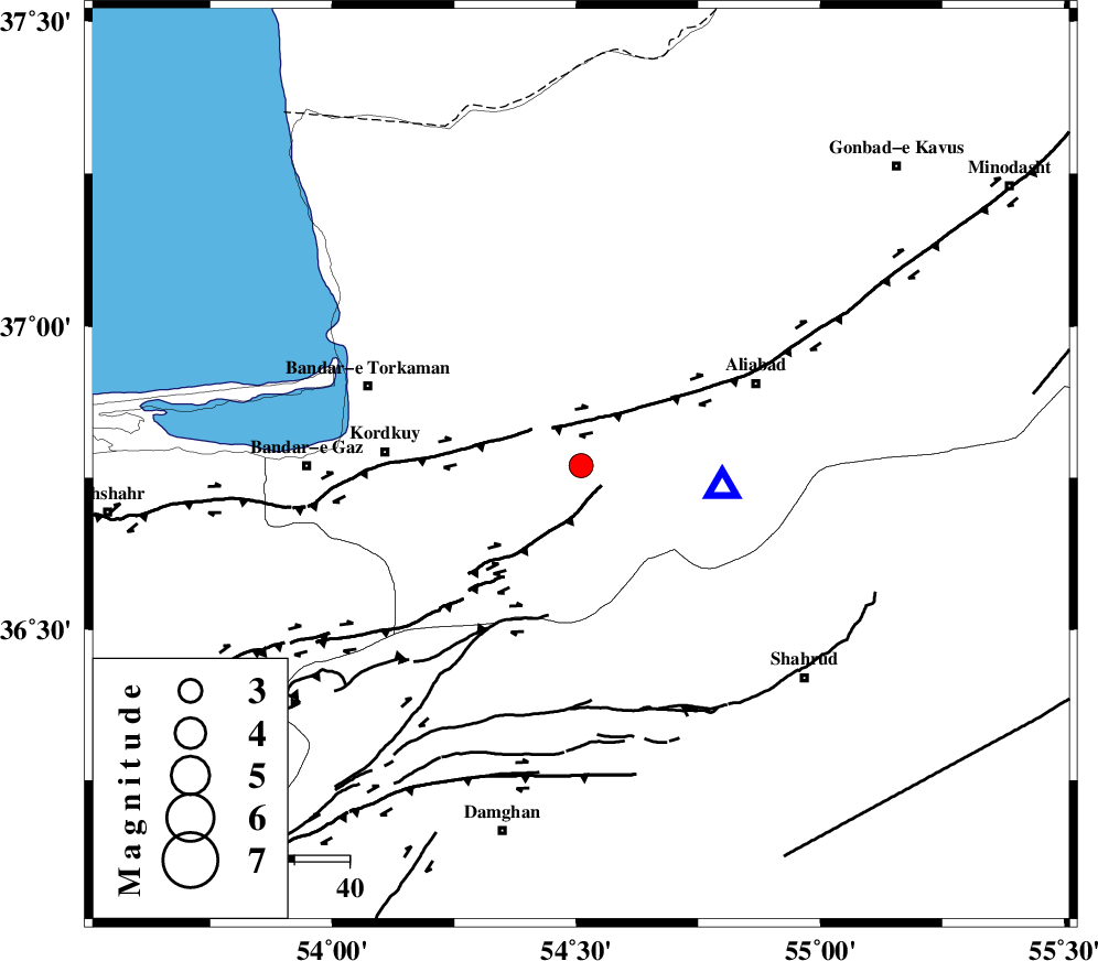
| Location | Lat:36.77 Lon: 54.51 |
| Region | |
Nearest Cities |
|
| 9 km of Jalin olia, Golestan Province | |
| 10 km of Gorgan, Golestan Province | |
| 13 km North of Naharkhoran, Golestan Province | |
| 18 km East of Lamsak, Golestan Province | |
| 24 km South of Nodeh malek, Golestan Province | |
| Depth | 14 km |
| Agency | |
Faults within 150 km: |
|
| KHAZAR_F (Length: 523 km) , Distance to epicenter: 9 km | |
| N_ALBORZ_F (Length: 360 km) , Distance to epicenter: 20 km | |
| SHAVAR_F (Length: 87 km) , Distance to epicenter: 24 km | |
| Number of Phases | 7 |
| RMS | 0.2 |
| Number of Stations | 5 |
| Error in Latitude | >6.8 km |
| Error in Longitude | 9.2 km |
| Error in Depth | 11.1 km |
Download waveform in seisan format
to download seisan software Click here
to access information about IIEES stations Click here
Amplitude | ||||||||
| UID | Agency | Station | Component | Amplitude | Period | Arrival Time | Proccessing Time | Signal Clip |
| 9928 | IIEES | DAMV | N | 107.4 | 0.36 | 2005-09-16 16:39:13 | 2006-01-09 11:55:00 | n |
| 9929 | IIEES | GRMI | N | 7 | 0.19 | 2005-09-16 16:40:21 | 2006-01-09 11:55:00 | n |
Phase | ||||||||||||
| Agency | Station | Component | Phase Type | Phase Quality | First Motion | Observed Arrival Time | Time Residual | Loc. Flag | Input Weight | Distance | Azimuth | |
| IIEES | DAMV | Z | Pg | E | 2005-09-16 16:38:34 | -0.5 | y | 261 | 242 | |||
| IIEES | DAMV | N | SG | E | 2005-09-16 16:39:05 | 0.1 | y | 261 | 242 | |||
| IIEES | THKV | Z | PN | E | 2005-09-16 16:38:41 | 0.1 | y | 339 | 255 | |||
| IIEES | NASN | Z | PN | E | 2005-09-16 16:38:58 | 0.1 | y | 467 | 200 | |||
| IIEES | ASAO | Z | PN | E | 2005-09-16 16:38:58 | 0.2 | y | 475 | 240 | |||
| IIEES | ASAO | E | SG | E | 2005-09-16 16:40:04 | 0.1 | y | 475 | 240 | |||
| IIEES | GRMI | Z | PN | E | 2005-09-16 16:39:17 | 0.2 | y | 625 | 293 | |||