
Magnitude |
:3.9 |
| Date & Time (UTC) | 2005-09-16 08:56:51.2 |
| Date & Time (Local) | 1384/6/25 13:26:51.2 |
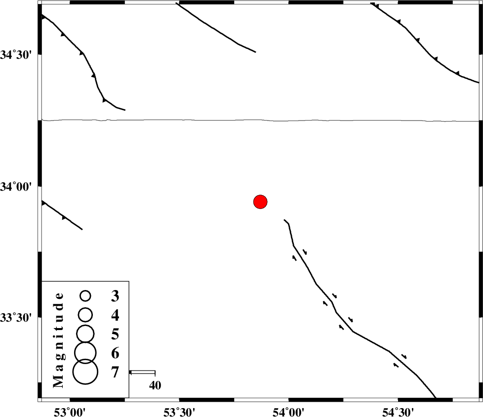
| Location | Lat:33.94 Lon: 53.87 |
| Region | |
Nearest Cities |
|
| 52 km South West of Jondaq, Esfahan Province | |
| 58 km North East of Maedan, Esfahan Province | |
| 59 km North West of Chupanan, Esfahan Province | |
| 71 km North East of Anarak, Esfahan Province | |
| 100 km North West of Farrokhi, Esfahan Province | |
| Depth | 14 km |
| Agency | |
Faults within 150 km: |
|
| DORUNEH_F (Length: 713 km) , Distance to epicenter: 29 km | |
| BIABANAK_F (Length: 162 km) , Distance to epicenter: 81 km | |
| CHAH_ZANGUL_F (Length: 123 km) , Distance to epicenter: 114 km | |
| Number of Phases | 9 |
| RMS | 0.3 |
| Number of Stations | 6 |
| Error in Latitude | >2.6 km |
| Error in Longitude | 4.5 km |
| Error in Depth | 7.1 km |
Download waveform in seisan format
to download seisan software Click here
to access information about IIEES stations Click here
Amplitude | ||||||||
| UID | Agency | Station | Component | Amplitude | Period | Arrival Time | Proccessing Time | Signal Clip |
| 9922 | IIEES | DAMV | N | 597.2 | 0.72 | 2005-09-16 08:58:35 | 2006-01-09 11:55:00 | n |
| 9923 | IIEES | ASAO | N | 337.9 | 0.57 | 2005-09-16 08:58:55 | 2006-01-09 11:55:00 | n |
Phase | ||||||||||||
| Agency | Station | Component | Phase Type | Phase Quality | First Motion | Observed Arrival Time | Time Residual | Loc. Flag | Input Weight | Distance | Azimuth | |
| IIEES | NASN | Z | PG | E | 2005-09-16 08:57:17 | -0.3 | y | 160 | 218 | |||
| IIEES | NASN | E | SG | E | 2005-09-16 08:57:37 | 0.1 | y | 160 | 218 | |||
| IIEES | DAMV | Z | PN | E | 2005-09-16 08:57:31 | 0.4 | y | 256 | 318 | |||
| IIEES | DAMV | N | SG | E | 2005-09-16 08:58:03 | -0.4 | y | 256 | 318 | |||
| IIEES | THKV | Z | PN | E | 2005-09-16 08:57:42 | 0.3 | y | 350 | 310 | |||
| IIEES | ASAO | Z | PN | E | 2005-09-16 08:57:44 | 0.2 | y | 360 | 282 | |||
| IIEES | KRBR | Z | PN | E | 2005-09-16 08:58:02 | -0.3 | y | 517 | 147 | |||
| IIEES | KRBR | E | SG | E | 2005-09-16 08:59:15 | 0.1 | y | 517 | 147 | |||
| IIEES | BNDS | Z | PN | E | 2005-09-16 08:58:32 | -0.2 | y | 758 | 162 | |||