
Magnitude |
:2.9 |
| Date & Time (UTC) | 2005-09-12 02:00:38.7 |
| Date & Time (Local) | 1384/6/21 06:30:38.7 |
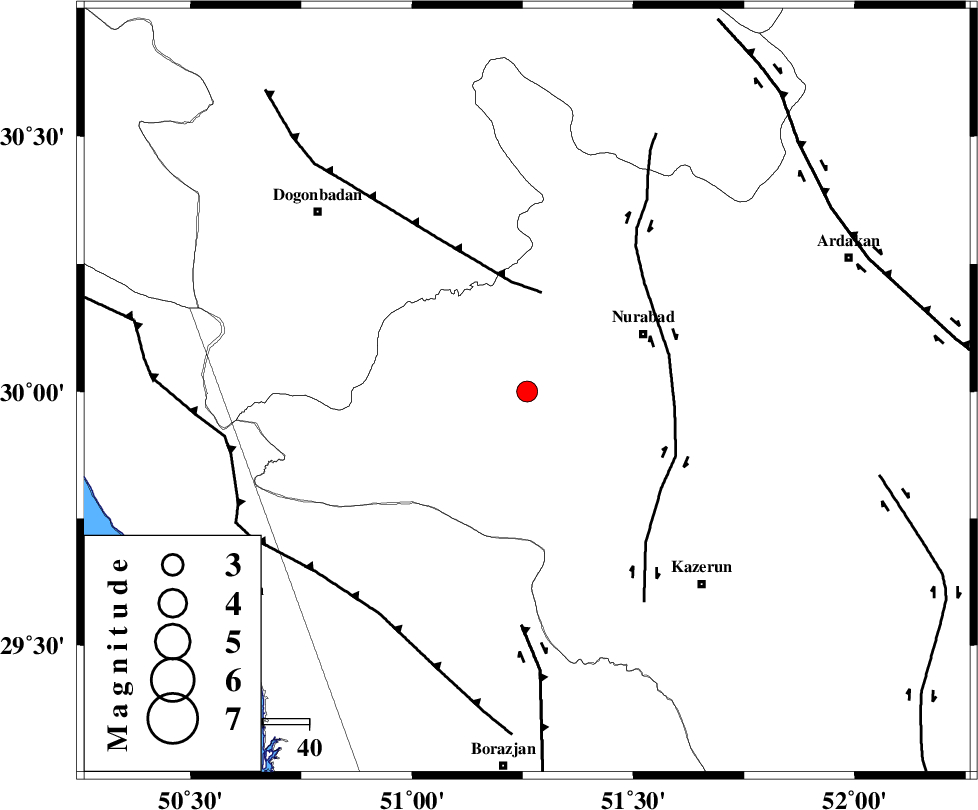
| Location | Lat:30 Lon: 51.26 |
| Region | |
Nearest Cities |
|
| 9 km of Babamonir, Fars Province | |
| 21 km South West of Ahangari, Fars Province | |
| 28 km West of Gachgaran, Fars Province | |
| 28 km South West of Nurabad, Fars Province | |
| 28 km South West of Fahlian-e olia, Fars Province | |
| Depth | 17 km |
| Agency | |
Faults within 150 km: |
|
| MISHAN_F (Length: 76 km) , Distance to epicenter: 22 km | |
| KAZERUN_F (Length: 96 km) , Distance to epicenter: 32 km | |
| BORAZJAN_F (Length: 168 km) , Distance to epicenter: 51 km | |
| Number of Phases | 6 |
| RMS | 0.1 |
| Number of Stations | 5 |
| Error in Latitude | >2.6 km |
| Error in Longitude | 4.2 km |
| Error in Depth | 6 km |
Download waveform in seisan format
to download seisan software Click here
to access information about IIEES stations Click here
Amplitude | ||||||||
| UID | Agency | Station | Component | Amplitude | Period | Arrival Time | Proccessing Time | Signal Clip |
| 9900 | IIEES | GHIR | N | 85.3 | 0.62 | 2005-09-12 02:02:07 | 2006-01-09 11:55:00 | n |
| 9901 | IIEES | ASAO | N | 10 | 0.48 | 2005-09-12 02:02:50 | 2006-01-09 11:55:00 | n |
Phase | ||||||||||||
| Agency | Station | Component | Phase Type | Phase Quality | First Motion | Observed Arrival Time | Time Residual | Loc. Flag | Input Weight | Distance | Azimuth | |
| IIEES | GHIR | Z | PN | E | 2005-09-12 02:01:17 | 0 | y | 253 | 138 | |||
| IIEES | GHIR | E | SG | E | 2005-09-12 02:01:50 | 0 | y | 253 | 138 | |||
| IIEES | NASN | Z | PN | E | 2005-09-12 02:01:29 | 0 | y | 344 | 25 | |||
| IIEES | ASAO | Z | PN | E | 2005-09-12 02:01:50 | 0.1 | y | 518 | 347 | |||
| IIEES | KRBR | Z | PN | E | 2005-09-12 02:01:52 | 0 | y | 531 | 89 | |||
| IIEES | SNGE | Z | PN | E | 2005-09-12 02:02:09 | -0.1 | y | 674 | 328 | |||