
Magnitude |
:2.8 |
| Date & Time (UTC) | 2005-09-11 20:47:12.9 |
| Date & Time (Local) | 1384/6/21 01:17:12.9 |
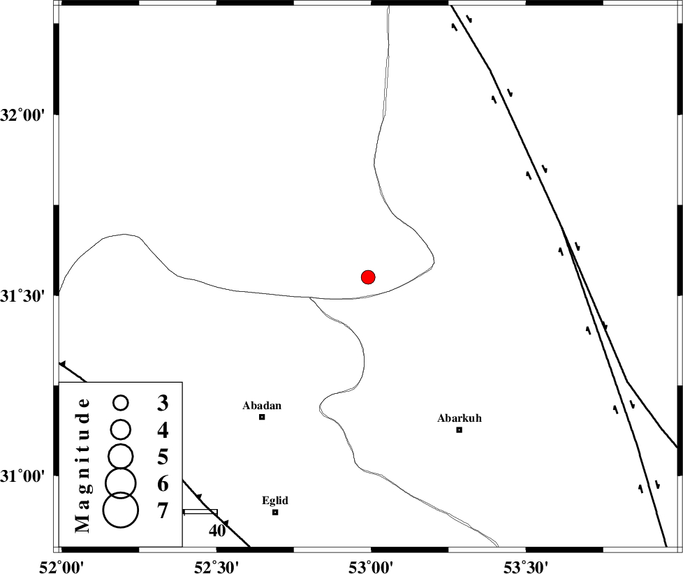
| Location | Lat:31.55 Lon: 52.99 |
| Region | |
Nearest Cities |
|
| 54 km North East of Abadan, Fars Province | |
| 55 km North West of Abarkuh, Yazd Province | |
| 58 km South East of Ramsheh, Esfahan Province | |
| 63 km North East of Bahman, Fars Province | |
| 69 km North West of Mehrabad, Yazd Province | |
| Depth | 14 km |
| Agency | |
Faults within 150 km: |
|
| SHAHR_E_BABAK_F1 (Length: 392 km) , Distance to epicenter: 61 km | |
| SHAHR_E_BABAK_F2 (Length: 272 km) , Distance to epicenter: 61 km | |
| MAIN_ZAGROS_R_F (Length: 1106 km) , Distance to epicenter: 86 km | |
| Number of Phases | 6 |
| RMS | 0.2 |
| Number of Stations | 4 |
| Error in Latitude | >4.1 km |
| Error in Longitude | 4.9 km |
| Error in Depth | 10.9 km |
Download waveform in seisan format
to download seisan software Click here
to access information about IIEES stations Click here
Amplitude | ||||||||
| UID | Agency | Station | Component | Amplitude | Period | Arrival Time | Proccessing Time | Signal Clip |
| 9898 | IIEES | KRBR | N | 19.7 | 0.55 | 2005-09-11 20:49:29 | 2006-01-09 11:55:00 | n |
| 9899 | IIEES | ASAO | N | 11.5 | 0.68 | 2005-09-11 20:49:23 | 2006-01-09 11:55:00 | n |
Phase | ||||||||||||
| Agency | Station | Component | Phase Type | Phase Quality | First Motion | Observed Arrival Time | Time Residual | Loc. Flag | Input Weight | Distance | Azimuth | |
| IIEES | NASN | Z | PG | E | 2005-09-11 20:47:36 | -0.3 | y | 140 | 353 | |||
| IIEES | NASN | N | SG | E | 2005-09-11 20:47:53 | 0 | y | 140 | 353 | |||
| IIEES | GHIR | Z | PN | E | 2005-09-11 20:48:05 | -0.2 | y | 362 | 180 | |||
| IIEES | KRBR | Z | Pn | E | 2005-09-11 20:48:10 | 0.3 | y | 401 | 115 | |||
| IIEES | ASAO | Z | PN | E | 2005-09-11 20:48:14 | 0 | y | 433 | 321 | |||
| IIEES | ASAO | N | SG | E | 2005-09-11 20:49:14 | 0.2 | y | 433 | 321 | |||