
Magnitude |
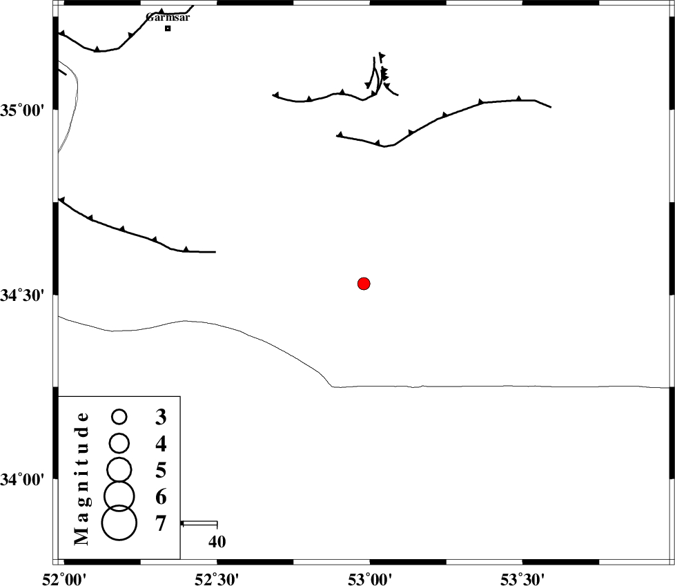
:2.5 |
| Date & Time (UTC) | 2005-09-07 07:51:01.2 |
| Date & Time (Local) | 1384/6/16 12:21:01.2 |
| Location | Lat:34.53 Lon: 52.98 |
| Region | |
Nearest Cities |
|
| 87 km South East of Kohanabad, Semnan Province | |
| 88 km South East of Gardovan, Semnan Province | |
| 89 km South East of Davarabad, Semnan Province | |
| 90 km South East of Aradan, Semnan Province | |
| 95 km South East of Lajran, Semnan Province | |
| Depth | 14 km |
| Agency | |
Faults within 150 km: |
|
| KUH_E_GUGERD_F (Length: 73 km) , Distance to epicenter: 42 km | |
| SIAHKUH_F (Length: 154 km) , Distance to epicenter: 44 km | |
| KUH_E_GACHAB_F1 (Length: 53 km) , Distance to epicenter: 57 km | |
| Number of Phases | 5 |
| RMS | 0.4 |
| Number of Stations | 3 |
| Error in Latitude | >4.2 km |
| Error in Longitude | 7.6 km |
| Error in Depth | 12.7 km |
Download waveform in seisan format
to download seisan software Click here
to access information about IIEES stations Click here
Amplitude | ||||||||
| UID | Agency | Station | Component | Amplitude | Period | Arrival Time | Proccessing Time | Signal Clip |
| 9875 | IIEES | DAMV | N | 56.3 | 0.19 | 2005-09-07 07:51:49 | 2006-01-09 11:55:00 | n |
| 9876 | IIEES | ASAO | N | 28.8 | 0.4 | 2005-09-07 07:52:22 | 2006-01-09 11:55:00 | n |
Phase | ||||||||||||
| Agency | Station | Component | Phase Type | Phase Quality | First Motion | Observed Arrival Time | Time Residual | Loc. Flag | Input Weight | Distance | Azimuth | |
| IIEES | DAMV | Z | PG | E | 2005-09-07 07:51:26 | 0 | y | 153 | 323 | |||
| IIEES | NASN | Z | PG | E | 2005-09-07 07:51:32 | -0.6 | y | 193 | 185 | |||
| IIEES | NASN | E | SG | E | 2005-09-07 07:51:56 | 0.3 | y | 193 | 185 | |||
| IIEES | ASAO | Z | Pn | E | 2005-09-07 07:51:43 | 0.4 | y | 271 | 271 | |||
| IIEES | ASAO | N | Sg | E | 2005-09-07 07:52:17 | -0.2 | y | 271 | 271 | |||