
Magnitude |
:3 |
| Date & Time (UTC) | 2005-09-03 17:37:06.8 |
| Date & Time (Local) | 1384/6/12 22:07:06.8 |
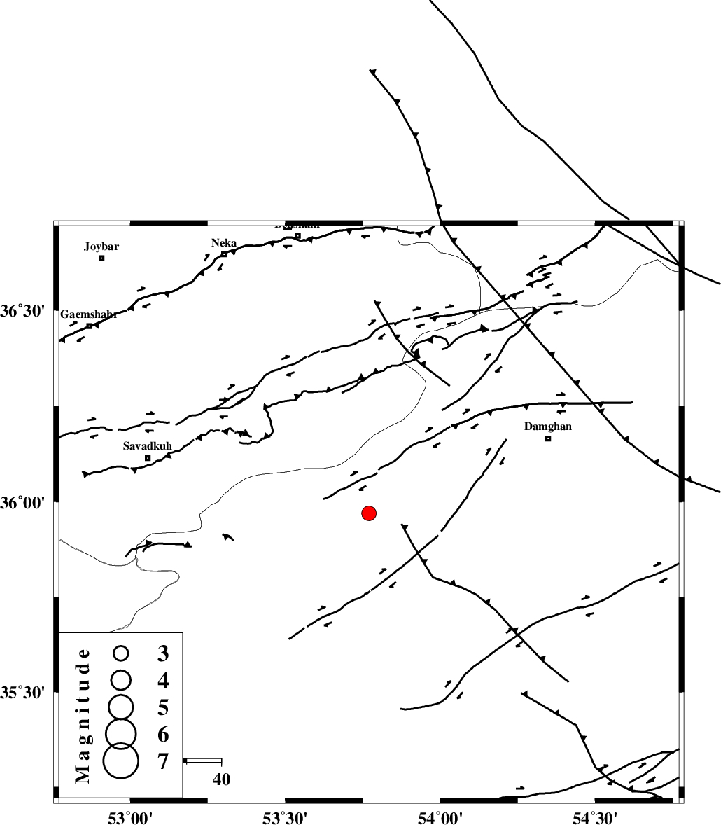
| Location | Lat:35.97 Lon: 53.77 |
| Region | |
Nearest Cities |
|
| 13 km West of Darvar, Semnan Province | |
| 28 km South of Talma darreh, Mazandaran Province | |
| 35 km West of Amirabad, Semnan Province | |
| 35 km West of Seydabad, Semnan Province | |
| 36 km South East of Kiasar, Mazandaran Province | |
| Depth | 14 km |
| Agency | |
Faults within 150 km: |
|
| ATARI_F (Length: 185 km) , Distance to epicenter: 11 km | |
| DAMGHAN_F (Length: 95 km) , Distance to epicenter: 21 km | |
| ASTANEH_F (Length: 72 km) , Distance to epicenter: 36 km | |
| Number of Phases | 6 |
| RMS | 0.1 |
| Number of Stations | 5 |
| Error in Latitude | >6.4 km |
| Error in Longitude | 6.4 km |
| Error in Depth | 7.5 km |
Download waveform in seisan format
to download seisan software Click here
to access information about IIEES stations Click here
Amplitude | ||||||||
| UID | Agency | Station | Component | Amplitude | Period | Arrival Time | Proccessing Time | Signal Clip |
| 9840 | IIEES | DAMV | N | 311.6 | 0.38 | 2005-09-03 17:37:59 | 2006-01-09 11:55:00 | n |
| 9841 | IIEES | ASAO | N | 24.1 | 0.6 | 2005-09-03 17:39:01 | 2006-01-09 11:55:00 | n |
Phase | ||||||||||||
| Agency | Station | Component | Phase Type | Phase Quality | First Motion | Observed Arrival Time | Time Residual | Loc. Flag | Input Weight | Distance | Azimuth | |
| IIEES | DAMV | Z | PG | E | 2005-09-03 17:37:34 | -0.2 | y | 166 | 257 | |||
| IIEES | DAMV | E | SG | E | 2005-09-03 17:37:54 | 0.1 | y | 166 | 257 | |||
| IIEES | THKV | Z | PN | E | 2005-09-03 17:37:47 | 0.2 | y | 260 | 270 | |||
| IIEES | NASN | Z | PN | E | 2005-09-03 17:37:59 | 0 | y | 363 | 194 | |||
| IIEES | ASAO | Z | PN | E | 2005-09-03 17:38:01 | 0 | y | 375 | 246 | |||
| IIEES | SNGE | Z | Pn | E | 2005-09-03 17:38:27 | -0.2 | y | 590 | 262 | |||