
Magnitude |
:3.6 |
| Date & Time (UTC) | 2005-08-31 14:34:40.6 |
| Date & Time (Local) | 1384/6/9 19:04:40.6 |
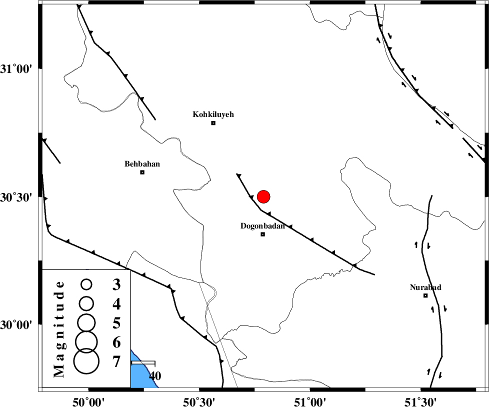
| Location | Lat:30.5 Lon: 50.79 |
| Region | |
Nearest Cities |
|
| 16 km North of Dogonbadan, Kohkiluieh va boyerahmad Province | |
| 25 km North West of Abdehgah, Kohkiluieh va boyerahmad Province | |
| 39 km South East of Dehdasht, Kohkiluieh va boyerahmad Province | |
| 39 km North West of Basht, Kohkiluieh va boyerahmad Province | |
| 44 km South of Savari, Kohkiluieh va boyerahmad Province | |
| Depth | 15 km |
| Agency | |
Faults within 150 km: |
|
| MISHAN_F (Length: 76 km) , Distance to epicenter: 6 km | |
| ZFF3 (Length: 125 km) , Distance to epicenter: 57 km | |
| RAG_E_SEFID_F (Length: 84 km) , Distance to epicenter: 57 km | |
| Number of Phases | 6 |
| RMS | 0.2 |
| Number of Stations | 7 |
| Error in Latitude | >4 km |
| Error in Longitude | 2.5 km |
| Error in Depth | 0 km |
Download waveform in seisan format
to download seisan software Click here
to access information about IIEES stations Click here
Amplitude | ||||||||
| UID | Agency | Station | Component | Amplitude | Period | Arrival Time | Proccessing Time | Signal Clip |
| 9831 | IIEES | SHGR | E | 185 | 0.85 | 2005-08-31 14:36:04 | 2006-01-09 11:55:00 | n |
| 9832 | IIEES | NASN | N | 73.2 | 0.8 | 2005-08-31 14:36:24 | 2006-01-09 11:55:00 | n |
| 9833 | IIEES | GHIR | N | 242.2 | 0.3 | 2005-08-31 14:36:27 | 2006-01-09 11:55:00 | n |
| 9834 | IIEES | BNDS | N | 71.1 | 0.35 | 2005-08-31 14:37:25 | 2006-01-09 11:55:00 | n |
Phase | ||||||||||||
| Agency | Station | Component | Phase Type | Phase Quality | First Motion | Observed Arrival Time | Time Residual | Loc. Flag | Input Weight | Distance | Azimuth | |
| IIEES | SHGR | Z | PN | E | 2005-08-31 14:35:20 | -0.1 | y | 260 | 314 | |||
| IIEES | NASN | Z | PN | E | 2005-08-31 14:35:28 | 0.2 | y | 319 | 36 | |||
| IIEES | GHIR | Z | PN | E | 2005-08-31 14:35:28 | 0.2 | y | 326 | 138 | |||
| IIEES | ASAO | Z | PN | E | 2005-08-31 14:35:44 | 0 | y | 454 | 351 | |||
| IIEES | KRBR | Z | PN | E | 2005-08-31 14:35:59 | -0.5 | y | 578 | 94 | |||
| IIEES | DAMV | Z | PN | E | 2005-08-31 14:36:00 | 0 | y | 579 | 11 | |||